
Cyganek is a village in the administrative district of Gmina Nowy Dwór Gdański, within Nowy Dwór Gdański County, Pomeranian Voivodeship, in northern Poland. It lies approximately 3 kilometres (2 mi) north-west of Nowy Dwór Gdański and 33 km (21 mi) south-east of the regional capital Gdańsk.
Cyganka is a village in the administrative district of Gmina Nowy Dwór Gdański, within Nowy Dwór Gdański County, Pomeranian Voivodeship, in northern Poland. It lies approximately 2 kilometres (1 mi) north of Nowy Dwór Gdański and 36 km (22 mi) south-east of the regional capital Gdańsk.
Jazowa is a village in the administrative district of Gmina Nowy Dwór Gdański, within Nowy Dwór Gdański County, Pomeranian Voivodeship, in northern Poland. It lies approximately 10 kilometres (6 mi) south-east of Nowy Dwór Gdański and 46 km (29 mi) south-east of the regional capital Gdańsk.
Kępki is a village in the administrative district of Gmina Nowy Dwór Gdański, within Nowy Dwór Gdański County, Pomeranian Voivodeship, in northern Poland. It lies approximately 14 kilometres (9 mi) east of Nowy Dwór Gdański and 49 km (30 mi) south-east of the regional capital Gdańsk.
Marynowy is a village in the administrative district of Gmina Nowy Dwór Gdański, within Nowy Dwór Gdański County, Pomeranian Voivodeship, in northern Poland. It lies approximately 7 kilometres (4 mi) south of Nowy Dwór Gdański and 38 km (24 mi) south-east of the regional capital Gdańsk.
Nowinki is a village in the administrative district of Gmina Nowy Dwór Gdański, within Nowy Dwór Gdański County, Pomeranian Voivodeship, in northern Poland. It lies approximately 10 kilometres (6 mi) east of Nowy Dwór Gdański and 45 km (28 mi) south-east of the regional capital Gdańsk.
Orliniec is a village in the administrative district of Gmina Nowy Dwór Gdański, within Nowy Dwór Gdański County, Pomeranian Voivodeship, in northern Poland. It lies approximately 8 kilometres (5 mi) east of Nowy Dwór Gdański and 43 km (27 mi) south-east of the regional capital Gdańsk.
Orłowskie Pole is a settlement in the administrative district of Gmina Nowy Dwór Gdański, within Nowy Dwór Gdański County, Pomeranian Voivodeship, in northern Poland. It lies approximately 3 kilometres (2 mi) west of Nowy Dwór Gdański and 34 km (21 mi) south-east of the regional capital Gdańsk.
Osłonka is a village in the administrative district of Gmina Nowy Dwór Gdański, within Nowy Dwór Gdański County, Pomeranian Voivodeship, in northern Poland. It lies approximately 10 kilometres (6 mi) north-east of Nowy Dwór Gdański and 40 km (25 mi) east of the regional capital Gdańsk.
Piotrowo is a village in the administrative district of Gmina Nowy Dwór Gdański, within Nowy Dwór Gdański County, Pomeranian Voivodeship, in northern Poland. It lies approximately 4 kilometres (2 mi) east of Nowy Dwór Gdański and 39 km (24 mi) south-east of the regional capital Gdańsk.
Rakowiska is a village in the administrative district of Gmina Nowy Dwór Gdański, within Nowy Dwór Gdański County, Pomeranian Voivodeship, in northern Poland. It lies approximately 8 kilometres (5 mi) south-east of Nowy Dwór Gdański and 43 km (27 mi) south-east of the regional capital Gdańsk.
Różewo is a village in the administrative district of Gmina Nowy Dwór Gdański, within Nowy Dwór Gdański County, Pomeranian Voivodeship, in northern Poland. It lies approximately 5 kilometres (3 mi) south-east of Nowy Dwór Gdański and 41 km (25 mi) south-east of the regional capital Gdańsk.
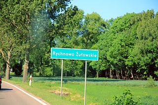
Rychnowo Żuławskie is a village in the administrative district of Gmina Nowy Dwór Gdański, within Nowy Dwór Gdański County, Pomeranian Voivodeship, in northern Poland. It lies approximately 4 kilometres (2 mi) south of Nowy Dwór Gdański and 38 km (24 mi) south-east of the regional capital Gdańsk.
Starocin is a village in the administrative district of Gmina Nowy Dwór Gdański, within Nowy Dwór Gdański County, Pomeranian Voivodeship, in northern Poland. It lies approximately 3 kilometres (2 mi) east of Nowy Dwór Gdański and 38 km (24 mi) south-east of the regional capital Gdańsk.
Stobna is a village in the administrative district of Gmina Nowy Dwór Gdański, within Nowy Dwór Gdański County, Pomeranian Voivodeship, in northern Poland. It lies approximately 11 kilometres (7 mi) east of Nowy Dwór Gdański and 46 km (29 mi) south-east of the regional capital Gdańsk.
Suchowo is a settlement in the administrative district of Gmina Nowy Dwór Gdański, within Nowy Dwór Gdański County, Pomeranian Voivodeship, in northern Poland. It lies approximately 6 kilometres (4 mi) south-east of Nowy Dwór Gdański and 41 km (25 mi) south-east of the regional capital Gdańsk.
Swaryszewo is a settlement in the administrative district of Gmina Nowy Dwór Gdański, within Nowy Dwór Gdański County, Pomeranian Voivodeship, in northern Poland. It lies approximately 8 kilometres (5 mi) east of Nowy Dwór Gdański and 42 km (26 mi) east of the regional capital Gdańsk.
Tuja is a village in the administrative district of Gmina Nowy Dwór Gdański, within Nowy Dwór Gdański County, Pomeranian Voivodeship, in northern Poland. It lies approximately 6 kilometres (4 mi) south-west of Nowy Dwór Gdański and 35 km (22 mi) south-east of the regional capital Gdańsk.
Wężowiec is a village in the administrative district of Gmina Nowy Dwór Gdański, within Nowy Dwór Gdański County, Pomeranian Voivodeship, in northern Poland. It lies approximately 11 kilometres (7 mi) east of Nowy Dwór Gdański and 44 km (27 mi) east of the regional capital Gdańsk.
Zawadka is a settlement in the administrative district of Gmina Nowy Dwór Gdański, within Nowy Dwór Gdański County, Pomeranian Voivodeship, in northern Poland. It lies approximately 11 kilometres (7 mi) south-east of Nowy Dwór Gdański and 46 km (29 mi) south-east of the regional capital Gdańsk.


