
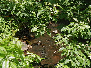
Stony Brook, also known as Stoney Brook, is a tributary of the Millstone River in Hunterdon and Mercer counties, New Jersey, in the United States.

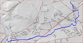
The Millstone River is a 38.6-mile-long (62.1 km) tributary of the Raritan River in central New Jersey in the United States.

Rocky Brook is a tributary of the Millstone River in Monmouth and Mercer counties, New Jersey in the United States.

Royce Brook is a tributary of the Millstone River in Hillsborough and Manville, New Jersey in the United States.

Six Mile Run is a tributary of the Millstone River that drains a large area in central Franklin Township in Somerset County and as well western portions of North Brunswick and South Brunswick Townships in Middlesex County, New Jersey in the United States.

The Sourlands is a region in the US state of New Jersey that includes portions of Hunterdon County, Mercer County and Somerset County. It is centered on Sourland Mountain and comprises parts of Lambertville, East Amwell, West Amwell, Hillsborough, Hopewell Boro, Hopewell Township, and Montgomery. The region is flanked by the Hopewell Fault to the south and Amwell Valley to the north that runs from Mount Airy to an area just west of Flagtown and a diabase formation running from Lambertville to Mount Airy. The Sourland also include a hilly area towards the southwest called Pleasant Valley, with a number of farms. Although much of the Sourlands is not conducive to farming, Pleasant Valley and the slopes on the surrounding ridges have a number of farms. The slopes of the ridge to the north are also home to Unionville Vineyard.

Oakeys Brook is a tributary of Lawrence Brook, a branch of the Raritan River in Middlesex County, New Jersey in the United States.

Nine Mile Run, known as Ninemile Run according to the USGS GNIS, is a moderately large tributary of the Six Mile Run, one of the branches of the Millstone River, in central New Jersey in the United States.
Middlebush Brook is a tributary of Six Mile Run in Somerset County, New Jersey in the United States.
Ireland Brook is a tributary of Lawrence Brook in Middlesex County, New Jersey in the United States.

Cross Brook is a tributary of Six Mile Run in Somerset and Middlesex Counties, New Jersey in the United States.

Ten Mile Run is a tributary of the Millstone River, draining an area in southern South Brunswick and southern Franklin Park, New Jersey in the United States.

Simonson Brook, also known as Sunonson Brook, is a tributary of the Millstone River in southern Franklin Park, Somerset County, New Jersey in the United States.
Heathcote Brook, also known as Heathcote Run, is a tributary of the Millstone River in central New Jersey in the United States.

Devils Brook is a tributary of the Millstone River in central New Jersey in the United States.

Cranbury Brook, also known as Cranberry Brook, is a tributary of the Millstone River in Middlesex and Monmouth Counties, New Jersey in the United States.

Little Bear Brook is a tributary of the Millstone River in Mercer County, New Jersey in the United States.

Honey Branch is a tributary of the Stony Brook in Mercer County, New Jersey in the United States.

Duck Pond Run is a tributary of the Stony Brook in Mercer County, New Jersey in the United States.
Bear Brook is a tributary of the Millstone River in central New Jersey in the United States.


