Stony Fork Creek

Last updated
Stony Fork
Creek
Stony fork of babb creek.jpg
Along Stony Fork Road
Country United States
State Pennsylvania
County Tioga County
Sourceconfluence of the creek's east and west branches
 - location Tioga State Forest northwest of Morris, Tioga County
 - elevation1,208 ft (368 m) [1]
 - coordinates 41°37′13″N77°22′08″W / 41.62028°N 77.36889°W / 41.62028; -77.36889   [2]
Mouth Babb Creek
 - locationnear Pennsylvania Route 414 east of Blackwell
 - elevation1,201 ft (366 m) [2]
 - coordinates 41°34′21″N77°20′15″W / 41.57250°N 77.33750°W / 41.57250; -77.33750 Coordinates: 41°34′21″N77°20′15″W / 41.57250°N 77.33750°W / 41.57250; -77.33750   [2]
Length4.1 mi (6.6 km)
USA Pennsylvania location map.svg
Red pog.svg
Location of the mouth of Stony Fork in Pennsylvania

Stony Fork Creek (shown as Stony Fork on federal maps [2] ) is a 4.1-mile-long (6.6 km) [3] tributary of Babb Creek in Tioga County, Pennsylvania in the United States. [4]

Tributary stream or river that flows into a main stem river or lake

A tributary or affluent is a stream or river that flows into a larger stream or main stem river or a lake. A tributary does not flow directly into a sea or ocean. Tributaries and the main stem river drain the surrounding drainage basin of its surface water and groundwater, leading the water out into an ocean.

Babb Creek creek in Pennsylvania, United States

Babb Creek is a 21.7-mile-long (34.9 km) tributary of Pine Creek in Pennsylvania in the United States.

Tioga County, Pennsylvania county in Pennsylvania, United States

Tioga County is a county located in the U.S. state of Pennsylvania. As of the 2010 census, the population was 41,981. Its county seat is Wellsboro. The county was created on March 26, 1804, from part of Lycoming County and later organized in 1812. It is named for the Tioga River.

Contents

Course

Stony Fork begins at the confluence of its east and west branches in the Tioga State Forest northwest of Morris. It flows south, receiving Black Run and Roland Run, both from the left. Stony Fork Road follows the entire length of the stream. [5]

Tioga State Forest

Tioga State Forest is a Pennsylvania State Forest in District #16, in the Allegheny Plateau region within Tioga County, Pennsylvania.

Morris, Pennsylvania Unincorporated community in Pennsylvania, United States

Morris is an unincorporated community in Morris Township, Tioga County, in the U.S. state of Pennsylvania. It lies at the junction of Pennsylvania Route 414 and Pennsylvania Route 287 between Williamsport and Wellsboro. Babb Creek, a tributary of Pine Creek, flows through Morris.

Stony Fork merges with Babb Creek near the unincorporated community of Doane, along Pennsylvania Route 414 between Morris and Blackwell. Babb Creek is a tributary of Pine Creek, a tributary of the West Branch Susquehanna River. [5]

Unincorporated area Region of land not governed by own local government

In law, an unincorporated area is a region of land that is not governed by a local municipal corporation; similarly an unincorporated community is a settlement that is not governed by its own local municipal corporation, but rather is administered as part of larger administrative divisions, such as a township, parish, borough, county, city, canton, state, province or country. Occasionally, municipalities dissolve or disincorporate, which may happen if they become fiscally insolvent, and services become the responsibility of a higher administration. Widespread unincorporated communities and areas are a distinguishing feature of the United States and Canada. In most other countries of the world, there are either no unincorporated areas at all, or these are very rare; typically remote, outlying, sparsely populated or uninhabited areas.

Pennsylvania Route 414 highway in Pennsylvania

Pennsylvania Route 414 is a 79.4-mile-long (127.8 km) state highway located in Lycoming, Tioga, and Bradford Counties in Pennsylvania. The western terminus is at PA 44 in Waterville. The eastern terminus is at US 220 in Monroe. The first leg of the highway, between its intersection with PA 44 in Waterville and Blackwell is very narrow and rugged.

Blackwell, Pennsylvania Unincorporated community in Pennsylvania, United States

Blackwell is an unincorporated community in Morris Township, Tioga County, in the U.S. state of Pennsylvania. It lies about 6 miles (10 km) southwest of Morris and about 6 miles (10 km) north of Cedar Run along Pennsylvania Route 414. Babb Creek enters Pine Creek at Blackwell, in the Pine Creek Gorge. The Pine Creek Rail Trail passes through Blackwell.

See also

Related Research Articles

Calapooia River river in the United States of America

The Calapooia River is an 80-mile (130 km) tributary of the Willamette River in the U.S. state of Oregon.

Stony Creek may refer to the following waterways or communities:

Sleepy Creek river in the United States of America

Sleepy Creek is a 44.0-mile-long (70.8 km) tributary of the Potomac River in the United States, belonging to the Chesapeake Bay's watershed. The stream rises in Frederick County, Virginia, and flows through Morgan County, West Virginia before joining the Potomac near the community of Sleepy Creek.

Larrys Creek tributary of the West Branch Susquehanna River

Larrys Creek is a 22.9-mile-long (36.9 km) tributary of the West Branch Susquehanna River in Lycoming County in the U.S. state of Pennsylvania. A part of the Chesapeake Bay drainage basin, its watershed drains 89.1 square miles (231 km2) in six townships and a borough. The creek flows south from the dissected Allegheny Plateau to the Ridge-and-valley Appalachians through sandstone, limestone, and shale from the Devonian, Mississippian, and Pennsylvanian periods.

Pine Creek (Pennsylvania) creek in Pennsylvania, United States

Pine Creek is a tributary of the West Branch Susquehanna River in Potter, Tioga, Lycoming, and Clinton counties in Pennsylvania in the United States. The creek is 87.2 miles (140.3 km) long. Within Tioga County, 23.25 miles (37.42 km) of Pine Creek are designated as a Pennsylvania Scenic River.

Marsh Creek (Pine Creek tributary) tributary of Pine Creek in Pennsylvania

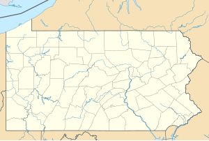
Marsh Creek is a 13.0-mile-long (20.9 km) tributary of Pine Creek in Pennsylvania in the United States.

Crooked Creek is a 26.3-mile-long (42.3 km) tributary of the Tioga River located entirely in Tioga County, Pennsylvania in the United States.

Seneca Creek (North Fork South Branch Potomac River) river in the United States of America

Seneca Creek is a 19.6-mile-long (31.5 km) tributary of the North Fork of the South Branch of the Potomac River located entirely within Pendleton County, West Virginia, USA.

Mill Creek is an 18.7-mile-long (30.1 km) tributary of the Tioga River in Tioga County, Pennsylvania in the United States.

Slate Run

Slate Run is a 7.3-mile-long (11.7 km) tributary of Pine Creek in Tioga and Lycoming counties, Pennsylvania in the United States.

Cedar Run (Pennsylvania) tributary of Pine Creek

Cedar Run is an 11.4-mile-long (18.3 km) tributary of Pine Creek in Lycoming and Tioga counties, Pennsylvania in the United States.

Sinnemahoning Creek tributary of the West Branch Susquehanna River in Pennsylvania

Sinnemahoning Creek is a 15.7-mile-long (25.3 km) tributary of the West Branch Susquehanna River in Cameron and Clinton counties, Pennsylvania, in the United States.

The West Branch Brandywine Creek is a 33.1-mile-long (53.3 km) tributary of Brandywine Creek in Chester County, Pennsylvania in the United States.

Leetonia, Pennsylvania Unincorporated community in Pennsylvania, United States

Leetonia is an unincorporated community in Elk Township, Tioga County, in the U.S. state of Pennsylvania. It lies along Leetonia Road, in the Tioga State Forest between Pennsylvania Route 414 and U.S. Route 6.

North Fork Siuslaw River river in the United States of America

The North Fork Siuslaw River is a tributary of the Siuslaw River in Lane County in the United States state of Oregon. It is formed by the confluence of Sam Creek and West Branch in the Siuslaw National Forest of the Central Oregon Coast Range. The former community of Pawn was once at the juncture of the two creeks. From here, the river flows about 2 miles (3 km) southeast, then about 25 miles (40 km) southwest to meet the main stem 1.2 miles (1.9 km) east of Florence.

References

  1. Source elevation derived from Google Earth search using GNIS source coordinates.
  2. 1 2 3 4 "Stony Fork". Geographic Names Information System (GNIS). United States Geological Survey. August 2, 1979. Retrieved September 14, 2012.
  3. U.S. Geological Survey. National Hydrography Dataset high-resolution flowline data. The National Map, accessed August 8, 2011
  4. Gertler, Edward. Keystone Canoeing, Seneca Press, 2004. ISBN   0-9749692-0-6
  5. 1 2 Pennsylvania Atlas & Gazetteer. Yarmouth, Maine: DeLorme. 2009. p. 25. ISBN   978-0-89933-280-2.