Morris, Pennsylvania | |
|---|---|
 Morris Post Office | |
 Morris, Pennsylvania | |
| Coordinates: 41°35′42″N77°17′32″W / 41.59500°N 77.29222°W | |
| Country | United States |
| State | Pennsylvania |
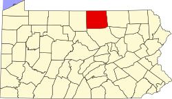
| County | Tioga |
| Elevation | 1,037 ft (316 m) |
| Time zone | UTC-5 (Eastern (EST)) |
| • Summer (DST) | UTC-4 (EDT) |
| ZIP | 16938 |
| Area code | 570 |
| GNIS feature ID | 1181566 [1] |
Morris is an unincorporated community that is located in Morris Township, Tioga County, in the U.S. state of Pennsylvania. [1]