Knoxville, Pennsylvania

Last updated

Knoxville, Pennsylvania
Mill in Knoxville, PA.JPG
The former Purina Mill and feed store on the western edge of Knoxville, January 2008
Tioga County Pennsylvania Incorporated and Unincorporated areas Knoxville Highlighted.svg
Location of Knoxville in Tioga County, Pennsylvania.
USA Pennsylvania location map.svg
Red pog.svg
Knoxville
Location within the U.S. state of Pennsylvania
Usa edcp location map.svg
Red pog.svg
Knoxville
Knoxville (the United States)
Coordinates: 41°57′25″N77°26′14″W / 41.95694°N 77.43722°W / 41.95694; -77.43722
Country United States
State Pennsylvania
County Tioga
Settled1835
Incorporated (borough)1851
Area
[1]
  Total0.62 sq mi (1.61 km2)
  Land0.62 sq mi (1.61 km2)
  Water0.00 sq mi (0.00 km2)
Elevation
1,240 ft (380 m)
Population
 (2020) [2]
  Total680
  Density1,096.77/sq mi (423.26/km2)
Time zone Eastern (EST)
  Summer (DST)EDT
ZIP code
16928
Area code 814
FIPS code 42-40360

Knoxville is a borough in northwestern Tioga County, Pennsylvania, United States. The population was 682 at the time of the 2020 census. [3]

Contents

History

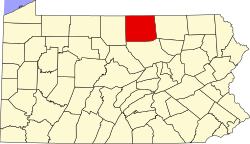
The land on which the town of Knoxville, Pennsylvania would be created was situated in Deerfield Township, Tioga County, Pennsylvania. The town was laid out and settled in 1835, and was officially incorporated as a borough in May 1851. [4]

In 1899, the borough had four churches: Deerfield Baptist, First Methodist, Union Church, and a Presbyterian church. Among the businesses operating that year were bakeries, barbershops, a bicycle store, multiple blacksmith operations, a book and stationary store, bootmakers and shoemakers, a brick, lime and cement manufacturer, a bridge builder, a building mover, multiple independent carpenters, a carpet weaver and carpet sellers, two carriage, sleigh and wagonmakers, a clothing store, two coal dealers, a confectioner, two crockery stores, nine dressmakers, one drug store, two dry goods stores, two express agents, three furniture stores, two general merchandise stores, one grain dealer, one grist mill, three grocers, two hardware stores, two harnessmakers, three hotels, three insurance agents, two jewelers, a laundry, two lawyers, one livestock breeder and one poultry retailer, one livery, sale and horse boarding stable, one marble and granite plant, one mason, one music teacher, one newspaper, one nickel plating operation, one optician, four painters and paper hangers, two paint and oil artists, four physicians, two plumbers, one printer, two produce dealers, two railroad agents, one restaurant, one roofer, one sash door and blind retailer, one sawmill, two sewing machine retailers, one stove and tinware retailer, one surveyor, one telegraph agent, eight tobacco growers, two undertakers, and one wallpaper hanger. [5]

Geography

Knoxville is located at 41°57′26″N77°26′19″W / 41.95722°N 77.43861°W / 41.95722; -77.43861 (41.957247, -77.438498). [6]

According to the United States Census Bureau, the borough has a total area of 0.5 square miles (1.3 km2), all of it land.

Historical population
CensusPop.Note
1860 313
1870 40027.8%
1880 45914.8%
1890 67947.9%
1900 86227.0%
1910 840−2.6%
1920 696−17.1%
1930 608−12.6%
1940 6649.2%
1950 656−1.2%
1960 6945.8%
1970 6980.6%
1980 650−6.9%
1990 589−9.4%
2000 6174.8%
2010 6291.9%
2020 6828.4%
2021 (est.)677 [3] −0.7%
Sources: [7] [8] [9] [2]

Demographics

As of the census [8] of 2000, there were 617 people, 242 households, and 166 families residing in the borough.

The population density was 1,348.8 inhabitants per square mile (520.8/km2). There were 273 housing units at an average density of 596.8 per square mile (230.4/km2).

The racial makeup of the borough was 99.68% White, 0.16% Native American, and 0.16% from two or more races. Hispanic or Latino of any race were 0.32% of the population.

There were 242 households, out of which 28.9% had children under the age of eighteen living with them; 52.5% were married couples living together, 10.7% had a female householder with no husband present, and 31.0% were non-families. 26.0% of all households were made up of individuals, and 12.4% had someone living alone who was sixty-five years of age or older.

The average household size was 2.55 and the average family size was 3.00.

In the borough the population was spread out, with 25.6% under the age of eighteen, 9.2% from eighteen to twenty-four, 24.3% from twenty-five to forty-four, 21.9% from forty-five to sixty-four, and 19.0% who were sixty-five years of age or older. The median age was thirty-six years.

For every one hundred females there were 100.3 males. For every one hundred females who were aged eighteen and over, there were 92.1 males.

The median income for a household in the borough was $30,000, and the median income for a family was $37,188. Males had a median income of $29,196 compared with that of $19,375 for females.

The per capita income for the borough was $15,605.

Roughly 5.6% of families and 8.9% of the population were living below the poverty line, including 10.2% of those who were under the age of eighteen and 6.9% of those who were aged sixty-five or over.

See also

Related Research Articles

<span class="mw-page-title-main">Liberty Township, Adams County, Pennsylvania</span> Township in Pennsylvania, United States

Liberty Township is a township that is located in Adams County, Pennsylvania, United States. The population was 1,237 at the time of the 2010 census.

<span class="mw-page-title-main">Glenfield, Pennsylvania</span> Borough in Pennsylvania, United States

Glenfield is a borough in Allegheny County, Pennsylvania, United States, situated along the Ohio River. The population was two hundred and twelve at the time of the 2020 census.

<span class="mw-page-title-main">Burnside, Pennsylvania</span> Borough in Pennsylvania, United States

Burnside is a borough that is located in Clearfield County, Pennsylvania, United States. The population was 188 at thetime of the 2020 census.

<span class="mw-page-title-main">Shiremanstown, Pennsylvania</span> Borough in Pennsylvania, United States

Shiremanstown is a borough in Cumberland County, Pennsylvania, United States. Bordered to the north by Hampden Township and to the south by Lower Allen Township, it is part of the Harrisburg–Carlisle Metropolitan Statistical Area.

<span class="mw-page-title-main">Laurel Run, Pennsylvania</span> Borough in Pennsylvania, United States

Laurel Run is a borough that is located in Luzerne County, Pennsylvania, United States. The population was 560 at the time of the 2020 census.

<span class="mw-page-title-main">Salladasburg, Pennsylvania</span> Borough in Pennsylvania, United States

Salladasburg is a borough in Lycoming County, Pennsylvania, United States. The population was 252 at the 2020 census, making it the smallest borough in Lycoming County. It is part of the Williamsport, Pennsylvania Metropolitan Statistical Area.

<span class="mw-page-title-main">Newton Hamilton, Pennsylvania</span> Borough in Pennsylvania, United States

Newton Hamilton is a borough in Mifflin County, Pennsylvania, United States. The population was 197 at the time of the 2020 census.

<span class="mw-page-title-main">Mechanicsville, Schuylkill County, Pennsylvania</span> Borough in Pennsylvania, United States

Mechanicsville is a borough in Schuylkill County, Pennsylvania, United States. Part of the Pottsville Area School District, it lies between Pottsville and Port Carbon. Pottsville Street is the community's main street.

<span class="mw-page-title-main">Deerfield Township, Tioga County, Pennsylvania</span> Township in Pennsylvania, United States

Deerfield Township is a township in Tioga County, Pennsylvania, United States. The population was 541 at the 2020 census.

<span class="mw-page-title-main">Liberty, Tioga County, Pennsylvania</span> Borough in Pennsylvania, United States

Liberty is a small borough in Tioga County, Pennsylvania, United States. The population was 232 at the time of the 2020 census.

<span class="mw-page-title-main">Tioga, Pennsylvania</span> Borough in Pennsylvania, United States

Tioga is a borough in Tioga County, Pennsylvania, United States. The population was 611 at the 2010 census. It is located north of Tioga and Hammond Lakes along the Tioga River.

<span class="mw-page-title-main">Westfield, Pennsylvania</span> Borough in Pennsylvania, United States

Westfield is a borough in Tioga County, Pennsylvania, United States. The population was 1,113 at the time of the 2020 census.

<span class="mw-page-title-main">Midway, Washington County, Pennsylvania</span> Borough in Pennsylvania, United States

Midway is a borough that is located in Washington County, Pennsylvania, United States. The population was 921 at the time of the 2020 census.

<span class="mw-page-title-main">Prompton, Pennsylvania</span> Borough in Pennsylvania, United States

Prompton is a borough that is located in Wayne County, Pennsylvania, United States. The population was 250 at the time of the 2010 census.

<span class="mw-page-title-main">Adamsburg, Pennsylvania</span> Borough in Pennsylvania, United States

Adamsburg is a borough that is located in Westmoreland County, Pennsylvania, United States. The population was 144 at the time of the 2020 federal census.

<span class="mw-page-title-main">New Florence, Pennsylvania</span> Borough in Pennsylvania, United States

New Florence is a borough that is located in Westmoreland County, Pennsylvania, United States. The population was 689 as of the 2010 census, which is a decrease from the total of 784 that was recorded by the 2000 census.

<span class="mw-page-title-main">North Belle Vernon, Pennsylvania</span> Borough in Pennsylvania, United States

North Belle Vernon is a borough in Westmoreland County, Pennsylvania, United States. The population was 1,971 at the time of the 2010 census.

<span class="mw-page-title-main">Loganville, Pennsylvania</span> Borough in Pennsylvania, United States

Loganville, which was founded in 1820 and named after Colonel Henry Logan, is a borough in York County, Pennsylvania, United States.

<span class="mw-page-title-main">Shrewsbury, Pennsylvania</span> Borough in Pennsylvania, United States

Shrewsbury is a borough in York County, Pennsylvania, United States. The population was 3,848 at the time of the 2020 census.

<span class="mw-page-title-main">Adamstown, Pennsylvania</span> Place in Pennsylvania, United States

Adamstown is a borough that is located in Lancaster County and Berks County in the U.S. state of Pennsylvania.

References

  1. "ArcGIS REST Services Directory". United States Census Bureau. Retrieved October 12, 2022.
  2. 1 2 "Census Population API". United States Census Bureau. Retrieved October 12, 2022.
  3. 1 2 Bureau, US Census. "City and Town Population Totals: 2020-2021". Census.gov. US Census Bureau. Retrieved July 16, 2022.
  4. "Tioga County" (summary of the county's history with a listing of town settling and incorporation dates). Harrisburg, Pennsylvania: Pennsylvania Historical and Museum Commission, October 24, 2011, retrieved online February 8, 2023.
  5. Hanford, George. Directory of Tioga County, Pa. with map, 1899 . Elmira, New York: George Hanford, 1899.
  6. "US Gazetteer files: 2010, 2000, and 1990". United States Census Bureau. February 12, 2011. Retrieved April 23, 2011.
  7. "Census of Population and Housing". U.S. Census Bureau. Retrieved December 11, 2013.
  8. 1 2 "U.S. Census website". United States Census Bureau . Retrieved January 31, 2008.
  9. "Incorporated Places and Minor Civil Divisions Datasets: Subcounty Resident Population Estimates: April 1, 2010 to July 1, 2012". Population Estimates. U.S. Census Bureau. Archived from the original on June 11, 2013. Retrieved December 11, 2013.

Commons-logo.svg Media related to Knoxville, Pennsylvania at Wikimedia Commons