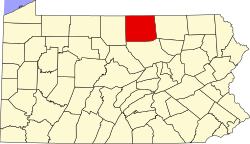
Roseville, Pennsylvania

Last updated
Roseville, Pennsylvania
PA 549 in Roseville.jpg
PA 549 southbound through Roseville.
Tioga County Pennsylvania Incorporated and Unincorporated areas Roseville Highlighted.svg
Location of Roseville in Tioga County, Pennsylvania.
USA Pennsylvania location map.svg
Red pog.svg
Roseville
Location within the U.S. state of Pennsylvania
Usa edcp location map.svg
Red pog.svg
Roseville
Roseville (the United States)
Coordinates: 41°51′50″N76°57′18″W / 41.86389°N 76.95500°W / 41.86389; -76.95500
Country United States
State Pennsylvania
County Tioga
Settled1806
Incorporated (borough)1876
Area
[1]
  Total0.47 sq mi (1.23 km2)
  Land0.47 sq mi (1.23 km2)
  Water0.00 sq mi (0.00 km2)
Elevation
1,342 ft (409 m)
Population
 (2020) [2]
  Total178
  Density374.74/sq mi (144.56/km2)
Time zone Eastern (EST)
  Summer (DST)EDT
Area code 570
FIPS code 42-66232

Roseville is a borough in Tioga County, Pennsylvania, United States. The population was 177 at the 2020 census. [3]

Contents

History

Roseville was first settled by its namesake, Dr. William Rose in 1806. Dr. Rose migrated to Tioga County from Rutland, Vermont. He served as a frontier doctor for the citizens of eastern Tioga and western Bradford Counties. Rose built a distillery at Roseville in 1822, soon after his son, William Rose Jr., opened a tavern. The tavern quickly became the center of commerce in Roseville. The tavern was replaced by a hotel built to serve the needs to travelers between Mansfield and Elmira, New York. [4]

Roseville was home to several businesses that served the needs of the people of Tioga County during the late 1800s and early 1900s. A gristmill was opened as was a cheese factory and a paint plant, but the principal form of business remained in the taverns along the highway. A devastating fire in 1888 destroyed 23 buildings in Roseville, thus ending the tavern era. [4]

Roseville formerly had a post office and a public school. The post office, Rutland Post Office, was closed in 1957. The public school was closed in 1966 when Roseville's school system became part of the Mansfield school system, which later was consolidated into the Southern Tioga School District. [4]

Geography

Roseville is located at 41°51′51″N76°57′34″W / 41.86417°N 76.95944°W / 41.86417; -76.95944 (41.864305, -76.959348). [5]

According to the United States Census Bureau, the borough has a total area of 0.5 square miles (1.3 km2), all land.

Roseville is surrounded by Rutland Township.

Demographics

Historical population
CensusPop.Note
1880 185
1890 21114.1%
1900 2151.9%
1920 119
1930 99−16.8%
1940 13334.3%
1950 126−5.3%
1960 16228.6%
1970 1789.9%
1980 21118.5%
1990 2309.0%
2000 207−10.0%
2010 189−8.7%
2020 177−6.3%
2021 (est.)176 [3] −0.6%
Sources: [6] [7] [8]

As of the census [7] of 2010, there were 189 people, [9] 75 households, and 57 families residing in the borough. The population density was 390.0 inhabitants per square mile (150.6/km2). There were 84 housing units at an average density of 158.3 per square mile (61.1/km2). The racial makeup of the borough was 97.58% White, 0.48% Native American, 0.97% Asian, and 0.97% from two or more races. Hispanic or Latino of any race were 0.48% of the population.

There were 75 households, out of which 32.0% had children under the age of 18 living with them, 58.7% were married couples living together, 12.0% had a female householder with no husband present, and 22.7% were non-families. 16.0% of all households were made up of individuals, and 4.0% had someone living alone who was 65 years of age or older. The average household size was 2.76 and the average family size was 3.02.

In the borough the population was spread out, with 28.0% under the age of 18, 9.7% from 18 to 24, 23.2% from 25 to 44, 30.0% from 45 to 64, and 9.2% who were 65 years of age or older. The median age was 34 years. For every 100 females there were 99.0 males. For every 100 females age 18 and over, there were 86.3 males.

The median income for a household in the borough was $27,188, and the median income for a family was $24,821. Males had a median income of $31,500 versus $21,667 for females. The per capita income for the borough was $11,683. About 10.5% of families and 14.1% of the population were below the poverty line, including 28.8% of those under the age of eighteen and none of those 65 or over.

Churches

There are two churches located in Roseville: Roseville Methodist Church and the Independent Baptist Church.

Related Research Articles

<span class="mw-page-title-main">Athens, Pennsylvania</span> Borough in Pennsylvania, United States

Athens is a borough in Bradford County, Pennsylvania, United States. It is part of Northeastern Pennsylvania and is located 2 miles (3 km) south of the New York state line on the Susquehanna and Chemung rivers. The population was 3,749 in 1900 and 3,796 in 1910. The population was 3,265 at the 2020 census. Athens is in a small area locally known as "The Valley", a group of four contiguous communities in Pennsylvania and New York: Waverly, New York; South Waverly, Pennsylvania; Sayre, Pennsylvania; and Athens. The Valley has a population near 30,000.

<span class="mw-page-title-main">Columbia Township, Bradford County, Pennsylvania</span> Township in Pennsylvania, United States

Columbia Township is a township in Bradford County, Pennsylvania, United States. It is part of Northeastern Pennsylvania. The population was 1,196 at the 2010 census. Children residing in the township are assigned to attend the Troy Area School District.

<span class="mw-page-title-main">Sayre, Pennsylvania</span> Borough in Pennsylvania

Sayre is a borough in Bradford County, Pennsylvania, United States. It is part of Northeastern Pennsylvania. It is the principal city in the Sayre, PA Micropolitan Statistical Area. It lies 18 miles (29 km) southeast of Elmira, New York, and 30 miles (48 km) southwest of Binghamton. It is currently the largest city in Bradford County. In the past, various iron products were made there. In 1900, 5,243 people lived there; in 1910, 6,426 people lived there, and in 1940, 7,569 persons made their homes in Sayre. The population was 5,403 at the 2020 census.

<span class="mw-page-title-main">South Waverly, Pennsylvania</span> Borough in Pennsylvania, United States

South Waverly is a borough in Bradford County, Pennsylvania, United States. It is part of Northeastern Pennsylvania. The population was 1,070 at the 2020 census. South Waverly is part of the Penn-York Valley, a group of four contiguous communities in New York and Pennsylvania: Waverly, New York, South Waverly, Sayre, and Athens, with a combined population near 30,000.

<span class="mw-page-title-main">Troy, Pennsylvania</span> Borough in Pennsylvania, United States

Troy is a borough in Bradford County, Pennsylvania, United States. It is part of Northeastern Pennsylvania. The population was 1,354 at the 2010 census. Children residing in the borough are assigned to attend the Troy Area School District.

<span class="mw-page-title-main">Wells Township, Bradford County, Pennsylvania</span> Township in Pennsylvania, United States

Wells Township is a township in Bradford County, Pennsylvania. It is part of Northeastern Pennsylvania. The population was 814 at the 2010 census.

<span class="mw-page-title-main">Windham Township, Bradford County, Pennsylvania</span> Township in Pennsylvania, United States

Windham Township is a township in Bradford County, Pennsylvania, USA. It is part of Northeastern Pennsylvania. The population was 818 at the 2020 census.

<span class="mw-page-title-main">Wysox Township, Bradford County, Pennsylvania</span> Township in Pennsylvania, United States

Wysox Township is a township in Bradford County, Pennsylvania. It is part of Northeastern Pennsylvania. The population was 1,721 at the 2010 census.

<span class="mw-page-title-main">New Columbus, Pennsylvania</span> Borough in Pennsylvania, United States

New Columbus is a borough in Luzerne County, Pennsylvania, United States. The population was 219 at the 2020 census.

<span class="mw-page-title-main">Blossburg, Pennsylvania</span> Borough in Pennsylvania, United States

Blossburg is a borough in Tioga County, Pennsylvania, United States. The population was 1,536 at the 2020 census.

<span class="mw-page-title-main">Jackson Township, Tioga County, Pennsylvania</span> Township in Pennsylvania, United States

Jackson Township is a township in Tioga County, Pennsylvania, United States. The population was 1,880 at the 2020 census.

<span class="mw-page-title-main">Knoxville, Pennsylvania</span> Borough in Pennsylvania, United States

Knoxville is a borough in northwestern Tioga County, Pennsylvania, United States. The population was 682 at the time of the 2020 census.

<span class="mw-page-title-main">Mansfield, Pennsylvania</span> Borough in Pennsylvania, United States

Mansfield is a borough located in east-central Tioga County, Pennsylvania, United States, in the Tioga River valley. It is situated at the intersection of U.S. Route 6 and U.S. Business Route 15, about 36 miles (58 km) southwest of Elmira, New York.

<span class="mw-page-title-main">Richmond Township, Tioga County, Pennsylvania</span> Township in Pennsylvania, United States

Richmond Township is a township in Tioga County, Pennsylvania, United States. The population was 2,164 at the 2020 census.

<span class="mw-page-title-main">Rutland Township, Tioga County, Pennsylvania</span> Township in Pennsylvania, United States

Rutland Township is a township in Tioga County, Pennsylvania, United States. The population was 776 at the 2020 census.

<span class="mw-page-title-main">Sullivan Township, Tioga County, Pennsylvania</span> Township in Pennsylvania, United States

Sullivan Township is a township in Tioga County, Pennsylvania, United States. The population was 1,470 at the 2020 census.

<span class="mw-page-title-main">Tioga, Pennsylvania</span> Borough in Pennsylvania, United States

Tioga is a borough in Tioga County, Pennsylvania, United States. The population was 611 at the 2010 census. It is located north of Tioga and Hammond Lakes along the Tioga River.

<span class="mw-page-title-main">Tioga Township, Tioga County, Pennsylvania</span> Township in Pennsylvania, United States

Tioga Township is a township in Tioga County, Pennsylvania, United States. The population was 941 at the 2020 census.

<span class="mw-page-title-main">Wellsboro, Pennsylvania</span> Borough in Pennsylvania, United States

Wellsboro is a borough in Tioga County, Pennsylvania. The borough was founded by Benjamin Wistar Morris. It is located 52 miles (84 km) northwest of Williamsport. The population was 3,472 at the 2020 census.

<span class="mw-page-title-main">Nichols (village), New York</span> Village in New York, United States

Nichols is a village located in the Town of Nichols in Tioga County, New York, United States. The population was 512 at the 2010 census. It is part of the Binghamton Metropolitan Statistical Area. The name is taken from that of a local benefactor, Colonel Nichols.

References

  1. "ArcGIS REST Services Directory". United States Census Bureau. Retrieved August 8, 2023.
  2. "Census Population API". United States Census Bureau. Retrieved Oct 12, 2022.
  3. 1 2 Bureau, US Census. "City and Town Population Totals: 2020-2021". Census.gov. US Census Bureau. Retrieved 16 July 2022.
  4. 1 2 3 The Elmira Telegram. "Roseville's 150 years". Joyce M. Tice (Rootsweb). Archived from the original on November 18, 2007. Retrieved 2008-01-15.
  5. "US Gazetteer files: 2010, 2000, and 1990". United States Census Bureau. 2011-02-12. Retrieved 2011-04-23.
  6. "Census of Population and Housing". U.S. Census Bureau. Retrieved 11 December 2013.
  7. 1 2 "U.S. Census website". United States Census Bureau . Retrieved 2008-01-31.
  8. "Incorporated Places and Minor Civil Divisions Datasets: Subcounty Resident Population Estimates: April 1, 2010 to July 1, 2012". Population Estimates. U.S. Census Bureau. Archived from the original on 11 June 2013. Retrieved 11 December 2013.
  9. "Roseville (Rutland), PA Population - Census 2010 and 2000 Interactive Map". Archived from the original on 2016-03-04. Retrieved 2023-08-03.