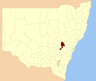
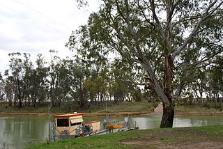
Stotts Creek is a locality in the Tweed Shire of New South Wales, Australia. [2] It had a population of 10 as of the 2021 census. [1]
Stotts Creek is a locality in the Tweed Shire of New South Wales, Australia. [2] It had a population of 10 as of the 2021 census. [1]

Bingara is a small town on the Gwydir River in Murchison County in the New England region of New South Wales, Australia. Bingara is currently the administrative centre for the Gwydir Shire that was created in 2003. The Gwydir River being a main highlight of the town is a main catchment of the Murray-Darling System.

Clarence Valley Council is a local government area in the Northern Rivers region of New South Wales, Australia.

The Bega Valley Shire is a local government area located adjacent to the south-eastern coastline of New South Wales, Australia. The Shire was formed in 1981 with the amalgamation of the Municipality of Bega, Imlay Shire and Mumbulla Shire, with its name deriving from the town of Bega. The shire is also known as the Sapphire Coast for tourism and marketing purposes. During the 2019–20 Australian bushfire season, the area was devastated by fire, with 448 houses being destroyed by fire and approximately 365,000 hectares burned, which is 58% of the Shire's total land mass.
South Windsor is a suburb of the town of Windsor, in the state of New South Wales, Australia. It is generally bounded in the west by Rickabys Creek and in the east by South Creek, both tributaries of the Hawkesbury River. It is also home of Bede Polding College, a Catholic secondary school.

The Liverpool City Council is a local government area to the south-west of Sydney, in the state of New South Wales, Australia. The area encompasses 305.5 square kilometres (118.0 sq mi) and its administrative centre is located in the suburb of Liverpool.

Tweed Shire is a local government area located in the Northern Rivers region of New South Wales, Australia. It is adjacent to the border with Queensland, where that meets the Tasman Sea. Administered from the town of Murwillumbah, Tweed Shire covers an area of 1,321 square kilometres (510 sq mi), and has existed as a local government entity since 1947. It was named for the Tweed River.

Cabonne Council is a local government area in the Central West region of New South Wales, Australia. The Shire is located adjacent to the Mitchell Highway and the Broken Hill railway line, partly surrounding the City of Orange. The administrative centre is located at Molong.

Mooney Mooney Creek is a suburb of the Central Coast region of New South Wales, Australia, located 60 kilometres (37 mi) north of Sydney along both sides of the river after which it is named. It is part of the Central Coast Council local government area.

Ballina Shire is a local government area in the Northern Rivers region of New South Wales, Australia. The Shire was formed on 1 January 1977 by the amalgamation of the Municipality of Ballina and Tintenbar Shire. The Shire is located adjacent to the Tasman Sea and the Pacific Highway. The council seat is located in the town of Ballina. The population of the Ballina Shire area was 44,208 in June 2018.

The City of Albury is a local government area in the Riverina region of New South Wales, Australia. The area covers 305.9 square kilometres (118.1 sq mi) to the north of the Murray River. The area extends around 10 to 12 kilometres east and west along the river from the centre of Albury and up to 20 kilometres (12 mi) north. The population of the City of Albury area was 53,767 in June 2018.

Bathurst Regional Council is a local government area in the Central West region of New South Wales, Australia. The area is located adjacent to the Great Western Highway, Mid-Western Highway, Mitchell Highway and the Main Western railway line. At the 2016 census, the Bathurst Region had a population of 41,300.

Bellingen Shire is a local government area in the mid north coast region of New South Wales, Australia. The Shire is located adjacent to the Pacific Highway, Waterfall Way and the North Coast railway line.

Jugiong is a locality and town on the banks of the Murrumbidgee River near its confluence with Jugiong Creek. in the Hilltops Council Local Government area, New South Wales, Australia. It is situated just off the Hume Highway, by road, about 30 kilometres southwest from Bookham and 40 kilometres northeast from Gundagai.
Mogo Creek is a locality within the City of Hawkesbury, in outer metropolitan Sydney, in the state of New South Wales, Australia. It is located south-west of the town of Bucketty. Mangrove Creek Dam is within the locality, and the western half of the locality is within Yengo National Park. Mogo Creek runs adjacent to the locality.

Sedan is a rural town in South Australia. It is located about 100 kilometres east of Adelaide and about 20 kilometres west of the Murray River. It is located on the dry eastern side of the Mount Lofty Ranges.

Speewa is a rural locality in the Riverina District of New South Wales, Australia near the Murray River in Murray River Council local government area.

Majors Creek is a small village in the Southern Tablelands region of New South Wales, Australia. The nearest major town is Braidwood, 16 km (9.9 mi) to the north. At the 2016 census, the population of Majors Creek was 249. A former gold mining town, the settlement is today associated with the operational Dargues Reef gold mine.

Hilltops Council is a local government area in the South West Slopes region of New South Wales, Australia. This area was formed on 12 May 2016 from the merger of Boorowa Council, Harden Shire and Young Shire. The local government area covers much the same area as the Hilltops wine region.

Queanbeyan–Palerang Regional Council is a local government area located in the Southern Tablelands region of New South Wales, Australia. The council was formed on 12 May 2016 through a merger of the City of Queanbeyan and Palerang Council.

Bayside Council is a local government in New South Wales, Australia. It is located in Sydney, around part of Botany Bay, 7 kilometres (4.3 mi) to 12 kilometres (7.5 mi) south of the CBD. It includes suburbs of South Sydney and the St George area separated by the Cooks River. It comprises an area of 50 square kilometres (19 sq mi) and as at the 2016 census had a population of 156,058.