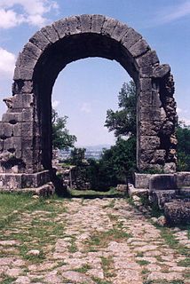
The Via Flaminia or Flaminian Way was an ancient Roman road leading from Rome over the Apennine Mountains to Ariminum (Rimini) on the coast of the Adriatic Sea, and due to the ruggedness of the mountains was the major option the Romans had for travel between Etruria, Latium, Campania, and the Po Valley. Today the same route, still called by the same name for much of its distance, is paralleled or overlaid by Strada Statale (SS) 3, also called Strada Regionale (SR) 3 in Lazio and Umbria, and Strada Provinciale (SP) 3 in Marche. It leaves Rome, goes up the Val Tevere and into the mountains at Castello delle Formiche, ascends to Gualdo Tadino, continuing over the divide at Scheggia Pass, 575 m (1,886 ft) to Cagli. From there it descends the eastern slope waterways between the Tuscan-Emilian Apennines and the Umbrian Apennines to Fano on the coast and goes north, parallel to Highway A14 to Rimini.

The Stubai Alps is a mountain range in the Central Eastern Alps of Europe. It derives its name from the Stubaital valley to its east and is located southwest of Innsbruck, Austria. Several peaks form the border between Austria and Italy. The range is bounded by the Inn River valley to the north; the Sill River valley (Wipptal) and the Brenner Pass to the east ; the Ötztal and Timmelsjoch to the west, and to the south by tributaries of the Passer River and Eisack.

Timmelsjoch, is a high mountain pass that creates a link through the Ötztal Alps along the border between Austria and Italy.

The Serchio is the third longest river in the Italian region of Tuscany at 126 kilometres (78 mi), coming after the Arno at 242 kilometres (150 mi) and the Ombrone, 161 kilometres (100 mi). By mean rate of flow, it is the second largest, smaller than Arno but larger than Ombrone.

The Sole Valley is a valley in Trentino, northern Italy.

Antrodoco is a town and comune in the province of Rieti, in the Lazio region of central Italy. The name derives from the Latin Interocrea.

Ratschings is a comune (municipality) in South Tyrol in northern Italy, located about 45 kilometres (28 mi) north of the city of Bolzano, on the border with Austria.

The Passeier Valley is the valley of the Passer river, in the mountains of South Tyrol, northern Italy. The Passer river is a left-bank tributary to the Adige. At the mouth of the valley, where the two rivers join, stands the town of Merano. From there, the valley runs north to the Timmelsjoch mountain pass, which leads to Sölden in the Ötztal valley of Austria and to the Jaufenpass which leads to Sterzing in the Wipptal.
The Dora di Bardonecchia is a short tributary of the Dora Riparia river, lying entirely within the upper Susa Valley in the Metropolitan City of Turin, Piedmont, Italy.
The Alpine Brigade "Orobica" was a light Infantry brigade of the Italian Army, specializing in mountain warfare. Its core units were Alpini, the mountain infantry corps of the Italian Army, that distinguished itself in combat during World War I and World War II.

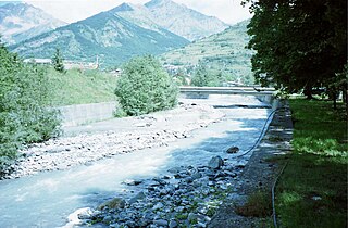
The Passer is a 42.6-kilometre (26.5 mi) torrent in northern Italy, a left tributary of the Adige, whose entire course lies within South Tyrol. The stream rises near the Alpine pass between Italy and Austria known as the Timmelsjoch, and flows through the Passeier Valley where the most important settlement is St. Leonhard in Passeier. The river joins the Adige at Merano, where it is a significant site for competitive canoeing, beneath the Steinerner Steg.
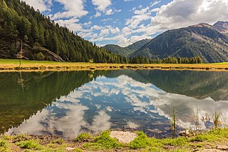
Stelvio National Park is a national park in the north-east of Italy, founded in 1935.

The Brenner Railway is a major line connecting the Austrian and Italian railways from Innsbruck to Verona, climbing up the Wipptal, passing over the Brenner Pass, descending down the Eisacktal to Bolzano/Bozen, then further down the Adige Valley to Roverto/Rofreit, and along the section of the Adige Valley, called in Italian the “Vallagarina”, to Verona. This railway line is part of the Line 1 of Trans-European Transport Networks (TEN-T). It is considered a "fundamental" line by the state railways Ferrovie dello Stato (FS).

Bolzano/Bozen railway station is the main station of Bolzano/Bozen, capital of the autonomous province of Alto Adige/Südtirol, in northeastern Italy.

The Stelvio Pass is a mountain pass in northern Italy bordering Switzerland at an elevation of 2,757 m (9,045 ft) above sea level. It is the highest paved mountain pass in the Eastern Alps, and the second highest in the Alps, 7 m (23 ft) below France's Col de l'Iseran.

The Stura di Demonte Valley is a valley in south-west of Piedmont in the Province of Cuneo, Italy.

Strada statale 4 Via Salaria is an Italian state highway, linking Rome to the Adriatic sea passing through Rieti and Ascoli Piceno. Its route retraces that of the ancient Via Salaria Roman road. It is a single carriageway highway for most of its route.
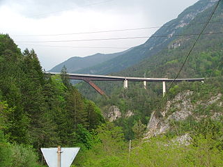
The Cadore Viaduct is a road bridge in Italy, in the southern Alps.

The Alpini Battalion "Val Chiese" is an inactive battalion of the Italian Army's mountain infantry speciality, the Alpini, which distinguished itself in combat during World War I and World War II.

Strada statale 44 bis Passo del Rombo is a motorway that connects Passeier Valley with Austria.

