Italy has a well developed transport infrastructure. The Italian rail network is extensive, especially in the north, and it includes a high-speed rail network that joins the major cities of Italy from Naples through northern cities such as Milan and Turin. The Florence–Rome high-speed railway was the first high-speed line opened in Europe when more than half of it opened in 1977. Italy has 2,507 people and 12.46 km2 per kilometer of rail track, giving Italy the world's 13th largest rail network. The Italian rail network is operated by state-owned Ferrovie dello Stato, while the rail tracks and infrastructure are managed by Rete Ferroviaria Italiana.
The Via Flaminia was an ancient Roman road leading from Rome over the Apennine Mountains to Ariminum (Rimini) on the coast of the Adriatic Sea, and due to the ruggedness of the mountains was the major option the Romans had for travel between Etruria, Latium, Campania, and the Po Valley. The section running through northern Rome is where Constantine the Great, allegedly, had his famous vision of the Chi Rho, leading to his conversion to Christianity and the Christianization of the Roman Empire.

A state highway, state road, or state route is usually a road that is either numbered or maintained by a sub-national state or province. A road numbered by a state or province falls below numbered national highways in the hierarchy.
Follonica is a town and comune (township) of province of Grosseto in the Italian region of Tuscany, on the Gulf of Follonica, about 40 kilometres (25 mi) northwest of the city of Grosseto.

The Via Salaria was an ancient Roman road in Italy. It eventually ran from Rome to Castrum Truentinum on the Adriatic coast, a distance of 242 km. The road also passed through Reate (Rieti) and Asculum.

Grosseto is a comune in the central Italian region of Tuscany, the capital of the province of Grosseto. The city lies 14 kilometres from the Tyrrhenian Sea, in the Maremma, at the centre of an alluvial plain on the Ombrone river.

The Via Aurelia is a Roman road in Italy constructed in approximately 241 BC. The project was undertaken by Gaius Aurelius Cotta, who at that time was censor. Cotta had a history of building roads for Rome, as he had overseen the construction of a military road in Sicily connecting Agrigentum and Panormus.
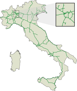
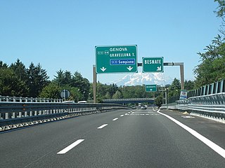
The autostrade are roads forming the Italian national system of motorways. The total length of the system is about 7,016 kilometres (4,360 mi), as of 30 July 2022. To these data are added 13 motorway spur routes, which extend for 355 kilometres (221 mi).

European route E80, also known as the Trans-European Motorway or TEM, is an A-Class West-East European route, extending from Lisbon, Portugal to Gürbulak, Turkey, on the border with Iran. The road connects 10 countries and has a length of approximately 6,102 kilometres (3,792 mi). At its eastern end it joins end-on with Asian Highway AH1 which continues all the way to Tokyo, Japan.

The GRA or Grande Raccordo Anulare is a toll-free, ring-shaped 68.2 kilometres (42.4 mi) long orbital motorway that encircles Rome. GRA is one of the most important roads in Rome, and traffic reaches 160,000 vehicles per day as of 2011.

Monte Argentario is a comune (municipality) and a peninsula belonging to the Province of Grosseto in the Italian region Tuscany, located about 150 kilometres (93 mi) south of Florence and about 35 kilometres (22 mi) south of Grosseto. The peninsula is connected with the mainland by three spits of land which form two lagoons, the Laguna di Ponente on the west side and the Laguna di Levante on the east side of the middle dam. The two main villages on Monte Argentario are Porto Santo Stefano, chief town, facing north, and Porto Ercole facing south.
The Strade Statali, abbreviated SS, are the Italian national network of state highways. The total length of the network is about 25,000 km (16,000 mi).

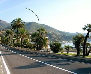
Roads in Italy are an important mode of transport in Italy. The classification of the roads of Italy is regulated by the Italian traffic code, both from a technical and administrative point of view. The street nomenclature largely reflects the administrative classification. Italy is one of the countries with the most vehicles per capita, with 690 per 1000 people in 2010.

Port of Civitavecchia, also known as "Port of Rome", or Civitavecchia Port of Rome, is the seaport of Civitavecchia, Metropolitan City of Rome, Italy. It is an important hub for the maritime transport in Italy, for goods and passengers. The Rome Cruise Terminal is part of the port. Part of the "Motorways of the Sea", it is linked to several Mediterranean ports and represents one of the main links between the Italian mainland and Sardinia.

Strada statale 4 Via Salaria is an Italian state highway, linking Rome to the Adriatic Sea passing through Rieti and Ascoli Piceno. Its route retraces that of the ancient Via Salaria Roman road. It is a single carriageway highway for most of its route.

The strada statale 18 "Tirrena Inferiore" is an Italian state road, connecting Campania and Calabria. It is among the longest and most important state highways in southern Italy, considering that it follows the Tyrrhenian coast, from Salerno to Reggio di Calabria.

Strada statale 148 Pontina , previously known as Strada regionale 148 Pontina , is a highway that connects Rome to Terracina, passing through Latina and through the localities of Pomezia, Ardea in the Metropolitan City of Rome and for Aprilia, Pontinia and Sabaudia in province of Latina.

Strada statale 72 di San Marino is a motorway that connects the province of Rimini and connects the provincial capital with the Republic of San Marino. The current road, built after the World War II, is 10,600 km long and has a typically flat layout. It consists of two lanes in each direction of travel and replaces the old state road 72. The road begins on the outskirts of Rimini and ends at the Dogana state border. In San Marino, it continues as the San Marino Highway.

Strada statale 35 dei Giovi is an Italian state highway, which connects Genoa and the Italian Riviera with Como and the Canton of Ticino, passing through Pavia and Milan. The road begins in Genoa in the Sampierdarena district where it constitutes an important urban crossing artery with the Reti and Fillak streets, and then ends in Como more precisely at the Customs House in Ponte Chiasso on the border with Switzerland. Between Tortona and Casteggio the SS 35 is in common with the strada statale 10, while the Milan-Cermenate section is a Superstrada, built around the 1960s known as Superstrada Milano-Meda.

Strada statale 7 Via Appia is a motorway that follows the path of the ancient Appian Way, connecting Rome to Brindisi. In the stretch between Cisterna di Latina and Terracina, the SS 7 is called "fettuccia di Terracina" due to its straight line.