
The Via Salaria was an ancient Roman road in Italy. It eventually ran from Rome to Castrum Truentinum on the Adriatic coast, a distance of 242 km. The road also passed through Reate (Rieti) and Asculum.

Arno was a department of the First French Empire in present-day Italy. It was named after the Arno river. It was formed in 1808, when the Kingdom of Etruria was annexed directly to France. Its capital was Florence.
Ameglia is a comune (municipality) in the Province of La Spezia in the Italian region of Liguria, located about 90 kilometres (56 mi) southeast of Genoa and about 11 kilometres (7 mi) southeast of La Spezia.

Riccò del Golfo di Spezia is a comune (municipality) in the Province of La Spezia in the Italian region Liguria, located about 80 kilometres (50 mi) southeast of Genoa and about 10 kilometres (6 mi) northeast of La Spezia.

Pelago is a comune (municipality) in the Metropolitan City of Florence in the Italian region Tuscany, located about 20 kilometres (12 mi) east of Florence. As of 31 December 2004, it had a population of 7,396 and an area of 54.8 square kilometres (21.2 sq mi).

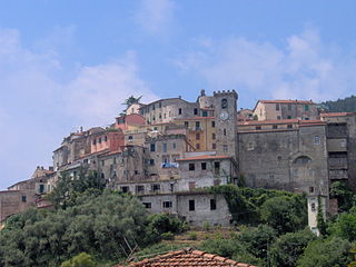
Cona is a quarter of Teramo, central Italy. It takes its name from the presence of the local church, Madonna della Cona. The Madonna della Cona is a religious symbol of abundance and fertility with a festival the first Sunday in September that is celebrated in her honor.

The Autostrada A91, also called Autostrada Roma-Fiumicino, is an Italian motorway which connects Rome to the Fiumicino Airport.

The Stura di Demonte Valley is a valley in south-west of Piedmont in the Province of Cuneo, Italy.

Strada statale 4 Via Salaria is an Italian state highway, linking Rome to the Adriatic sea passing through Rieti and Ascoli Piceno. Its route retraces that of the ancient Via Salaria Roman road. It is a single carriageway highway for most of its route.

The strada statale 18 "Tirrena Inferiore" is an Italian state road, connecting Campania and Calabria. It is among the longest and most important state highways in southern Italy, considering that it follows the Tyrrhenian coast, from Salerno to Reggio di Calabria.

The strada statale 235 "di Orzinuovi" was an Italian state road, created in 1959 and disestablished in 2000. It began in Pavia and ended in Brescia, going through the Po Valley in the Lombardy region.

The strada statale 234 "Codognese" was an Italian state road, created in 1959 and disestablished in 2000. It began in Pavia and ended in Cremona, going through the Po Valley in the Lombardy region.

Strada statale 148 Pontina , previously known as Strada regionale 148 Pontina , is a highway that connects Rome to Terracina, passing through Latina and through the localities of Pomezia, Ardea in the Metropolitan City of Rome and for Aprilia, Pontinia and Sabaudia in province of Latina.
Strada statale 44 bis Passo del Rombo is a motorway that connects Passeier Valley with Austria.

Strada statale 12 dell'Abetone e del Brennero is a national highway in Italy that connects Pisa to the Austrian border at Brenner Pass.

Strada statale 44 delle Dolomiti, also known as strada regionale 48 delle Dolomiti is a motorway located in the Italian regions of Trentino-Alto Adige/Südtirol and Veneto. It is a mountainous road that runs through the Dolomite area from South Tyrol, through Trentino to Cadore, crossing very suggestive mountain scenery.

Strada statale 37 del Maloja is a motorway located in the Italian region of Lombardy.

Strada statale 35 dei Giovi is an Italian state highway, which connects Genoa and the Italian Riviera with Como and the Canton of Ticino, passing through Pavia and Milan. The road begins in Genoa in the Sampierdarena district where it constitutes an important urban crossing artery with the Reti and Fillak streets, and then ends in Como more precisely at the Customs House in Ponte Chiasso on the border with Switzerland. Between Tortona and Casteggio the SS 35 is in common with the strada statale 10, while the Milan-Cermenate section is a Superstrada, built around the 1960s known as Superstrada Milano-Meda.

Strada statale 7 Via Appia is a motorway that follows the path of the ancient Appian Way, connecting Rome to Brindisi. In the stretch between Cisterna di Latina and Terracina, the SS 7 is called "fettuccia di Terracina" due to its straight line.

The strada statale 310 "del Bidente" was an Italian state road, created in 1962 and disestablished in 2000. It began in Campaldino and ended in Ronco by Forlì, going through the Apennine Mountains between Tuscany and Emilia-Romagna.
