State Highway 18 | ||||
---|---|---|---|---|
Strada statale 18 | ||||
Tirrena Inferiore | ||||
Route information | ||||
Maintained by ANAS | ||||
Length | 406.15 km (252.37 mi) | |||
Existed | 1928–present | |||
Major junctions | ||||
From | A2 at Fratte junction | |||
To | Reggio di Calabria | |||
Location | ||||
Country | Italy | |||
Regions | Campania, Basilicata, Calabria | |||
Highway system | ||||
|
The strada statale 18 "Tirrena Inferiore" (SS 18) an Italian state highway 406.15 kilometres (252.37 mi) long in Italy located in the regions of Campania, Basilicata and Calabria. It is among the longest and most important state highways in southern Italy, considering that it follows the Tyrrhenian coast, from Salerno to Reggio di Calabria.
The road was created in 1928 with the following route: "Naples - Torre Annunziata - Salerno - Battipaglia - Rutino - Vallo - Torre Orsaia - Sapri - Paola - Sant'Eufemia Lamezia - Nicastro - Monteleone - Reggio Calabria." [2] The road was called "Tirrena Inferiore", from the name of the Tyrrhenian Sea. In 1953 the route was modified.
Campania
Naples, San Giorgio a Cremano, Portici, Ercolano, Torre del Greco, Torre Annunziata, Pompei.
Scafati, Angri, Sant'Egidio del Monte Albino, Pagani, Nocera Inferiore, Nocera Superiore, Cava de' Tirreni, Vietri sul Mare, Salerno.
Tirrena Inferiore Tangenziale di Salerno | ||||
Exit | ↓km↓ | Province | ||
---|---|---|---|---|
diramazione Napoli | 54.8 km (34.1 mi) | SA | ||
Fratte dei Due Principati | 55.3 km (34.4 mi) | |||
Salerno Centro via Irno Rione Petrosino | 55.8 km (34.7 mi) | |||
Sala Abbagnano - Torrione | 57.3 km (35.6 mi) | |||
Pastena Giovi - S. Eustachio - S. Margherita - Mercatello | 58.9 km (36.6 mi) | |||
Mariconda Mercatello - Arbostella - Salerno est | 60.7 km (37.7 mi) | |||
Rest area "San Leonardo" | 61.6 km (38.3 mi) | |||
San Giovanni di Dio e Ruggi d'Aragona - Scuola Medica Salernitana Hospital San Leonardo ex- Tirrena Inferiore | 62.2 km (38.6 mi) | |||
Industrial area Fuorni Stadio Arechi Litoranea | 63.5 km (39.5 mi) | |||
Aversana Salerno Costa d'Amalfi Airport Paestum | 64.3 km (40.0 mi) | |||
Pontecagnano Tirrena Inferiore | 66.1 km (41.1 mi) | |||
del Mediterraneo | 66.6 km (41.4 mi) | |||
Campania
Salerno, Pontecagnano, Bivio Pratole (Montecorvino Pugliano-Bellizzi), Bellizzi, Battipaglia, Corno d'Oro (Eboli), Cioffi (Eboli), Santa Cecilia (Eboli), Ponte Barizzo (Capaccio), Paestum (Capaccio), Mattine (Agropoli), Ogliastro Cilento, Prignano Cilento, Sant'Antuono (Torchiara), Rutino, Omignano Scalo (Omignano), Vallo Scalo (Casal Velino), Pantana (Castelnuovo Cilento), Vallo della Lucania, Novi Velia, San Biase (Ceraso), Massascusa (Ceraso), Cuccaro Vetere, Futani, Montano Antilia, Laurito, Alfano, Castel Ruggero (Torre Orsaia), Torre Orsaia, Policastro Bussentino (Santa Marina), Capitello (Ispani), Villammare (Vibonati), Sapri.
Basilicata
Acquafredda, Cersuta, Marina di Maratea, Castrocucco (all frazioni of Maratea).
Calabria
Tortora Marina (Tortora), Praia a Mare, San Nicola Arcella, Scalea, Santa Maria del Cedro, Grisolia, Cirella, Diamante, Belvedere Marittimo, Sangineto, Bonifati, Cetraro, Acquappesa, Marina di Guardia Piemontese (Guardia Piemontese), Marina di Fuscaldo (Fuscaldo), Paola, San Lucido, Falconara Albanese, Fiumefreddo Bruzio, Longobardi, Belmonte Calabro, Amantea, Campora San Giovanni.
Nocera Terinese, Falerna Marina (Falerna), Gizzeria Lido (Gizzeria), Lamezia Terme, Curinga.
Pizzo Calabro, Vibo Valentia, Mileto.
Rosarno, Gioia Tauro, Palmi, Seminara, Bagnara Calabra, Scilla, Villa San Giovanni, Reggio Calabria.
The province of Salerno is a province in the Campania region of Italy.
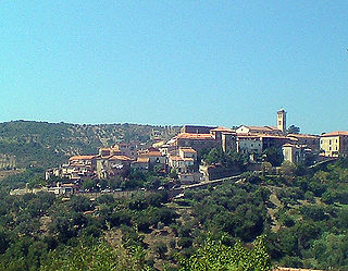
Casal Velino, also spelled Casalvelino, is a town and comune in the province of Salerno in the Campania region of south-western Italy.
Castelnuovo Cilento is a town and comune in the province of Salerno in the Campania region of south-western Italy.
Prignano Cilento is a town and comune in the province of Salerno in the Campania region of south-western Italy. As of 2017 its population was of 1,035.
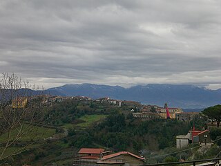
Rutino is a town and comune in the province of Salerno in the Campania region of southwestern Italy. It is in the geographic region Cilento.
Santa Barbara is an Italian village and hamlet (frazione) of the commune of Ceraso in the Province of Salerno, Campania. It has a population of roughly a thousand.
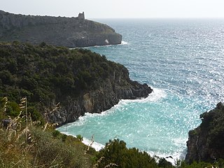
Cilento is an Italian geographical region of Campania in the central and southern part of the province of Salerno and an important tourist area of southern Italy.
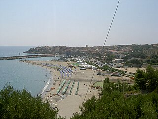
Marina di Camerota is an Italian town, the largest Civil parish of Camerota, situated in the province of Salerno, Campania. In 2007 it had a population of 2,674.
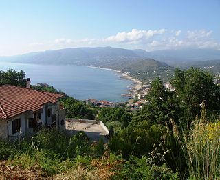
Palinuro is an Italian small town, the most populated civil parish (frazione) of Centola, Province of Salerno, in the Campania region. The name of the town is derived from Palinurus, the helmsman of Aeneas, as recorded in the fifth and sixth books of the Aeneid.
Policastro Bussentino is an Italian town and hamlet (frazione) of the municipality of Santa Marina in the province of Salerno, Campania region. It is a former bishopric, now titular see, and has a population of 1,625.
Cilento, Vallo di Diano and Alburni National Park is an Italian national park in the Province of Salerno, in Campania in southern Italy. It includes much of the Cilento, the Vallo di Diano and the Monti Alburni. It was founded in 1991 and was formerly known as the Parco Nazionale del Cilento e Vallo di Diano.
Salerno railway station serves the Italian city of Salerno and was opened in 1866. It is the main railway station of the city.
The Vallo di Diano is an Italian valley of the south-eastern side of Campania, in the province of Salerno.
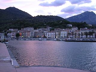
Scario is an Italian village and hamlet (frazione), the largest of the municipality of San Giovanni a Piro in the province of Salerno, Campania region. In 2011, it had a population of 1,124.
The Cilento Coast is an Italian stretch of coastline in Cilento, on the southern side of the Province of Salerno. It is situated between the gulfs of Salerno and Policastro, extending from the municipalities of Capaccio-Paestum in the north-west, to Sapri in the south-east.
Castel Ruggero, also spelled as Castelruggero, is a southern Italian village and hamlet (frazione) of Torre Orsaia, a municipality in the province of Salerno, Campania. As of 2011, it had a population of 400.
San Severino is an Italian village and hamlet (frazione) of the municipality of Centola in the Province of Salerno, Campania. As of 2011 its population was 435.
The Salerno–Reggio Calabria railway is the most important north–south railway connection between Sicily, Calabria and the rest of the Italian peninsula. It forms the southern section of Corridor 1 of the European Union's Trans-European high-speed rail network, which connects Berlin and Palermo. Its southern part, between Rosarno and San Lucido is also used as an RFI freight route between the Port of Gioia Tauro and the Adriatic railway.
Capitello is a southern Italian village and hamlet (frazione) of Ispani, a municipality in the province of Salerno, Campania. As of 2009 its population was of 626.
Media related to Strada Statale 18 Tirrena Inferiore at Wikimedia Commons