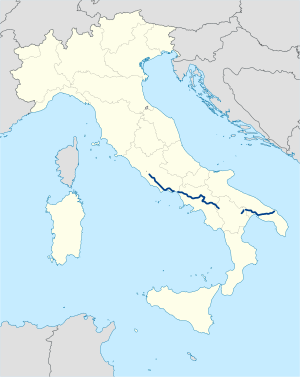
The Appian Way is one of the earliest and strategically most important Roman roads of the ancient republic. It connected Rome to Brindisi, in southeast Italy. Its importance is indicated by its common name, recorded by Statius, of Appia longarum... regina viarum . The road is named after Appius Claudius Caecus, the Roman censor who began and completed the first section as a military road to the south in 312 BC during the Samnite Wars.
The province of Caserta is a province in the Campania region of Italy. Its capital is the city of Caserta, situated about 36 kilometres (22 mi) by road north of Naples. The province has an area of 2,651.35 square kilometres (1,023.69 sq mi), and had a total population of 924,414 in 2016. The Palace of Caserta is located near to the city, a former royal residence which was constructed for the Bourbon kings of Naples. It was the largest palace and one of the largest buildings erected in Europe during the 18th century. In 1997, the palace was designated a UNESCO World Heritage Site.

The Archdiocese of Gaeta is a Latin Church ecclesiastical territory or archdiocese of the Catholic Church in southern Italy, in the city of Gaeta, in the Lazio region. The archbishop's cathedra is located in the Cathedral of SS. Erasmus and Marcianus and the Assumption of the Virgin Mary in the episcopal see of Gaeta. A non-metropolitan see, the archdiocese is immediately exempt to the Holy See.
Santeramo in Colle is a town in the Metropolitan City of Bari and region of Apulia, southern Italy.

The Milan–Bologna railway is the northern part of the traditional main north–south trunk line of the Italian railway network. It closely follows the ancient Roman Road, the Via Aemilia. The line was opened between 1859 and 1861 as a single-line railway, and was doubled between 1866 and 1894. It was electrified at 3,000 volts DC in 1938. High-speed trains on the route have used the parallel Milan–Bologna high-speed line since 13 December 2008.

The Florence–Rome railway is part of the traditional main north–south trunk line of the Italian railway network. The line is referred to by Ferrovie dello Stato as the Linea Lenta to distinguish it from the parallel high-speed line. The Linea Lenta is now mainly used for regional services, for the InterCity services — rather than the faster Le Frecce trains — between Florence and Rome and for the majority of freight trains. Some types of passenger train are routed on the line to serve smaller stations not served by the high-speed line or in order to improve traffic flow during peak periods or other periods of congestion.

The Rome–Formia–Naples railway—also called the Rome–Naples Direttissima in Italian –is part of the traditional main north-south trunk line of the Italian railway network. It was opened in 1927 as a fast link as an alternative to the existing Rome–Naples via Cassino line, significantly reducing journey times. High-speed trains on the route use the parallel Rome–Naples high-speed railway, which was partially opened in December 2005, and fully in December 2009.

Anas S.p.A. is an Italian joint-stock company that deals with road infrastructure and manages the network of state roads and motorways of national interest. Founded in 1946 with the name Azienda Nazionale Autonoma delle Strade (ANAS), this acronym became a proper name with the transformation first into a public economic body (1996) and subsequently into a joint-stock company (2002). Since January 2018, it has been part of the Ferrovie dello Stato Italiane corporate group. Legally, the company can be classified as a public law body; furthermore, within the European System of Accounts, it appears among the companies in the consolidated income statement of the Italian state.

The Genoa–Pisa railway is one of the trunk lines of the Italian railway network. It runs along the Ligurian coast from Genoa to Pisa through the Riviera di Levante and the Versilia. It passes through the cities of Massa, Carrara and La Spezia. South of Pisa the Pisa–Rome line continues along the Tyrrhenian coast to Rome. The line is double track and is fully electrified at 3,000 V DC. Passenger traffic is managed by Trenitalia.

Treviglio railway station, also known as Treviglio centrale railway station is the main station serving the town and comune of Treviglio, in the region of Lombardy, northern Italy. Opened in 1878, it has a higher average number of passengers per day than Treviglio's other railway station, Treviglio Ovest.

Olbia railway station serves the town and comune of Olbia, in the northeast of the island and region of Sardinia, Italy. Opened in 1881, it forms part of the Cagliari–Golfo Aranci railway, the main railway line in Sardinia.

The Bologna–Ancona railway is an Italian railway that connects the city of Bologna with the city of Ancona, passing through the Po Valley to Rimini and along the Adriatic coast for the rest of the line.

Davide Carlo Caparini is an Italian politician and entrepreneur.

Strada statale 148 Pontina , previously known as Strada regionale 148 Pontina , is a highway that connects Rome to Terracina, passing through Latina and through the localities of Pomezia, Ardea in the Metropolitan City of Rome and for Aprilia, Pontinia and Sabaudia in province of Latina.

Strada statale 48 delle Dolomiti, also known as strada regionale 48 delle Dolomiti is a motorway located in the Italian regions of Trentino-Alto Adige/Südtirol and Veneto. It is a mountainous road that runs through the Dolomite area from South Tyrol, through Trentino to Cadore, crossing very suggestive mountain scenery.

Strada statale 35 dei Giovi is an Italian state highway, which connects Genoa and the Italian Riviera with Como and the Canton of Ticino, passing through Pavia and Milan. The road begins in Genoa in the Sampierdarena district where it constitutes an important urban crossing artery with the Reti and Fillak streets, and then ends in Como more precisely at the Customs House in Ponte Chiasso on the border with Switzerland. Between Tortona and Casteggio the SS 35 is in common with the strada statale 10, while the Milan-Cermenate section is a Superstrada, built around the 1960s known as Superstrada Milano-Meda.
The Via Flacca was a Roman road along the western coast of Latium, Italy. It was built under censor Lucius Valerius Flaccus around 184 BC. Parts of it have recently been renovated as a trekking route.