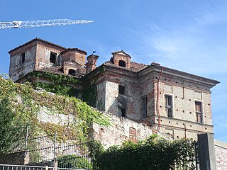
Roccavione is a comune (municipality) in the Province of Cuneo in the Italian region Piedmont, located about 90 kilometres (56 mi) south of Turin and about 9 kilometres (6 mi) southwest of Cuneo.
San Zenone al Po is a comune in the province of Pavia, Lombardy, Italy.

Mercenasco is a comune (municipality) in the Metropolitan City of Turin in the Italian region Piedmont, located about 35 kilometres (22 mi) northeast of Turin.
Beinette is a comune (municipality) in the Province of Cuneo in the Italian region Piedmont, located about 80 kilometres (50 mi) south of Turin and about 8 kilometres (5 mi) east of Cuneo. As of 31 December 2004, it had a population of 2,898 and an area of 17.4 square kilometres (6.7 sq mi).
Camerana is a comune (municipality) in the Province of Cuneo in the Italian region Piedmont, located about 80 kilometres (50 mi) southeast of Turin and about 45 kilometres (28 mi) east of Cuneo.
Isasca is a comune (municipality) in the Province of Cuneo in the Italian region Piedmont, located about 60 kilometres (37 mi) southwest of Turin and about 25 kilometres (16 mi) northwest of Cuneo, in the Valle Varaita.

Montelupo Albese is a comune (municipality) in the Province of Cuneo in the Italian region Piedmont, located about 60 kilometres (37 mi) southeast of Turin and about 45 kilometres (28 mi) northeast of Cuneo.
Murazzano is a comune (municipality) in the Province of Cuneo in the Italian region Piedmont, located about 70 kilometres (43 mi) southeast of Turin and about 40 kilometres (25 mi) east of Cuneo.
Piobesi d'Alba is a comune (municipality) in the Province of Cuneo in the Italian region Piedmont, located about 45 kilometres (28 mi) southeast of Turin and about 50 kilometres (31 mi) northeast of Cuneo. As of 31 December 2004, it had a population of 1,170 and an area of 4.0 square kilometres (1.5 sq mi).
Ruffia is a comune (municipality) in the Province of Cuneo in the Italian region Piedmont, located about 40 kilometres (25 mi) south of Turin and about 35 kilometres (22 mi) north of Cuneo. As of 1-1-2017, it had a population of 366 and an area of 7.51 square kilometres (2.90 sq mi).
Salmour is a comune (municipality) in the Province of Cuneo in the Italian region Piedmont, located about 50 kilometres (31 mi) south of Turin and about 30 kilometres (19 mi) northeast of Cuneo. Salmour borders the following municipalities: Bene Vagienna, Cervere, Cherasco, Fossano, and Narzole.
Vottignasco is a comune (municipality) in the Province of Cuneo in the Italian region Piedmont, located about 60 kilometres (37 mi) south of Turin and about 20 kilometres (12 mi) north of Cuneo.

Gandosso is a comune (municipality) in the Province of Bergamo in the Italian region of Lombardy, located about 60 kilometres (37 mi) northeast of Milan and about 20 kilometres (12 mi) southeast of Bergamo.
Gaverina Terme is a comune (municipality) in the Province of Bergamo in the Italian region of Lombardy, located about 70 kilometres (43 mi) northeast of Milan and about 20 kilometres (12 mi) northeast of Bergamo.

Mornico al Serio is a comune (municipality) in the Province of Bergamo in the Italian region of Lombardy, located about 50 kilometres (31 mi) northeast of Milan and about 14 kilometres (9 mi) southeast of Bergamo. As of 31 December 2004, it had a population of 2,632 and an area of 7.0 square kilometres (2.7 sq mi).

San Giovanni Bianco is a comune (municipality) in the Province of Bergamo in the Italian region Lombardy, located about 60 kilometres (37 mi) northeast of Milan and about 20 kilometres (12 mi) north of Bergamo, located in the Val Brembana.

Santa Brigida is a comune (municipality) in the Province of Bergamo in the Italian region of Lombardy, located about 70 kilometres (43 mi) northeast of Milan and about 30 kilometres (19 mi) north of Bergamo. As of 31 December 2004, it had a population of 623 and an area of 14.2 square kilometres (5.5 sq mi).
Bressana Bottarone is a comune (municipality) in the Province of Pavia in the Italian region Lombardy, located about 45 km south of Milan and about 11 km south of Pavia.
Cura Carpignano is a comune (municipality) in the Province of Pavia in the Italian region Lombardy, located about 30 km south of Milan and about 9 km northeast of Pavia.

Villanterio is a comune (municipality) in the Province of Pavia in the Italian region Lombardy, located about 30 km southeast of Milan and about 15 km east of Pavia.


