Chioggia is a coastal town and comune of the Metropolitan City of Venice in the Veneto region of northern Italy.

Grottaglie is a town and comune in the province of Taranto, Apulia, in southern Italy.

Paternò is a southern Italian town and comune of the Metropolitan City of Catania, Sicily. With a population (2016) of 48,009, it is the third municipality of the province after Catania and Acireale.
Telese Terme, called simply Telese until 1991, is a city, comune (municipality) and former episcopal seat in the Province of Benevento, in the Campania region of southern Italy. It is located in the valley of the Calore, well known for its sulfuric hot springs.

Arienzo is a town and comune in the Province of Caserta, Campania, southern Italy. It is located across the Appian Way.

Mentana is a town and comune, former bishopric and present Latin Catholic titular see in the Metropolitan City of Rome, Lazio, central Italy. It is located 29 kilometres (18 mi) north-east of Rome and has a population of about 23,000.

San Pietro Vernotico is a town and comune in the province of Brindisi, Apulia, on the south-east coast of Italy. Its main economic activities are tourism and the growing of olives and grapes. It was the site of a substantial Messapian community c. 500 BC.

Calascibetta is a comune in the Province of Enna, Sicily, southern Italy.

Montemarano is a town and comune, former Latin bishopric and present titular see in the province of Avellino in the Campania region of southern Italy.

Acquaformosa is a town and comune in the province of Cosenza in the Calabria region of Italy. Since the Middle Ages it is home to an Arbëresh minority, which is reflected in the presence of Skanderbeg's heraldic eagle in the comune's coat of arms. The town is also the seat of the Arberesh Orthodox Church.
San Giovanni Teatino is a comune and town in the Province of Chieti in the Abruzzo region of Italy. Until 1894 this comune was known as Forcabobolina. Situated on a hill overlooking the valley of the river Pescara (Aterno-Pescara), in recent years the place has undergone an industrial development, especially in the area of Sambuceto. Abruzzo Airport is also located in a portion of the municipal territory, close to the border with Pescara. In fact, the municipality is virtually divided into two, San Giovanni Teatino (Alto), which is the historic village on the hill, and the aforementioned Sambuceto, an ever-growing urban settlement, home to a large shopping area and an important industrialized area.<>

Villamagna is a comune and town in the province of Chieti in the Abruzzo region of south-eastern Italy.

Calascio is a comune and village in the province of L'Aquila, in the Abruzzo region of central Italy. It is located in the Gran Sasso e Monti della Laga National Park.

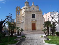
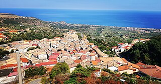
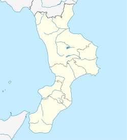
Montauro is a comune and town in the province of Catanzaro in the Calabria region of Italy. The municipalities of Gasperina, Montepaone, Palermiti, Squillace, Stalettì are nearby. Agricultural center of the Ionian coast of the greenhouses, in foothills sloping towards the Gulf of Squillace, North of the mouth of the river Soverato. Built before the year 1000, the village had name from the mountain on which it stands, felt with gold. In 1101 by Count Roger was given in fief to the carthusians of Serra San Bruno. Severely damaged by the earthquake of 1783, in 1846 he suffered other damage due to an exceptional flood. The parish church incorporates remains of medieval fortifications with its external structures; in the Interior, which currently occurs in the appearance given to him in the 17th century, wooden ceiling and choir ' 600, sumptuous altar in polychrome marble and bronze sculptures and marble of 600-700 's. Near the village there are the ruins of the monastery of San Domenico now call "La Grangia di Sant' Anna", of Norman Foundation and destroyed by an earthquake in 1783. Montauro has amazing Portals from many years of age. A Medieval town that looks over the Ionian Sea. In Montauro there are many different association registered like:

Torremaggiore is a town, comune (municipality) and former seat of a bishopric, in the province of Foggia in the Apulia, region of southeast Italy.

Cerchiara di Calabria is a town and comune in the province of Cosenza, part of the Calabria region of southern Italy.

Montesarchio is a comune in the Province of Benevento, Campania, southern Italy. It is located 18 kilometres south-west of Benevento in the Valle Caudina at the foot of Monte Taburno. The commune was granted the official status of City (Città) by a presidential decree of 31 July 1977.

San Siro is a comune (municipality) in the Province of Como in the Italian region Lombardy, located on the west shore of Lake Como immediately north of Menaggio and south of Cremia.
Castel di Lucio is a comune (municipality) in the Province of Messina in the Italian region Sicily, located about 90 kilometres (56 mi) southeast of Palermo and about 110 kilometres (68 mi) southwest of Messina. Castel di Lucio borders the following municipalities: Geraci Siculo, Mistretta, Nicosia, Pettineo, San Mauro Castelverde.

San Fratello, formerly San Filadelfo, is a comune (municipality) in the Metropolitan City of Messina in the Italian region Sicily, located about 110 kilometres (68 mi) east of Palermo and about 90 kilometres (56 mi) west of Messina. San Fratello borders the following municipalities: Acquedolci, Alcara li Fusi, Caronia, Cesarò, Militello Rosmarino, Sant'Agata di Militello.


