Bourbon whiskey is a type of American whiskey, a barrel-aged distilled spirit made primarily from corn. The name ultimately derives from the French Bourbon dynasty, although the precise inspiration for the whiskey's name is uncertain; contenders include Bourbon County in Kentucky and Bourbon Street in New Orleans, both of which are named after the dynasty. Bourbon has been distilled since the 18th century. The use of the term "bourbon" for the whiskey has been traced to the 1820s, with consistent use beginning in Kentucky in the 1870s. Although bourbon may be made anywhere in the United States, it is strongly associated with the American South and with Kentucky in particular. As of 2014, distillers' wholesale market revenue for bourbon sold within the U.S. was about $2.7 billion, and bourbon made up about two-thirds of the $1.6 billion of U.S. exports of distilled spirits.

Breckinridge County is a county located in the Commonwealth of Kentucky. As of the 2010 census, the population was 20,059. Its county seat is Hardinsburg, Kentucky. The county was named for John Breckinridge (1760–1806), a Kentucky Attorney General, state legislator, United States Senator, and United States Attorney General. It was the 38th Kentucky county in order of formation.

Breathitt County is a county located in the eastern Appalachian portion of the U.S. state of Kentucky. As of the 2010 census, the population was 13,878. Its county seat is Jackson, Kentucky. The county was formed in 1839 and was named for John Breathitt, who was Governor of Kentucky from 1832 to 1834. Breathitt County was a prohibition or dry county, until a public vote in July 2016 that allowed alcohol sales.

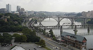
The Tennessee River is the largest tributary of the Ohio River. It is approximately 652 miles (1,049 km) long and is located in the southeastern United States in the Tennessee Valley. The river was once popularly known as the Cherokee River, among other names, as many of the Cherokee had their territory along its banks, especially in eastern Tennessee and northern Alabama. Its current name is derived from the Cherokee village Tanasi.

Jim Beam is a brand of bourbon whiskey produced in Clermont, Kentucky, by Beam Suntory, a subsidiary of Suntory Holdings of Osaka, Japan. It is one of the best-selling brands of bourbon in the world. Since 1795, seven generations of the Beam family have been involved in whiskey production for the company that produces the brand, which was given the name "Jim Beam" in 1933 in honor of James B. Beam, who rebuilt the business after Prohibition ended. Previously produced by the Beam family and later owned by the Fortune Brands holding company, the brand was purchased by Suntory Holdings in 2014.

The Battle of Middle Creek was an engagement fought January 10, 1862, in Eastern Kentucky during the American Civil War.

Carr Creek Lake, located east of Hazard, Kentucky, along Kentucky Route 15 in Knott County, is a 710 acres (3 km2) reservoir created by the U.S. Army Corps of Engineers in 1976. Carr Creek Lake's earth and rock fill dam is 130 ft (40 m) tall and 720 ft (219 m) long, and the dam is located 8.8 mi (14 km) above the mouth of Carr Fork River, a tributary of the North Fork Kentucky River.

Knob Creek is a brand of Kentucky straight bourbon whiskey produced by Beam Suntory at the Jim Beam distillery in Clermont, Kentucky. It is one of the four Jim Beam small batch bourbon brands targeted for the high-end liquor market. Its siblings in the line are Booker's, Baker's, and Basil Hayden's.
The Fugates, a family that lived in the hills of Kentucky, commonly known as the "Blue Fugates" or the Blue People of Kentucky, are notable for having been carriers of a genetic trait that led to the disease methemoglobinemia, which gives sufferers blue-tinged skin.

Princess is a small unincorporated community in Boyd County, Kentucky, United States. Princess is located along Kentucky Route 5, near the intersection of U.S. Route 60 and Kentucky Route 5.

Carr Creek State Park is a park located along Kentucky Route 15 in Knott County, Kentucky, United States. The park itself encompasses 29 acres (12 ha), while the park's main feature, Carr Creek Lake, covers 750 acres (300 ha).
U.S. Route 421 (US 421) in the U.S. state of Kentucky is a 250.536-mile-long (403.199 km) north–south United States highway that traverses twelve counties in the central and eastern parts of the state. It travels in a southeast-to-northwest path from the Virginia state line near Pennington Gap to the Indiana state line, on the Ohio River at Milton, Kentucky and Madison, Indiana.
Straight Creek may refer to:

Kettle Island is an unincorporated community and coal town in Bell County, Kentucky, United States. Kettle Island is located on Kentucky Route 1630 near Kentucky Route 221, 5.35 miles (8.61 km) east-northeast of Pineville. Kettle Island has a post office with ZIP code 40958, which opened on March 15, 1912. The community also had a station on the Louisville and Nashville Railroad.
Kentucky Route 221 (KY 221) is a 42.5-mile-long (68.4 km) state highway in the U.S. state of Kentucky. The highway connects mostly rural areas of Bell, Harlan, Perry, and Leslie counties with the Daniel Boone National Forest.


