Strelac

Last updated
Strelac
Стрелац
Village
Serbia adm location map.svg
Red pog.svg
Strelac
Coordinates: 42°59′05″N22°27′45″E / 42.98472°N 22.46250°E / 42.98472; 22.46250
CountryFlag of Serbia.svg  Serbia
District Nišavski okrug
Municipality Babušnica
Local community Strelac
Population (2011)
  Total 214
Time zone CET (UTC+1)
  Summer (DST) CEST (UTC+2)
Historical population
YearPop.±%
19481,589    
19531,507−5.2%
19611,367−9.3%
19711,156−15.4%
1981844−27.0%
1991605−28.3%
2002392−35.2%
2011214−45.4%
Source: [1]

Strelac (Serbian : Стрелац) is a village in the municipality of Babušnica, in southeast Serbia. Until the 1960s, Strelac was the largest settlement in the region of Lužnica, but having a constant and accelerating depopulation like most of the settlements in the region, according to the 2011 census, the village had a population of only 214.

Serbian language South Slavic language

Serbian is the standardized variety of the Serbo-Croatian language mainly used by Serbs. It is the official language of Serbia, the territory of Kosovo, and one of the three official languages of Bosnia and Herzegovina. In addition, it is a recognized minority language in Montenegro where it is spoken by the relative majority of the population, as well as in Croatia, North Macedonia, Romania, Hungary, Slovakia, and the Czech Republic.

Village Small clustered human settlement smaller than a town

A village is a clustered human settlement or community, larger than a hamlet but smaller than a town, with a population ranging from a few hundred to a few thousand. Though villages are often located in rural areas, the term urban village is also applied to certain urban neighborhoods. Villages are normally permanent, with fixed dwellings; however, transient villages can occur. Further, the dwellings of a village are fairly close to one another, not scattered broadly over the landscape, as a dispersed settlement.

Babušnica Town and municipality in Southern and Eastern Serbia, Serbia

Babušnica is a town and municipality located in the Pirot District of south|eastern Serbia. According to 2011 census, the population of the town is 4,601, while population of the municipality is 12,307.

Contents

History

A settlement in the area of Strelac existed in Roman times. There are remnants of the Roman cemetery, an aqueduct and a water well. [2]

According to the 1948 census, Strelac had a population of 1,589 and was the largest village in the region, and until the census of 1961 it had more population than the regional center and its own municipal seat, town of Babušnica. [1] In previous, more prosperous periods, the village had a school with a dormitory, stores, post office, community health center, agricultural cooperative, local community office but also grocery shops, watermills, sawmills, kafanas and artisan shops (furriers, tailors, stitchers, blacksmiths, farriers). [2]

Community health center

A healthcare center, health center, or community health center is one of a network of clinics staffed by a group of general practitioners and nurses providing healthcare services to people in a certain area. Typical services covered are family practice and dental care, but some clinics have expanded greatly and can include internal medicine, pediatric, women’s care, family planning, pharmacy, optometry, laboratory testing, and more. In countries with universal healthcare, most people use the healthcare centers. In countries without universal healthcare, the clients include the uninsured, underinsured, low-income or those living in areas where little access to primary health care is available. In the Central and East Europe, bigger health centres are commonly called policlinics.

Kafana

Kafana, kafene\kafeneja, kafeana, kavana are terms used in most former Yugoslav countries and Albania for a distinct type of local bistro which primarily serves alcoholic beverages and coffee, and often also light snacks ("Meze") and other food. Most kafanas feature live music performances.

Name

Name of the village, strelac, means "archer" in Serbian (in modern language, also "shooter"). The name is old but there is no definite explanation how the village got it. There are two popular myths on the origin of the name, both connecting it to the Middle Ages. According to one, the village had an archery field and one of the village archers won the knight's competition. The other claims that there was an archery workshop which produced well known arrows in the mediaeval period. [2]

Characteristics

The village has a Church of the Dormition of the Mother of God. It was built in 1837 by the priest Radenko Gmitrović, on the foundations of an older temple. Gmitrović was educated in Belgrade, which was already liberated at that time, but returned to his homeland which was still under the Ottoman rule. Because of the foreign rule, the construction and painting of the church went slow. Local population helped the construction as much as they could: some donated stone, some gave money for the materials while some brought food for the builders. In the 19th century, the church served also as a seminary for the Serbian, Bulgarian and Greek priests (Strelac Seminary). [2]

Dormition of the Mother of God Great Feast of the Eastern Orthodox, Oriental Orthodox and Eastern Catholic Churches which commemorates the "falling asleep" or death of Mary the Theotokos ("Mother of God"), and her bodily resurrection before being taken up into heaven.

The Dormition of the Mother of God, Albanian: Fjetja e Shën Marisë, is a Great Feast of the Eastern Orthodox, Oriental Orthodox and Eastern Catholic Churches which commemorates the "falling asleep" or death of Mary the Theotokos, and her bodily resurrection before being taken up into heaven. It is celebrated on 15 August as the Feast of the Dormition of the Mother of God. The Armenian Apostolic Church celebrates the Dormition not on a fixed date, but on the Sunday nearest 15 August.

Belgrade City in Serbia

Belgrade is the capital and largest city of Serbia. It is located at the confluence of the Sava and Danube rivers, where the Pannonian Plain meets the Balkans. The urban area of the City of Belgrade has a population of 1.23 million, while nearly 1.7 million people live within its administrative limits.

Ottoman Empire Former empire in Asia, Europe and Africa

The Ottoman Empire, also historically known in Western Europe as the Turkish Empire or simply Turkey, was a state that controlled much of Southeast Europe, Western Asia and North Africa between the 14th and early 20th centuries. It was founded at the end of the 13th century in northwestern Anatolia in the town of Söğüt by the Oghuz Turkish tribal leader Osman I. After 1354, the Ottomans crossed into Europe, and with the conquest of the Balkans, the Ottoman beylik was transformed into a transcontinental empire. The Ottomans ended the Byzantine Empire with the 1453 conquest of Constantinople by Mehmed the Conqueror.

The church is located on the 14 km (8.7 mi) of the Babušnica-Zvonačka Banja road. It has a small central building and a wooden bell tower and is situated in the ash tree forest. [2]

Bell tower a tower that contains one or more bells, or that is designed to hold bells

A bell tower is a tower that contains one or more bells, or that is designed to hold bells even if it has none. Such a tower commonly serves as part of a church, and will contain church bells, but there are also many secular bell towers, often part of a municipal building, an educational establishment, or a tower built specifically to house a carillon. Church bell towers often incorporate clocks, and secular towers usually do, as a public service.

Related Research Articles

Sremski Karlovci Town and municipality in Vojvodina, Serbia

Sremski Karlovci is a town and municipality located in the South Bačka District of the autonomous province of Vojvodina, Serbia. It is situated on the bank of the river Danube, 8 kilometres from Novi Sad. According to the 2011 census results, it has a population of 8,750 inhabitants. The town has traditionally been known as the seat of the Serbian Orthodox Church in the Habsburg Monarchy, as well as political and cultural capital of Serbian Vojvodina after the May Assembly and during the Revolution in 1848.

Inđija Town and municipality in Vojvodina, Serbia

Inđija is a town and a municipality located in the Srem District of the autonomous province of Vojvodina, Serbia. As of 2011, the town has total population of 26,025, while the municipality has 47,433 inhabitants. It is located in the geographical region of Syrmia.

Lazarevac Municipality in Belgrade, Serbia

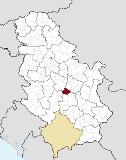
Lazarevac is a municipality of the city of Belgrade. As of 2011, the town has a total population of 25,526 inhabitants, while the municipal area has a total of 58,622 inhabitants.

Paraćin Town and municipality in Šumadija and Western Serbia, Serbia

Paraćin is a town and municipality located in the Pomoravlje District of central Serbia. It is located in the valley of the Velika Morava river, north of Kruševac and southeast of Kragujevac. In 2011 the town had a population of 24,573. It also had a civil airport.

Sombor City in Vojvodina, Serbia

Sombor is a city and the administrative center of the West Bačka District in the autonomous province of Vojvodina, Serbia. The city has a total population of 47,623, while its administrative area has 85,903 inhabitants.

Bela Palanka Town and municipality in Southern and Eastern Serbia, Serbia

Bela Palanka is a town and municipality located in the Pirot District of southeastern Serbia. According to the 2011 census, the population of the town is 8,143, and the population of the municipality is 12,126. In ancient times, the town was known as Remesiana. The name Bela Palanka means 'white town'.

Bački Petrovac Town and municipality in Vojvodina, Serbia

Bački Petrovac is a town and municipality located in the South Bačka District of the autonomous province of Vojvodina, Serbia. The town has a population of 6,063, while Bački Petrovac municipality has 13,302 inhabitants.

Srbobran Town and municipality in Vojvodina, Serbia

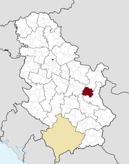
Srbobran is a town and municipality located in the South Bačka District of the autonomous province of Vojvodina, Serbia. The town is located on the north bank of the Danube-Tisa-Danube canal. The town has a population of 12,009, and the municipality of 16,317.

Žitorađa Village and municipality in Southern and Eastern Serbia, Serbia

Žitorađa is a village and municipality located in the Toplica District of the southern Serbia. The municipality includes 30 settlements. According to the 2011 census, the population of the municipality is 16,368 inhabitants.

Loznica City in Šumadija and Western Serbia, Serbia

Loznica is a city located in the Mačva District of western Serbia. It lies on the right bank of the Drina river. In 2011 the city had a total population of 19,572, while the administrative area had a population of 79,327.

Topola Town and municipality in Šumadija and Western Serbia, Serbia

Topola is a town and municipality located in the Šumadija District of central Serbia. It was the place where Karađorđe, a Serbian revolutionary, was chosen as the leader of the First Serbian Uprising against the Ottoman Empire in 1804. The local St. George Church is the burial place of the Ducal and Royal Family of Serbia and Yugoslavia.

Rekovac Village and municipality in Šumadija and Western Serbia, Serbia

Rekovac is a village and municipality located in the Pomoravlje District of central Serbia. According to 2011 census, the population of the village is 1,587, while population of the municipality is 10,971. Rekovac is the center of small geographical region called Levač.

Boljevac Town and municipality in Southern and Eastern Serbia, Serbia

Boljevac is a town and municipality located in the Zaječar District of the eastern Serbia. According to 2011 census, the population of the town is 3,332, while population of the municipality is 12,865.

Gadžin Han Village and municipality in Southern and Eastern Serbia, Serbia

Gadžin Han is a village and municipality located in the Nišava District of the southern Serbia. According to 2011 census, the municipality has 8,389 inhabitants.

Crna Trava Village and municipality in Southern and Eastern Serbia, Serbia

Crna Trava is a village and municipality located in the Jablanica District of southern Serbia. According to 2011 census, the population of the village is 434 inhabitants, while population of the municipality is 1,663. This is the smallest by population and poorest municipality in Serbia.

Boljevci Suburban settlement in Serbia

Boljevci is a suburban settlement of Belgrade, the capital of Serbia. It is located in Belgrade's municipality of Surčin.

Zuce suburban settlement in Serbia

Zuce is a suburban settlement of Belgrade, the capital of Serbia. It is located in Belgrade's municipality of Voždovac.

Masurovci Village in Šumadija, Serbia

Masurovci is a village in the municipality of Babušnica, Serbia. According to the 2002 census, the village has a population of 28 people.

Beloinje Village in Nišava District, Serbia

Beloinje is a village in Serbia, in the municipality of Svrljig in Nisava district. According to the census of 2002, there were 343 people.

References

  1. 1 2 Comparative overview of the number of population in 1948, 1953, 1961, 1971, 1981, 1991, 2002 and 2011 – Data by settlements, page 29. Statistical Office of the Republic of Serbia, Belgrade. 2014. ISBN   978-86-6161-109-4.
  2. 1 2 3 4 5 Dana Stanković (24 September 2017), "Zamiljiva Srbija: Babušnica - Spas za Bogorodičinu crkvu u Strelcu", Politika-Magazin, No. 1043 (in Serbian), p. 22-23

Coordinates: 42°59′05″N22°27′45″E / 42.98472°N 22.46250°E / 42.98472; 22.46250