Stupart, Ontario

Last updated
Stupart
Canada Ontario location map 2.svg
Red pog.svg
Stupart
Location in Ontario
Coordinates: 47°20′51″N81°32′40″W / 47.34750°N 81.54444°W / 47.34750; -81.54444 Coordinates: 47°20′51″N81°32′40″W / 47.34750°N 81.54444°W / 47.34750; -81.54444 [1]
Country Canada
Province Ontario
District Sudbury
Part Sudbury, Unorganized, North
Established 1912 (1912)
Elevation [2] 398 m (1,306 ft)
Time zone Eastern Time Zone (UTC-5)
  Summer (DST) Eastern Time Zone (UTC-4)
Postal Code P0M
Area code(s) 705,249

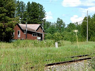
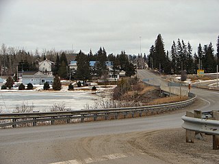
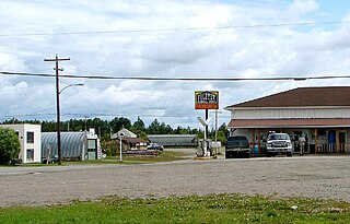
Stupart is an unincorporated place and railway point in geographic Hennessy Township [3] in the Unorganized North Part of Sudbury District in Northeastern Ontario, Canada. [1] The community is just off Deschênes Lake in the Opikinimika River system, part of the James Bay drainage basin.
Unorganized North Sudbury District Unorganized area in Ontario, Canada

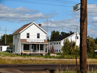
Unorganized North Sudbury District is an unorganized area in the Canadian province of Ontario, comprising all portions of the Sudbury District which are not organized into incorporated municipalities. Despite its name, there is no longer an accompanying "South Part", as that subdivision has subsequently been incorporated into municipalities and Statistics Canada has not renamed the North Part.

Northeastern Ontario Secondary region in Ontario, Canada

Northeastern Ontario is a secondary region of Northern Ontario which lies north of Lake Huron and east of Lake Superior.
Ontario Province of Canada

Ontario is one of the 13 provinces and territories of Canada and is located in east-central Canada. It is Canada's most populous province accounting for 38.3 percent of the country's population, and is the second-largest province in total area. Ontario is fourth-largest in total area when the territories of the Northwest Territories and Nunavut are included. It is home to the nation's capital city, Ottawa, and the nation's most populous city, Toronto, which is also Ontario's provincial capital.

Stupart is on the Canadian National Railway transcontinental main line, and is passed but not served by Via Rail Canadian trains. The next community eastbound is Ruel, served by Ruel railway station; the next community westbound is Westree on Ontario Highway 560A, served by Westree railway station.

Canadian National Railway railway company

Canadian National is a Canadian Class I freight railway headquartered in Montreal, Quebec that serves Canada and the Midwestern and Southern United States.

Transcontinental railroad contiguous network of railroad trackage that crosses a continental land mass with terminals at different oceans or continental borders

A transcontinental railroad is a contiguous network of railroad trackage that crosses a continental land mass with terminals at different oceans or continental borders. Such networks can be via the tracks of either a single railroad, or over those owned or controlled by multiple railway companies along a continuous route. Although Europe is crisscrossed by railways, the railroads within Europe are usually not considered transcontinental, with the possible exception of the historic Orient Express. Transcontinental railroads helped open up unpopulated interior regions of continents to exploration and settlement that would not otherwise have been feasible. In many cases they also formed the backbones of cross-country passenger and freight transportation networks.

The main line, or mainline in American English, of a railway is a track that is used for through trains or is the principal artery of the system from which branch lines, yards, sidings and spurs are connected. It generally refers to a route between towns, as opposed to a route providing suburban or metro services. For capacity reasons, main lines in many countries have at least a double track and often contain multiple parallel tracks. Main line tracks are typically operated at higher speeds than branch lines and are generally built and maintained to a higher standard than yards and branch lines. Main lines may also be operated under shared access by a number of railway companies, with sidings and branches operated by private companies or single railway companies.

Related Research Articles

Foleyet Place in Ontario, Canada

Foleyet is an unincorporated community in the Unorganized North Part of Sudbury District in Northeastern Ontario, Canada, midway between Chapleau and Timmins on Highway 101. The town was created during the construction of the Canadian Northern Railway (CNR) through the area in the early years of the 20th century.

Jogues, Ontario dispersed rural communityunincorporated area in Ontario, Canada

Jogues is a dispersed rural community and unincorporated place in geographic Way Township, Cochrane District in Northeastern Ontario, Canada. It is about 11 kilometres (6.8 mi) southwest of Hearst. Jogues is also a designated place served by a local services board.

Coppell, Ontario dispersed rural communityUnincorporated area in Ontario, Canada

Coppell is a dispersed rural community and unincorporated place in geographic Lowther Township, Cochrane District in Northeastern Ontario, Canada. It is about 22 kilometres (14 mi) southwest of Hearst, and is counted as part of Unorganized Cochrane North Part in Canadian census data.

Mead, Ontario Dispersed Rural CommunityUnincorporated area in Ontario, Canada

Mead is a Dispersed Rural Community and unincorporated place in geographic Lowther Township, Cochrane District in Northeastern Ontario, Canada. The community is counted as part of Unorganized Cochrane North Part in Canadian census data, and is located just north of the border with Algoma District.

Westree, Ontario Place in Ontario, Canada

Westree is an unincorporated community in the Unorganized, North Part of Sudbury District in northeastern Ontario, Canada. It is located at the end of the spur Ontario Highway 560A and lies on the north shore of Duchabani Lake about 110 kilometres (68 mi) northwest of the centre of Sudbury. The community is on the Canadian National Railway mainline, and is the location of Westree railway station served by Via Rail.

Departure Lake, Ontario Dispersed rural community in Ontario, Canada

Departure Lake is a dispersed rural community and unincorporated place in geographic Haggart Township, Cochrane District in Northeastern Ontario, Canada. It is located on Ontario Highway 11 between the communities of Strickland to the west and Smooth Rock Falls to the east.

Clute, Ontario Dispersed Rural Community in Ontario, Canada

Clute is a Dispersed Rural Community and unincorporated place in the town of Cochrane, in Cochrane District, Ontario, Canada. It is also the name of a geographic township in Cochrane District, at the northeastern corner of which the community lies. An irregularly-shaped eastern part of the geographic township lies in the town of Cochrane following an amalgamation after 1996; the rest, the majority of the township, lies in the Unorganized North Part of Cochrane District.

Girdwood, Ontario Railway point in Ontario, Canada

Girdwood is a railway point and unincorporated place in geographic Atkinson Township in the Unorganized North Part of Algoma District in northeastern Ontario, Canada. It lies on the Canadian Pacific Railway transcontinental main line between the settlements of Amyot on the line 13.5 kilometres (8.4 mi) to the west northwest and Ryerson on the line 4 kilometres (2 mi) to the northeast. Via Rail provides services to Girdwood railway station with the Sudbury – White River train once daily in each direction. Girdwood is adjacent to Tripoli Creek, a tributary of the Magpie River.

Ruel, Ontario Place in Ontario, Canada

Ruel is an unincorporated community in geographic Blewett Township in the Unorganized North Part of Sudbury District in Northeastern Ontario, Canada. The community is on the Opikinimika River, part of the James Bay drainage basin, just over the height of land between the latter basin and the Great Lakes Basin.

Lapalmes, Ontario Unincorporated placeRailway point in Ontario, Canada

Lapalmes is an unincorporated place and railway point in geographic Marshay Township in the Unorganized North Part of Sudbury District in Northeastern Ontario, Canada. The community is on Pazhig Lake in the Wanapitei River system, part of the Great Lakes Basin.

Felix, Ontario Unincorporated placeRailway point in Ontario, Canada

Felix is an unincorporated place and railway point in geographic Marshay Township in the Unorganized North Part of Sudbury District in Northeastern Ontario, Canada. The community is on Ningoowaswi Lake in the Wanapitei River system, part of the Great Lakes Basin.

Black River (Abitibi River tributary) river in Canada

The Black River is a river in Cochrane District and Timiskaming District in Northeastern Ontario, Canada. It is part of the James Bay drainage basin, and is a right tributary of the Abitibi River. The municipality of Black River-Matheson is named after the river.

Horsey, Ontario Railway pointUnincorporated area in Ontario, Canada

Horsey is a Railway point and unincorporated place in geographic Templeton Township, Algoma District in Northeastern Ontario, Canada. The community is counted as part of Unorganized Algoma North Part in Canadian census data, and is located just south of the border with Cochrane District.

Boon, Ontario Railway pointUnincorporated area in Ontario, Canada

Boon is a railway point and unincorporated place in geographic Templeton Township, Algoma District in Northeastern Ontario, Canada. The community is counted as part of Unorganized Algoma North Part in Canadian census data.

Hale, Ontario Railway pointUnincorporated area in Ontario, Canada

Hale is a Railway point and unincorporated place in geographic Templeton Township, Algoma District in Northeastern Ontario, Canada. The community is counted as part of Unorganized Algoma North Part in Canadian census data.

Kennedy, Ontario Railway pointUnincorporated area in Ontario, Canada

Kennedy is a Railway point and unincorporated place in geographic Talbott Township, Algoma District in Northeastern Ontario, Canada. The community is counted as part of Unorganized Algoma North Part in Canadian census data.

Norris, Ontario Railway pointUnincorporated area in Ontario, Canada

Norris is a Railway point and unincorporated geographic township located in Algoma District, Northeastern Ontario, Canada. The community is counted as part of the Unorganized North Algoma District in Canadian census data.

Shabaqua dispersed rural communityunincorporated area in Ontario, Canada

Shabaqua is a dispersed rural community and unincorporated area in geographic Laurie Township in the Unorganized Part of Thunder Bay District in Northwestern Ontario, Canada. It is on the right bank of the Shebandowan River, as well as on a Canadian National Railway main line, built originally as the Canadian Northern Railway transcontinental main line, between Mabella to the west and Glenwater to the southeast.

Dishnish, Ontario Railway point in Ontario, Canada

Dishnish is an unincorporated place and railway point in geographic Legge Township, in the Unorganized North part of Algoma District in northeastern Ontario, Canada. It is on the Canadian National Railway transcontinental railway main line between the Dispersed Rural Community of Minnipuka to the west and the railway point of Fire River to the east, has a passing track, and is passed but not served by Via Rail transcontinental Canadian passenger trains. The place is on Dishnish Creek, a left tributary of the Fire River.

Minnipuka, Ontario Dispersed Rural Community in Ontario, Canada

Minnipuka is an unincorporated place and Dispersed Rural Community in geographic Marjorie Township, in the Unorganized North part of Algoma District in northeastern Ontario, Canada. It is on the Canadian National Railway transcontinental railway main line between the railway points of Neswabin to the west and Dishnish to the east, has a passing track, and is passed but not served by Via Rail transcontinental Canadian passenger trains. The place is on the east side of Minnipuka Lake, part of the Goat River system.

References

  1. 1 2 "Stupart". Geographical Names Data Base. Natural Resources Canada . Retrieved 2014-05-20.
  2. Elevation taken from Google Earth at geographical coordinates, accessed 2014-05-20.
  3. "Hennessy" (PDF). Geology Ontario - Historic Claim Maps. Ontario Ministry of Northern Development, Mines and Forestry . Retrieved 2014-05-20.

Other map sources:

Ministry of Transportation of Ontario government ministry in Ontario

The Ministry of Transportation of Ontario (MTO) is the provincial ministry of the Government of Ontario that is responsible for transport infrastructure and related law in Ontario. The ministry traces its roots back over a century to the 1890s, when the province began training Provincial Road Building Instructors. In 1916, the Department of Public Highways of Ontario (DPHO) was formed and tasked with establishing a network of provincial highways. The first was designated in 1918, and by the summer of 1925, sixteen highways were numbered. In the mid-1920s, a new Department of Northern Development (DND) was created to manage infrastructure improvements in northern Ontario; it merged with the Department of Highways of Ontario (DHO) on April 1, 1937. In 1971, the Department of Highways took on responsibility for Communications and in 1972 was reorganized as the Ministry of Transportation and Communications (MTC), which then became the Ministry of Transportation in 1987.

The Ministry of Municipal Affairs and Housing is the department of the Government of Ontario that is responsible for municipal affairs and housing in the Canadian province of Ontario.