Sturgills | |
|---|---|
 Sturgills | |
| Coordinates: 36°33′N81°29′W / 36.55°N 81.49°W | |
| Country | |
| State | North Carolina |
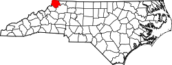
| County | Ashe |
| Named after | Sheriff B. Sturgills |
| Time zone | UTC-5 (EST) |
| • Summer (DST) | UTC-4 (EDT) |
| ZIP Code | 28643 |
| Area code(s) | 336, 743 |
Sturgills is an unincorporated community in Ashe County, North Carolina, United States. [1] [2] [3]