Stąporków

Last updated • 2 min readFrom Wikipedia, The Free Encyclopedia
Stąporków
Staporkow centrum.jpg
POL Staporkow COA.svg
Poland adm location map.svg
Red pog.svg
Stąporków
Coordinates: 51°9′N20°33′E / 51.150°N 20.550°E / 51.150; 20.550
Country Flag of Poland.svg  Poland
Voivodeship Świętokrzyskie
County Końskie
Gmina Stąporków
Area
  Total
11.07 km2 (4.27 sq mi)
Population
 (2012)
  Total
6,110
  Density550/km2 (1,400/sq mi)
Time zone UTC+1 (CET)
  Summer (DST) UTC+2 (CEST)
Postal code
26-220
Area code +48 41
Car plates TKN
National roads DK42-PL.svg
Website http://www.staporkow.pl

Stąporków [stɔmˈpɔrkuf] is a town with 6,200 inhabitants in Końskie County, Świętokrzyskie Voivodeship, i south-central Poland. It is situated on the Czarna River, in the historic region of Lesser Poland.

History

The town's name is probably derived from the name of the owner, Stąpor. In the past, it also used to be called Stomporków.

The history of Stąporków dates back to the mid-16th century, and is associated with early ironworks, which was part of the Old-Polish Industrial Region. It was a private village, administratively located in the Żarnów County in the Sandomierz Voivodeship in the Lesser Poland Province of the Kingdom of Poland. [1] In 1738–1739 a blast furnace was built here by Polish Crown Chancellor Jan Małachowski. [2] In 1781, Count Friedrich Wilhelm von Reden, a German pioneer in mining and metallurgy, visited Stąporków. At that time, the village's furnace produced a hundredweight of pig iron per week, more than similar plants in Upper Silesia. In 1838 the Małachowski family expanded and modernized the plant. An old blast furnace was replaced by two modern ones. Between 1876 and 1895, new upgrades and expansions of the plant took place.

Memorial plaques to local victims of German occupation MOs810 WG 25 2024 (Kielce-Wisla) Church in Staporkow (2) 04.jpg
Memorial plaques to local victims of German occupation

Despite the widespread destruction and requisition of equipment during World War I, the plant operated until 1938, and the buildings survived until 1945, when they were destroyed during heavy fighting. During the German occupation (World War II), on April 4, 1940, German gendarmes committed a massacre of the family of Marian Gut, an 18-year-old soldier of the local Polish resistance. [3] In the massacre, his parents, 12-year-old brother and 2-year-old sister were murdered and the family's house was burned down. [3] There is a memorial at the site. [3] The Germans operated a forced labour camp for Jews in the town. [4]

After World War II, the local industry was reopened, and iron ore mining was initiated. The iron foundry in 1961 employed 1,100 people, and Stąporków population increased from 700 in 1946 to 3,472 in 1961. In 1967 Stąporków received municipal rights, and in the late 1960s, a Health Centre, a Gymnasium, and a sports hall were built.

Related Research Articles

<span class="mw-page-title-main">Silesian Voivodeship</span> Voivodeship of Poland

Silesian Voivodeship is a voivodeship, or province, in southern Poland centered on the historic region known as Upper Silesia, with Katowice serving as its capital.

<span class="mw-page-title-main">Masovian Voivodeship</span> Voivodeship of Poland

Masovian Voivodeship or Mazowieckie Province or Mazowieckie Voivodeship or Mazovian Voivodeship or Mazovian Province, etc. is a voivodeship (province) in east-central Poland, containing Poland's capital Warsaw.

<span class="mw-page-title-main">Dąbrowa Górnicza</span> Place in Silesian Voivodeship, Poland

Dąbrowa Górnicza is a city in Zagłębie Dąbrowskie, southern Poland, near Katowice and Sosnowiec. It is located in eastern part of the Silesian Voivodeship, on the Czarna Przemsza and Biała Przemsza rivers.

<span class="mw-page-title-main">Świętokrzyskie Voivodeship</span> Voivodeship of Poland

Świętokrzyskie Voivodeship, also known as Holy Cross Voivodeship, is a voivodeship (province) in southeastern Poland, in the historical region of Lesser Poland. The province's capital and largest city is Kielce.

<span class="mw-page-title-main">Lublin Voivodeship</span> Voivodeship of Poland

Lublin Voivodeship is a voivodeship (province) of Poland, located in the southeastern part of the country, with its capital being the city of Lublin.

<span class="mw-page-title-main">Lubartów</span> Town in Lublin Voivodeship, Poland

Lubartów is a town in eastern Poland, with 23,000 inhabitants (2004), situated in Lublin Voivodeship. It is the capital of Lubartów County and the Lubartów Commune. Historically it belongs to Lesser Poland.

<span class="mw-page-title-main">Zawiercie</span> Place in Silesian Voivodeship, Poland

Zawiercie ( ) is a town in southern Poland located in the Silesian Voivodeship with 49,334 inhabitants (2019). It is situated in the Kraków-Częstochowa Upland near the source of the Warta River. The town lies near the historical region of Silesia, but belongs to Lesser Poland.

<span class="mw-page-title-main">Parczew</span> Place in Lublin Voivodeship, Poland

Parczew is a town in eastern Poland, with a population of 10,281 (2006). It is the capital of Parczew County in the Lublin Voivodeship.
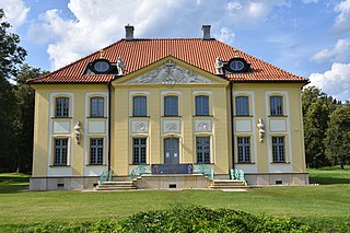
<span class="mw-page-title-main">Choroszcz</span> Place in Podlaskie Voivodeship, Poland

Choroszcz is a town in north-eastern Poland, located in Białystok County, Podlaskie Voivodeship, seat of Gmina Choroszcz.
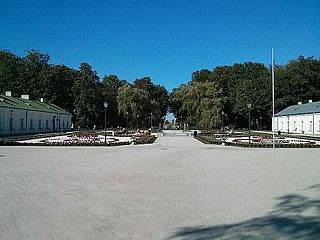
<span class="mw-page-title-main">Końskie</span> Place in Świętokrzyskie Voivodeship, Poland

Końskie is a town in south-central Poland with 20,328 inhabitants (2008), situated in the Świętokrzyskie Voivodeship. Historically, Końskie belongs to the province of Lesser Poland, and since its foundation, until 1795, it was part of Lesser Poland's Sandomierz Voivodeship.

<span class="mw-page-title-main">Starachowice</span> Place in Świętokrzyskie Voivodeship, Poland

Starachowice is a city in southeastern Poland, with 49,513 inhabitants (31.12.2017). It is the capital of Starachowice County in the Świętokrzyskie Voivodeship. It is situated upon the River Kamienna, a tributary of the Vistula River, among hills and forests.
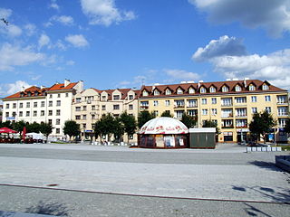
<span class="mw-page-title-main">Ostrowiec Świętokrzyski</span> Place in Świętokrzyskie Voivodeship, Poland

Ostrowiec Świętokrzyski, often referred to as Ostrowiec, is a city in southeastern Poland, in the historical region of Lesser Poland, with 66,258 residents. The town is one of the historic centers of Polish industry and metallurgy, and was part of the Old-Polish Industrial Region, the oldest industrial basin of the country.

<span class="mw-page-title-main">Janów Lubelski</span> Place in Lublin Voivodeship, Poland

Janów Lubelski is a town in southeastern Poland. It has 11,938 inhabitants (2006). Situated in the Lublin Voivodship, Janów Lubelski belongs to Lesser Poland, and is located in southeastern corner of this historic Polish province. It is the capital of Janów Lubelski County. It has a large hospital. It also has several tourist attractions, including buildings and churches from the 17th and 18th centuries. Janów Lubelski is home to the Open-air museum of the Forest Railway in Janów Lubelski

<span class="mw-page-title-main">Ogrodzieniec</span> Place in Silesian Voivodeship, Poland

Ogrodzieniec is a town in Zawiercie County, Silesian Voivodeship, Poland, with 4,282 inhabitants (2019). It is noted for the extensive ruins of a medieval castle.

<span class="mw-page-title-main">Żarki</span> Place in Silesian Voivodeship, Poland

Żarki is a town in Myszków County, Silesian Voivodeship, Poland, with 4,556 inhabitants (2019). The history of Żarki dates back to the early 14th century, as the village was first mentioned in documents from the 1320s. For centuries, Żarki belonged to Lelow County, Kraków Voivodeship, historic province of Lesser Poland.
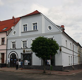
<span class="mw-page-title-main">Międzychód</span> Place in Greater Poland Voivodeship, Poland

Międzychód is a town in Greater Poland Voivodeship, Poland, the administrative seat of Międzychód County. It is located on the southern shore of the Warta river, about 75 km (47 mi) west of Poznań. Population is 10,844 (2010).
<span class="mw-page-title-main">Blachownia</span> Place in Silesian Voivodeship, Poland

Blachownia is a town in Częstochowa County, Silesian Voivodeship, Poland. It lies about 10 km (6.2 mi) west of the city of Częstochowa. The town belongs to historic Lesser Poland. As of December 2021, it has a population of 9,383.

Old Polish Industrial Region is an industrial region in northern part of Lesser Poland. It is the oldest and in terms of area covered, largest of Polish industrial regions. Most of the region is located in Lesser Poland Upland, and its historic center lies along the Kamienna river. Primary industrial cities: Kielce, Radom, Ostrowiec Świętokrzyski, Starachowice and Skarżysko-Kamienna.

<span class="mw-page-title-main">Radoszyce, Świętokrzyskie Voivodeship</span> Town in Świętokrzyskie Voivodeship, Poland

Radoszyce is a town in Końskie County, Świętokrzyskie Voivodeship, in south-central Poland. It is the seat of the gmina called Gmina Radoszyce. It lies approximately 19 kilometres (12 mi) south-west of Końskie and 33 km (21 mi) north-west of the regional capital Kielce.
<span class="mw-page-title-main">Mazovia</span> Historical region in mid-northeastern Poland

Mazovia or Masovia is a historical region in mid-north-eastern Poland. It spans the North European Plain, roughly between Łódź and Białystok, with Warsaw being the unofficial capital and largest city. Throughout the centuries, Mazovia developed a separate sub-culture featuring diverse folk songs, architecture, dress and traditions different from those of other Poles.

References

  1. Województwo sandomierskie w drugiej połowie XVI wieku; Cz.1, Mapy, plany (in Polish). Warszawa: Wydawnictwo Naukowe PWN. 1993. p. 3.
  2. Słownik geograficzny Królestwa Polskiego i innych krajów słowiańskich, Tom XI (in Polish). Warszawa. 1890. p. 307.{{cite book}}: CS1 maint: location missing publisher (link)
  3. 1 2 3 "Pomnik pamięci rodziny Gutów". Fundacja Pamięć i Niepodległość (in Polish). Retrieved 14 November 2021.
  4. "Zwangsarbeitslager für Juden Staporków". Bundesarchiv.de (in German). Retrieved 3 January 2025.