
Idyllwild, Pine Cove, and Fern Valley are three adjacent unincorporated communities, of which Idyllwild is the largest, located in the San Jacinto Mountains in Riverside County, California, United States. The Idyllwild community also generally includes the hamlets of Mountain Center and Garner Valley, though individual residents embrace this association to varying degrees. "Mile-high Idyllwild" is a popular southern California mountain resort about one mile (1.6 km) in altitude. Idyllwild is flanked by two large and one smaller rock formation, Tahquitz Peak and Suicide Rock, which are famous in Southern California rock climbing circles, and Mt Atlas. One of Idyllwild's attractions is that it offers all four seasons, yet in winter is only an hour's drive down to the desert on the Pines to Palms Scenic Byway. It currently offers no skiing; thus "the Hill" has been minimally developed over the years and remains a center for hiking, mountain and rock climbing, mountain biking, and horseback riding.

Indio is a city in Riverside County, California, United States, located in the Coachella Valley of Southern California's Colorado Desert region. It lies 23 miles (37 km) east of Palm Springs, 75 miles (121 km) east of Riverside, 127 miles (204 km) east of Los Angeles, and 148 miles northeast of San Diego. The word Indio is Spanish for Indian.

San Jacinto Peak is the highest peak of the San Jacinto Mountains, and of Riverside County, California. It lies within Mount San Jacinto State Park. Naturalist John Muir wrote of San Jacinto Peak, "The view from San Jacinto is the most sublime spectacle to be found anywhere on this earth!"

The San Jacinto Mountains are a mountain range, in Riverside County, east of Los Angeles southern California in the United States. The mountains are named for one of the first Black Friars Saint Hyacinth, who is popular patron in Latin America.

The Santa Rosa Mountains are a short mountain range in the Peninsular Ranges system, located east of the Los Angeles Basin and northeast of the San Diego metropolitan area of southern California, in the southwestern United States.

Lake Hemet is a water storage reservoir located in the San Jacinto Mountains in Mountain Center, Riverside County, California, with a capacity of 14,000 acre feet (17,000,000 m3) of water. It was created in 1895 with the construction of the Hemet Dam, and is owned and operated by the Lake Hemet Municipal Water District (LHMWD).

Box Springs Mountain is the highest peak in the Box Springs Mountains range, at 3083+ feet in elevation. The mountain is located in northwestern Riverside County, Southern California.

Sugarloaf Mountain is a mountain located in Carrabassett Valley, Franklin County, Maine. It is the third highest peak in the state, after Mount Katahdin's Baxter and Hamlin peaks. Sugarloaf is flanked to the south by Spaulding Mountain.
Skinner Reservoir, also known as Lake Skinner, is a reservoir in western Riverside County, California, located at the foot of Bachelor Mountain in the Auld Valley, approximately 10 miles (16 km) northeast of Temecula. It was created in 1973 by the construction of the Skinner Clearwell Dam on Tucalota Creek, and currently has a capacity of 44,200 acre feet (54,500,000 m3). Located just off Rancho California Road, The address of the reservoir is: 37701 Warren Road, Temecula, CA 92592.
Rancho Jurupa was a 40,569-acre (164.18 km2) Mexican land grant in California, United States, that is divided by the present-day counties of Riverside and San Bernardino. The land was granted to Juan Bandini by Governor Juan B. Alvarado in 1838. Located along both banks of the Santa Ana River in southern California, the rancho included much of the land in the present day city of Jurupa Valley, as well as the downtown area in the city of Riverside.

Sugarloaf Mountain is a mountain located in Greene County, New York. The mountain is part of the Devil's Path range of the Catskill Mountains. To the northwest, Sugarloaf is separated from Plateau Mountain by Mink Hollow Notch; to the southeast, Sugarloaf is separated from Twin Mountain by Pecoy Notch.
The Bradshaw Trail, nicknamed the Gold Road at one time, is an historic overland stage route in Southern California which originally connected San Bernardino, California to gold fields in La Paz, Arizona Territory some 5 miles northeast of Ehrenberg, and the road to the mining districts of Central Arizona Territory, near Wickenburg and Prescott. In later years it was the first road connecting Riverside County to the Colorado River.
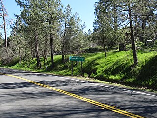
Mountain Center is a census-designated place in the San Jacinto Mountains, within western central Riverside County, California.

Riverside Municipal Auditorium and Soldiers' Memorial Building, also known as the Riverside Auditorium and Events Center is an entertainment venue in Riverside, California, United States. It is owned by the City of Riverside, but is privately managed and available to rent for meetings, conventions and social functions. Opened on November 12, 1928, it also serves as a memorial to the 87 servicemembers from Riverside County who died during World War I. This reinforced concrete Mission Revival style building was added to the National Register of Historic Places in 1978.

Sugarloaf Mountain Park is a census-designated place (CDP) in Tulare County, California. Sugarloaf Mountain Park sits at an elevation of 5,991 feet (1,826 m). The 2010 United States census reported Sugarloaf Mountain Park was uninhabited.

Sugarloaf Mountain, one of several in the U.S. state of New York with that name, is located in the town of Fishkill near the Hudson River and Breakneck Ridge. It is part of the Hudson Highlands, located entirely within the similarly-named state park. Sugarloaf's summit is 900 feet (270 m) above sea level.
Hamilton Creek is a tributary stream of Cahuilla Creek,, in Riverside County, California. Its mouth is found in the Anza Valley at an elevation of 3,865 feet / 1,178 meters. Its source is at 33°32′46″N116°34′36″W at an elevation of 4,800 feet on the southwest facing slope of Lookout Mountain in the Santa Rosa Mountains.


