Suj Tilla

Last updated

Suj Tilla
India Uttarakhand relief map.svg
Red triangle with thick white border.svg
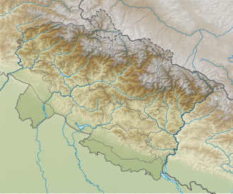
Suj Tilla
Location in Uttarakhand
Highest point
Elevation 6,373 m (20,909 ft)
Coordinates 30°19′48″N80°22′48″E / 30.33000°N 80.38000°E / 30.33000; 80.38000
Geography
Location Pithoragarh, Uttarakhand, India
Parent range Kumaun Himalaya
Climbing
First ascent 2001
Easiest route rock/snow/ice on southwest face
Suj Tilla

Suj Tilla or Suitilla [1] is a Himalayan peak located on the eastern side of Uttarakhand state in Pithoragarh District of India. The peak is located above the junction of Kalabaland, Sankalp and Yankchar glaciers. Ralam Dhura pass is situated to the south of this peak, which connects Ralam valley to Darma valley.

This peak is characterised by steep ice-flutings and sharp ridges, so named as Peak of needles. This peak was first climbed in 2001 by an Indo-British joint expedition by two Britishers Graham Little and Jim Lowther. The Indian navy team was led by Lt. Cdr. Satyabrata Dam. The climbers who made the summit are Divyesh Muni, Lt. Amit Pande, Sherpa Nima Dorje, Lt. K S Balaji, Lt. Amit Rajora, Chera Rajkumar, A. Chaudhury, Sherpa Tsange, Puri and Nima Thondup. The most popular route to the summit is through the south west face.

About 200 m away from Suj Tilla is Suj Tilla East (6394 m). This peak is still unclimbed due to multiple cornices on the ridge.

Related Research Articles

<span class="mw-page-title-main">Makalu</span> Eight-thousander and 5th-highest mountain on Earth, located in Nepal and China

Makalu is the fifth highest mountain in the world at 8,481 metres (27,825 ft). It is located in the Mahalangur Himalayas 19 km (12 mi) southeast of Mount Everest, on the China–Nepal border. One of the eight-thousanders, Makalu is an isolated peak in the shape of a four-sided pyramid.

<span class="mw-page-title-main">Dhaulagiri</span> Eight-thousander and 7th-highest mountain on Earth, located in Nepal

Dhaulagiri is the seventh highest mountain in the world at 8,167 metres (26,795 ft) above sea level, and the highest mountain within the borders of a single country (Nepal). It was first climbed on 13 May 1960 by a Swiss-Austrian-Nepali expedition. Annapurna I is 34 km (21 mi) east of Dhaulagiri. The Kali Gandaki River flows between the two in the Kaligandaki Gorge, said to be the world's deepest. The town of Pokhara is south of the Annapurnas, an important regional center and the gateway for climbers and trekkers visiting both ranges as well as a tourist destination in its own right.

<span class="mw-page-title-main">Manaslu</span> Eight-thousander and 8th-highest mountain on Earth, located in Nepal

Manaslu is the eighth-highest mountain in the world at 8,163 metres (26,781 ft) above sea level. It is in the Mansiri Himal, part of the Nepalese Himalayas, in the west-central part of Nepal. The name Manaslu means "mountain of the spirit" and is derived from the Sanskrit word manasa, meaning "intellect" or "soul". Manaslu was first climbed on May 9, 1956, by Toshio Imanishi and Gyalzen Norbu, members of a Japanese expedition. It is said that, given the many unsuccessful attempts by the British to climb Everest before Nepali Tenzing Norgay and New Zealander Edmund Hillary, "just as the British consider Everest their mountain, Manaslu has always been a Japanese mountain".

<span class="mw-page-title-main">Gaurishankar</span> Mountain in the Nepal Himalayas

Gaurishankar is a mountain in the Nepal Himalayas, the second highest peak of the Rolwaling Himal, behind Melungtse (7,181m). The name comes from the Hindu goddess Gauri, a manifestation of Parvati, and her consort Shankar, denoting the sacred regard to which it is afforded it by the people of Nepal. The Sherpas name the mountain as Jomo Tseringma. The Nepal Standard Time (GMT+05:45) is based on the meridian of this mountain peak.

<span class="mw-page-title-main">Kabru</span> Mountain of the Himalayas

Kabru is a mountain in the Himalayas on the border of eastern Nepal and India. It is part of a ridge that extends south from Kangchenjunga and is the southernmost 7,000 metres (23,000 ft) peak in the world.

<span class="mw-page-title-main">Baruntse</span> Mountain in Nepal

Baruntse is a mountain in the Khumbu region of eastern Nepal, crowned by four peaks and bounded on the south by the Hunku Glacier, on the east by the Barun Glacier, and on the northwest by the Imja Glacier. The mountain was first climbed May 30, 1954 via the south ridge by Colin Todd and Geoff Harrow of a New Zealand expedition led by Sir Edmund Hillary. The first ascent of the East Ridge was made on April 27, 1980 by Lorenzo Ortas, Javier Escartín, Jeronimo Lopez and Carlos Buhler (America) of a Spanish expedition led by Juan José Díaz Ibañez.

<span class="mw-page-title-main">Tirsuli</span>

Tirsuli is a Himalayan mountain peak in the Chamoli district of Uttarakhand, India. It is part of the complex of mountains, including Tirsuli West, Hardeol, Dunagiri, Changabang, and Kalanka, which make up the northeast wall of the Nanda Devi Sanctuary, in the Garhwal Himalaya. It rises at the northern end of the Johar Valley, which drains into the Ghori Ganga. This peak should not be confused with nearby Trisul, which is on the southwest side of the Sanctuary.

Rajrambha is the name of a Himalayan mountain peak, situated in the Pithoragarh district of Uttarakhand state of India. It means 'celestial nymph' (Apsara) in Hindi. This peak is situated south of the Kalabaland Glacier in eastern Kumaun in the Ralam valley. The summit of the peak is 6,537 m. The nearby peaks which form the north-south massif are Suitilla 6,373 m, Chaudhara 6,510 m, and Ngalaphu 6,410 m.

Chiring We is the Himalayan peak situated in eastern Kumaun of the Pithoragarh district of Uttarakhand state in India. The altitude of the peak is 6,559 m. Chiring We is the highest peak above the Kalabaland Glacier. Chiring We massif, which include peaks like Bamba Dhura (6,334 m), Suli Top (6,300 m), Trigal (5,983 m), Suitilla (6,373 m), separates Lassar Yankti valley from Kalabaland valley. The peak literally means 'Mountain of long life'. The route is through glaciers of Kalabaland, Sankalpa and Yankchar, icefall, crevasses, ice-pinnacles, ice walls and sharp ridges. First ascent to this peak was made in 1979 by an Indian team led by Harish Kapadia via northeast ridge.

Chaudhara is a Himalayan mountain peak, situated in the Pithoragarh district of Kumaon, India. The altitude of the peak is 6,510 m. The peak lies to the south of Ralam pass and north west of Panchchuli. The peak is so named due to the peak having four corners. The peak was climbed for the first time by an Indian team led by A.R.Chandekar and Sherpa Ajeeba in 1973. Rajrambha is its neighbouring peak. Chaudhara is situated at the south east end of Kalabaland Glacier-Sankalp Glacier-Yangchar Glacier group. Chaudhara is the part of Himalayan massif between Ralam and Lassar valley. The most popular route to the summit is via the west face.

Suj Tilla East is a Himalayan mountain peak in the eastern part of Uttarakhand state in Pithoragarh district of India. The peak is located above the junction of Kalabaland, Sankalp and Yankchar glaciers. Ralam Dhura pass is situated to the south of this peak, which connects Ralam valley to Darma valley. This peak is characterised by steep ice-flutings and sharp ridges, so named as 'Peak of needles'. This peak has not been climbed so far. The most popular route to the summit is through the south west face. Suj Tilla East is situated 200 m away from Suj Tilla West. Suj Tilla East is 21 m higher than Suj Tilla West. This peak is still an unclimbed peak due to sharp cornices and icefalls on the ridge.

Chamar is the highest peak of the Sringi Himal, which is a subrange of the Nepalese Himalayas. Chamar and the entire Sringi Himal lie in Central Nepal, just south of the Tibetan border, between the Shyar Khola valley on the east and the Tom Khola–Trisuli Gandaki valley on the west. Chamar is about 90 km northwest of Kathmandu, and about 25 km east of Manaslu, the nearest eight-thousander.

<span class="mw-page-title-main">Nun Kun</span> Mountain in Jammu and Kashmir, India

Nun Kun is a mountain massif of the greater Himalayan range, located on the border of Jammu and Kashmir and Ladakh in northern India. It consists of two main peaks: Nun and Kun, separated from each other by a 4 km long snowy plateau, with a third peak of the massif, known as Pinnacle Peak, lying at its eastern end. Nun is the tallest peak of Jammu and Kashmir, while its sister peak Kun lies in Ladakh. It is about 250 km (160 mi) east of Srinagar. The Nun Kun massif is bounded to the north by the Suru valley and the Zanskar range, flanked to the east by the Pensi La (4400 m), which separates the Suru and Zanskar Valleys, while the Kishtwar National Park and the Krash Nai river lie to its south. The rocks predominantly are stratified sedimentary rocks composed of shale and sandstone. Metamorphic rocks and granite formations are also seen at places. The area is rich in minerals, especially garnets.

<span class="mw-page-title-main">Nilkantha (mountain)</span>

Nilkantha is a major peak of the Garhwal division of the Himalayas, in the Uttarakhand region of the Indian state of Uttarakhand. Although substantially lower than the highest peaks of the region, it towers dramatically over the valley of the Alaknanda River and rises 3,474 metres (11,398 ft) above the Hindu pilgrimage site of Badrinath, only 9 km (6 mi) to the east. Frank Smythe described the peak as "second only to Siniolchu in Himalayan beauty."

<span class="mw-page-title-main">Ang Dorje Sherpa</span> Nepali sherpa (born 1970)

Ang Dorje (Chhuldim) Sherpa is a Nepali sherpa mountaineering guide, climber, and porter from Pangboche, Nepal, who has climbed to the summit of Mount Everest 22 times. He was the climbing Sirdar for Rob Hall's Adventure Consultants expedition to Everest in spring 1996, when a freak storm led to the deaths of eight climbers from several expeditions, considered one of the worst disasters in the history of Everest mountaineering.

Nawang Dorje Sherpa, is a Nepalese mountaineer and mountain guide, best known for the first ascent of Dhaulagiri, as a member of Helvetic-Austrian expedition and many ascents in the mountains of the Himalaya Range.

Bethartoli South is a mountain of the Garhwal Himalaya in Uttarakhand, India.The elevation of Bethartoli South is 6,318 metres (20,728 ft) and its prominence is 277 metres (909 ft). It is 117th highest located entirely within the Uttrakhand. Nanda Devi, is the highest mountain in this category. It is situated in the Nanda Devi sanctuary. It lies 1.3 km south of Bethartoli 6,352 metres (20,840 ft) its nearest higher neighbor. It is 17 km west of Nanda Devi 7,816 metres (25,643 ft)and it lies 8.9 km NW of Devistan 6,678 metres (21,909 ft).

References

  1. Little, Graham. "SUJ TILLA". himalayanclub.org. The Himalayan Club. Retrieved 19 August 2023.