Sullivan County Airport

Last updated
Sullivan County Airport
Summary
Airport typePublic
Owner Sullivan County BOAC
Serves Sullivan, Indiana
Elevation  AMSL 539 ft / 164 m
Coordinates 39°06′53″N87°26′54″W / 39.11472°N 87.44833°W / 39.11472; -87.44833
Website www.sctb.net/new/airport.html
Maps
Map of Indiana highlighting Sullivan County.svg
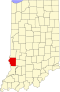
Location of Sullivan County in Indiana
Map of Sullivan County Indiana Townships.svg
Airplane silhouette.svg
SIV
Location of airport in Sullivan County
Runways
Direction LengthSurface
ftm
18/364,3591,329 Asphalt
Statistics (2019)
Aircraft operations5,366
Based aircraft21

Sullivan County Airport( IATA : SIV, ICAO : KSIV, FAA LID : SIV) is a county-owned public-use airport located three nautical miles (6 km) northwest of the central business district of Sullivan, a city in Sullivan County, Indiana, United States. [1] It is included in the FAA's National Plan of Integrated Airport Systems for 2011–2015, which categorized it as a general aviation facility. [2]

Contents

Facilities and aircraft

Sullivan County Airport covers an area of 108 acres (44  ha ) at an elevation of 539 feet (164 m) above mean sea level. It has one asphalt paved runway designated 18/36 which measures 4,359 by 75 feet (1,329 x 23 m). [1]

For the 12-month period ending December 31, 2019, the airport had 5,366 aircraft operations, an average of 103 per week: 97% general aviation and 3% air taxi. At that time there were 21 aircraft based at this airport: 20 single-engine and 1 multi-engine. [1]

See also

Related Research Articles

<span class="mw-page-title-main">Monroe County Airport (Alabama)</span> Airport

Monroe County Airport is a county-owned public-use airport located three nautical miles (6 km) south of the central business district of Monroeville, in Monroe County, Alabama, United States. According to the FAA's National Plan of Integrated Airport Systems for 2009–2013, it is categorized as a general aviation facility.

<span class="mw-page-title-main">Prineville Airport</span> Airport

Prineville Airport is a public use airport located three nautical miles southwest of the central business district of Prineville, in Crook County, Oregon, United States. According to the FAA's National Plan of Integrated Airport Systems for 2009–2013, it is classified as a general aviation airport.

Greensburg Municipal Airport is a public use airport located two nautical miles (4 km) southwest of the central business district of Greensburg, a city in Decatur County, Indiana, United States. Owned by the Greensburg-Decatur County Board of Aviation Commissioners, it was formerly known as Greensburg-Decatur County Airport. It is included in the National Plan of Integrated Airport Systems for 2017–2021, which categorized it as a general aviation facility.

Delaware County Regional Airport is in Delaware County, Indiana three miles northwest of Muncie. Owned by the Delaware County Airport Authority, it was formerly Delaware County Airport and Johnson Field. The National Plan of Integrated Airport Systems for 2011–2015 categorized it as a general aviation facility.

Sullivan County International Airport is in Bethel, Sullivan County, New York. It is seven miles northwest of Monticello, a village in the Town of Thompson. The National Plan of Integrated Airport Systems for 2011–2015 categorized it as a general aviation facility.

<span class="mw-page-title-main">Guntersville Municipal Airport</span> Airport

Guntersville Municipal Airport, also known as Joe Starnes Field, is a city-owned public-use airport located three nautical miles northeast of the central business district of Guntersville, a city in Marshall County, Alabama, United States. According to the FAA's National Plan of Integrated Airport Systems for 2009–2013, it is categorized as a general aviation facility.

<span class="mw-page-title-main">Lanett Municipal Airport</span> Airport

Lanett Municipal Airport is a city-owned public-use airport located three nautical miles southwest of the central business district of Lanett, a city in Chambers County, Alabama, United States. According to the FAA's National Plan of Integrated Airport Systems for 2009–2013, it is categorized as a general aviation facility.

<span class="mw-page-title-main">Scottsboro Municipal Airport</span> Airport

Scottsboro Municipal Airport, also known as Word Field, is a city-owned public-use airport located two nautical miles (3.7 km) northeast of the central business district of Scottsboro, a city in Jackson County, Alabama, United States. According to the FAA's National Plan of Integrated Airport Systems for 2009–2013, it is categorized as a general aviation facility.

Shelbyville Municipal Airport is a public use airport located four nautical miles (7 km) northwest of the central business district of Shelbyville, in Shelby County, Indiana, United States. The airport is owned by the city of Shelbyville and is controlled by the mayor and an appointed Board of Commissioners. According to the FAA's National Plan of Integrated Airport Systems for 2009–2013, it was classified as a general aviation airport.

Huntington Municipal Airport is a city-owned, public-use airport located three nautical miles southeast of the central business district of Huntington, a city in Huntington County, Indiana, United States. According to the FAA's National Plan of Integrated Airport Systems for 2009–2013, it was classified as a general aviation airport.

Tri-State Steuben County Airport is a public use airport in Steuben County, Indiana, United States. Owned by the Steuben County Board of Aviation Commissioners, it is located three nautical miles (6 km) west of the central business district of Angola, Indiana. The airport is included in the National Plan of Integrated Airport Systems for 2011–15, which categorized it as a general aviation facility.

<span class="mw-page-title-main">Kokomo Municipal Airport</span> Airport in Indiana, United States

Kokomo Municipal Airport is five miles northeast of Kokomo, in Howard County, Indiana. It is owned by the Kokomo Board of Aviation Commissioners. The FAA's National Plan of Integrated Airport Systems for 2009–2013 categorized it as a general aviation facility.

Marion Municipal Airport is located three miles southwest of Marion, in Grant County, Indiana. The FAA's National Plan of Integrated Airport Systems for 2021–2025 categorized it as a general aviation facility.

Huntingburg Airport is a public use airport located three nautical miles (6 km) south of the central business district of Huntingburg, a city in Dubois County, Indiana, United States. It is owned by the Dubois County Airport Authority. This airport is included in the National Plan of Integrated Airport Systems for 2011–2015, which categorized it as a general aviation facility.

Salem Municipal Airport is a city-owned, public-use airport located two nautical miles (4 km) west of the central business district of Salem, a city in Washington County, Indiana, United States. It is included in the National Plan of Integrated Airport Systems for 2011–2015, which categorized it as a general aviation facility.

Portland Municipal Airport is a city-owned, public-use airport located one nautical mile (2 km) northwest of the central business district of Portland, a city in Jay County, Indiana, United States. It is included in the National Plan of Integrated Airport Systems for 2011–2015, which categorized it as a general aviation facility.

Plymouth Municipal Airport is a public use airport located two nautical miles (4 km) north of the central business district of Plymouth, a city in Marshall County, Indiana, United States. It is owned by the Plymouth Board of Aviation of Commissioners. This airport is included in the National Plan of Integrated Airport Systems for 2011–2015, which categorized it as a general aviation facility.

New Castle-Henry County Municipal Airport is a public use airport located four nautical miles southeast of the central business district of New Castle, a city in Henry County, Indiana, United States. It is included in the National Plan of Integrated Airport Systems for 2011–2015, which categorized it as a general aviation facility.

White County Airport is a public use airport in White County, Indiana, United States. It is owned by the White County Board of Aviation Commissioners and located three nautical miles (6 km) south of the central business district of Monticello, Indiana. This airport is included in the National Plan of Integrated Airport Systems for 2011–2015, which categorized it as a general aviation facility.

Kentland Municipal Airport is a public use airport located one nautical mile (2 km) southeast of the central business district of Kentland, in Newton County, Indiana, United States. It is owned by the Kentland Board of Aviation Commissioners. This airport was included in the National Plan of Integrated Airport Systems for 2011–2015, which categorized it as a general aviation facility.

References

  1. 1 2 3 4 FAA Airport Form 5010 for SIV PDF . Federal Aviation Administration. Effective May 16, 2024.
  2. National Plan of Integrated Airport Systems for 2011–2015: Appendix A (PDF, 2.03 MB). Federal Aviation Administration. Updated 4 October 2010.