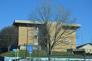
Lee County is the westernmost county in the U.S. Commonwealth of Virginia. As of the 2020 census, the population was 22,173. Its county seat is Jonesville.

Hopkins County is a county located in the U.S. state of Texas. As of the 2010 census, its population was 35,161. Its county seat is Sulphur Springs. Hopkins County is named for the family of David Hopkins, an early settler in the area. Hopkins County comprises the Sulphur Springs, TX Micropolitan Statistical Area. Hopkins County was once known as the Dairy Capital of Texas. Although dairy farms declined in the area in the late 1990s there are still a number of these located there. The Southwest Dairy Museum is located in Sulphur Springs.

Trimble County is a county located in the north central part of the U.S. state of Kentucky. As of the 2010 census, the population was 8,809. Its county seat is Bedford. The county was founded in 1837 and is named for Robert Trimble. Trimble is no longer a prohibition or dry county.
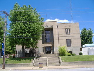
Ohio County is a county located in the U.S. state of Kentucky. As of the 2010 census, the population was 23,842. Its county seat is Hartford. The county is named after the Ohio River, which originally formed its northern boundary. It is a moist county, which means that the sale of alcohol is only legal within certain city limits.

Henry County is a county located in the north central portion of the U.S. state of Kentucky bordering the Kentucky River. As of the 2010 census, the population was 15,416. Its county seat is New Castle, but its largest city is Eminence. The county was founded in 1798 from portions of Shelby County. It was named for the statesman and governor of Virginia Patrick Henry.

Floyd County is a county located in the U.S. state of Kentucky. As of the 2010 census, the population was 39,451. Its county seat is Prestonsburg. The county, founded in 1800, is named for Colonel John Floyd (1750–1783).
Fayette County is located in the central part of the U.S. state of Kentucky. As of the 2010 census, the population was 295,803, making it the second-most populous county in the commonwealth. Its territory, population and government are coextensive with the city of Lexington, which also serves as the county seat. Fayette County is part of the Lexington–Fayette, KY Metropolitan Statistical Area.

Maysville is a home rule-class city in Mason County, Kentucky, United States and is the seat of Mason County. The population was 8,782 as of 2019, making it the 51st-largest city in Kentucky by population. Maysville is on the Ohio River, 66 miles (106 km) northeast of Lexington. It is the principal city of the Maysville Micropolitan Statistical Area, which includes Mason and Lewis counties. Two bridges cross the Ohio from Maysville to Aberdeen, Ohio: the Simon Kenton Memorial Bridge built in 1931 and the William H. Harsha Bridge built in 2001.
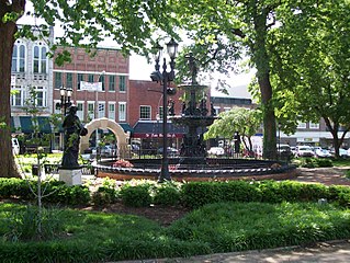
Bowling Green is a home rule-class city and the county seat of Warren County, Kentucky, United States. Founded by pioneers in 1798, Bowling Green was the provisional capital of Confederate Kentucky during the American Civil War. As of the 2020 census, its population of 72,294 made it the third-most-populous city in the state, after Louisville and Lexington; its metropolitan area, which is the fourth largest in the state after Louisville, Lexington, and Northern Kentucky, had an estimated population of 179,240; and the combined statistical area it shares with Glasgow has an estimated population of 233,560.

Felix Grundy was a congressman and senator from Tennessee who also served as the 13th Attorney General of the United States.

The Red River, 100 miles (161 km) long, is a major stream of north-central Tennessee and south-central Kentucky, and a major tributary of the Cumberland River.

Sulphur Springs is a census-designated place (CDP) in eastern Liberty Township, Crawford County, Ohio, United States. As of the 2010 census it had a population of 194. It has a post office with the ZIP code 44881. It is located along State Route 98 northeast of the city of Bucyrus, the county seat of Crawford County.

Jefferson Township is one of thirteen townships in Henry County, Indiana, United States. As of the 2010 census, its population was 1,504 and it contained 615 housing units.

Green Sulphur Springs is an unincorporated community in Summers County, West Virginia, United States. It lies near Interstate 64 to the northeast of the city of Hinton, the county seat of Summers County. Its elevation is 1,552 feet. Green Sulphur Springs had a post office, with the ZIP code of 25966, until it closed on February 29, 1992.

The following outline is provided as an overview of and topical guide to the United States Commonwealth of Kentucky:
Mud Lick is a rural unincorporated community in Monroe County, Kentucky, United States. It is concentrated around the intersection of Kentucky Route 63 and Kentucky Route 870, northwest of Tompkinsville.

Turners Station is an unincorporated community within Henry County, Kentucky, United States.
Neosheo is an unincorporated community within Simpson County, Kentucky, United States, located at the intersection of Sulphur Springs Road and the Neosheo-Prices Mill Road approximately four (4) miles west of the town of Franklin, KY—the county seat of Simpson County. The old Neosheo Store, which was torn down in the 1970s, was located on the southwest corner of the intersection, just across the road from the Sulphur Springs Baptist Church and approximately one-half mile west of the old West Simpson Elementary School building. Neosheo was also historically known as the Georgia Settlement.
Sulphur Well is an unincorporated community located in Metcalfe County, Kentucky, United States.
Jericho is an unincorporated community in Henry County, Kentucky, in the United States.


