Mannsville is an unincorporated community in Taylor County, Kentucky, United States. First called "Manns Lick" for a salt lick discovered on the site by its pioneer settler, American Revolutionary War veteran Moses Mann (c1757-1849), the site is at the junction of Kentucky Routes 70 and 337, some 7 miles east of the county seat of Campbellsville. Its elevation is 738 feet (225 m). It has a post office with the ZIP code 42758.
Beaverlick is an unincorporated community in Boone County, Kentucky, United States. Beaverlick is located along U.S. Route 42 and U.S. Route 127 4.5 miles (7.2 km) west of Walton. The community was established as a fur trading site between 1780 and 1820. The community was founded sometime in the early 1800s. A post office was established at Beaver Lick in 1854 with John Tucker its postmaster. The post office closed in 1944.

Gray Hawk is a small, unincorporated community in eastern Jackson County, KY. The community is located along US Route 421. Services in the community include a post office, gas station, and restaurant. Gray Hawk has a community park and two waterfalls: McCammon Branch Falls and Flat Lick Falls.
'Knob Lick' is an unincorporated community in Metcalfe County, Kentucky, United States. Knob Lick is located on Kentucky Route 70, 8 miles (13 km) northwest of Edmonton. Knob Lick has a post office with ZIP code 42154.
Mud Lick is a rural unincorporated community in Monroe County, Kentucky, United States. It is concentrated around the intersection of Kentucky Route 63 and Kentucky Route 870, northwest of Tompkinsville.
Ogle is an unincorporated community in Clay County, Kentucky, United States. Ogle is located on Otter Creek Road 9 miles (14 km) south-southeast of Manchester. There is no town. It does not appear on the 1900 census, where people are listed rather as living in Otter Creek. The origin of the name is unknown. The Ogle post office was established in April 1893, with Morris Jackson as the first postmaster.

Wises Landing is a hamlet located in Trimble County, Kentucky, United States. It is at the mouth of Barebone Creek, two miles from Corn Creek creek, at the headwaters of which is Corn Creek Church. In the 19th century it was a thriving port town for traffic inland into Trimble via the creeks. The community was served by the Corn Creek post office and was damaged in the 1937 Ohio River flood. In 1974, the Louisville Gas & Electric Company selected the area for the construction of a new power plant, which was completed in 1990. The Yeager General Store, which was listed on the National Register of Historic Places in 1983, is located in Wise's Landing.
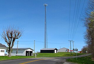
Temple Hill is an unincorporated community in Barren County, Kentucky, in the United States.

Hueysville, also known as Bosco, is an unincorporated community in Floyd County, Kentucky, United States. It has a post office with a ZIP Code of 41640. Hueysville is located on Salt Lick Creek Road west of Kentucky Route 550. CSX Transportation's E&BV Subdivision passes through Hueysville.
Horse Creek is a tributary of Goose Creek river in Clay County in the U.S. state of Kentucky. The Cumberland and Manchester Railway built a spur line up the creek, and it has been the site of operations of at least eight coal mining companies. The name comes, according to local tradition, from the proliferation of "horseweed" in the creek valley.
Eriline was a post office in Clay County, Kentucky, United States from 1902-12-09 to 1988, with a 32-year hiatus from 1911. It was supposed to be named after Eveline Britton (1861–1939), wife of Van Britton (1855–1911) its first postmaster, but the clerks at the USPS could not read the handwriting on the application form, naming it Eriline instead, and the Brittons did not consider it important enough to make a fuss about the name.
Flat Lick is an unincorporated community and census-designated place (CDP) in Knox County, Kentucky, United States. As of the 2010 census, the population was 960.
Big Creek is a 4.5 miles (7.2 km) long creek in Kentucky, United States whose headwaters are in Leslie County and that flows into the Red Bird River in Clay County. A postoffice and village are named for it. Its own name is likely purely descriptive of its frequent flooding and high water levels, as it is not otherwise one of the biggest tributaries of Red Bird River.

Lamb is an unincorporated community located 1/2 mi. south of the Monroe-Barren County boundary line on Kentucky Route 249, and centered at its intersection with New Design Road and Jack Hunt Road, in Monroe County, Kentucky, United States.

Flippin is an unincorporated community located in Monroe County, Kentucky, United States. A small residential village and community surround the intersections of Kentucky Route 249, Kentucky Route 678, and Kentucky Route 100, approximately 3.6 miles (5.8 km) south of the Monroe-Barren County line, where the South Fork and main stream of Indian Creek converge.
Goose Creek is a stream in Clay County in the U.S. state of Kentucky. It is one of two tributaries at the head of the South Fork of the Kentucky River, the other being the Red Bird River. It is 40 miles (64 km) long.
Sulphur Well is an unincorporated community located in Metcalfe County, Kentucky, United States.
Glenville is an unincorporated community in McLean County, Kentucky, United States.
Collins Creek, also known as Collins Fork, is a tributary of Goose Creek in Clay County in the U.S. state of Kentucky. It is 9 miles (14 km) long; is named for its first settler James Collins, a salt maker and hunter; joins Goose just south of Garrard; and is paralleled by road and railway for most of its course.

Jeffrey is an unincorporated community located near Peter/s Creek on Bethlehem Church Road, approximately eight miles (13 km) northwest of Tompkinsville, Monroe County, Kentucky, United States.


