Mount Sinai traditionally known as Jabal Musa is a mountain on the Sinai Peninsula of Egypt. It may possibly be the same as the biblical Mount Sinai, the place where, according to the Bible, Moses received the Ten Commandments.

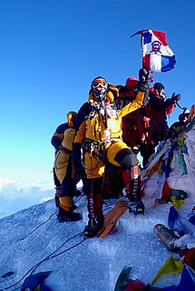
A summit is a point on a surface that is higher in elevation than all points immediately adjacent to it. The topographic terms acme, apex, peak, and zenith are synonymous.

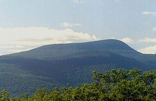
Slide Mountain is the highest peak in the Catskill Mountains of the U.S. state of New York. It is located in the town of Shandaken in Ulster County. While the 4,180-foot (1,270 m) contour line on topographic maps is generally accepted as its height, the exact elevation of the summit has never been officially determined by the U.S. Coast and Geodetic Survey, and many informal surveys suggest the mountain may actually top 4,200 feet above sea level.

The Tenmile Range is a mountain range in U.S. state of Colorado. The range is an extension of the Mosquito Range which is part of the Rocky Mountains. The two ranges are effectively the same range. They are split only by the Continental Divide and name. The Tenmile Range is on the north side of the divide, and the Mosquito on the south. The range is often referred to as the Tenmile-Mosquito Range.

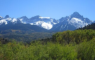
The Southern Rocky Mountains are a major subregion of the Rocky Mountains of North America located in the southeastern portion of the U.S. state of Wyoming, the central and western portions of Colorado, the northern portion of New Mexico, and extreme eastern portions of Utah. The Southern Rocky Mountains are also commonly known as the Southern Rockies, and since the highest peaks are located in the State of Colorado, they are sometimes known as the Colorado Rockies, although many important ranges and peaks rise in the other three states. The Southern Rockies include the highest mountain ranges of the Rocky Mountains and include all 30 of the highest major peaks of the Rockies.

This article comprises three sortable tables of major mountain peaks of Canada.
The Fitzsimmons Range is a small mountain range on the northwestern edge of the Garibaldi Ranges in southwestern British Columbia, Canada, located between the valleys of Cheakamus Lake (SW) and Fitzsimmons Creek (NE). Its most famous summit is Whistler Mountain, which overlooks the resort town of Whistler and is one of the two mountains forming the Whistler Blackcomb ski resort. Most of the range is within Garibaldi Provincial Park, while its northeastern extremity is part of the resort municipality, and of the lands associated with the ski resort operation. Other summits in the range include Oboe Summit, Piccolo Summit and Flute Summit, which are hillocks along the ridge running southeast from Whistler Mountain and were named in association with the renaming of Whistler. Beyond them is Singing Pass and Mount Fitzsimmons 2603 m (8540 ft) which is at the opposite end of the range from Whistler Mountain and the location of Fitzsimmons Glacier, which is the source of Fitzsimmons Creek.

Grizzly Peak is a high mountain summit in the Front Range of the Rocky Mountains of North America. Also known as Grizzly Peak D, the 13,433-foot (4,094 m) thirteener is located in Arapaho National Forest, 2.1 miles (3.4 km) southeast by east of Loveland Pass, Colorado, United States, on the Continental Divide between Clear Creek and Summit counties. Its proximate parent peak is Torreys Peak.

The Anthracite Range is a mountain range in the West Elk Mountains, a sub-range of the Rocky Mountains of North America. The range is located in Gunnison County of western Colorado and lies within the West Elk Wilderness of the Gunnison National Forest. The Anthracite Range is one of several prominent laccoliths found in the West Elk Mountains.


