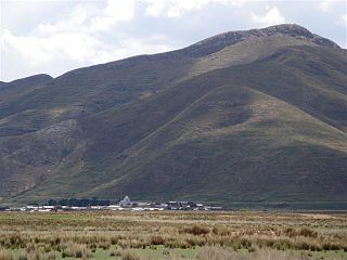
Sandia Province is a province of the Puno Region in Peru. The capital of the province is the city of Sandia.

Chaupi Orco or Viscachani is a mountain in the Andes on the border of Bolivia and Peru. It has a height of 6,044 metres (19,829 ft). On the Bolivian side it is located in the La Paz Department, Franz Tamayo Province, Pelechuco Municipality, and on the Peruvian side it lies in the Puno Region, Putina Province, Sina District. It lies north of Salluyu.

Qulu Qulu is an archaeological site in Peru. It is located in the Puno Region, Sandia Province, Patambuco District. The site was declared a National Cultural Heritage (Patrimonio Cultural) of Peru by the National Institute of Culture.

Pukarani is a mountain with an archaeological site of the same name in the Andes of Peru, about 4,301.9 m (14,114 ft) high. It is located in the Puno Region, Lampa Province, Nicasio District.

Jampatune is a mountain in the Vilcanota mountain range in the Andes of Peru, about 5,300 metres (17,388 ft) high. It is situated in the Cusco Region, Canchis Province, San Pablo District, and in the Puno Region, Carabaya Province, Corani District. Jampatune lies west of the mountain Pomanota.

Hueco is a mountain in the Vilcanota mountain range Andes of Peru, about 5,200 metres (17,060 ft) high. It is located in the Cusco Region, Canchis Province, San Pablo District, and in the Puno Region, Melgar Province, Nuñoa District. Hueco is situated southwest of Pomanota, Jatuncucho, Cochacucho and Jatun Sallica, and northeast of Quellhuacota.

Quellhuacota is a mountain in the Vilcanota mountain range in the Andes of Peru, about 5,300 metres (17,388 ft) high. It is located in the Cusco Region, Canchis Province, San Pablo District, and in the Puno Region, Melgar Province, Nuñoa District. It is situated southwest of the mountains Jochajucho, Jatun Sallica and Wiqu, and northeast of the mountain Sampu.

Culi is a 5,290-metre-high (17,356 ft) mountain in the Vilcanota mountain range in the Andes of Peru. It is situated in the Cusco Region, Canchis Province, Checacupe District, and in the Puno Region, Carabaya Province, Corani District. Culi lies south of the mountain Otoroncane, west of Sapanuta, northwest of Pomanota and Jampatune and southeast of Sayrecucho and Tutallipina. The river Pomanota originates southeast of the mountain. It flows to the southwest as a tributary of Vilcanota River.

Chuqi Pirwa is a mountain in the Andes of Peru, about 5,200 m (17,100 ft) high. It is situated in the Cusco Region, Espinar Province, Condoroma District, and in the Puno Region, Lampa Province, Ocuviri District. Chuqi Pirwa lies southwest of Sawanani Lake (Saguanani) and northwest of Qullqi Q'awa.

Q'iwiri is a 5,255-metre-high (17,241 ft) mountain in the Peruvian Andes. It is located in the Moquegua Region, Mariscal Nieto Province, Carumas District, and in the Puno Region, Puno Province, in the districts Acora and Pichacani. Q'iwiri lies northwest of Qurini and north of a lake named Aqhuya Ch'alla.

Tankani is a mountain in the Andes of southern Peru, about 5,000 metres (16,404 ft) high. It is situated in the Puno Region, Puno Province, San Antonio District, near the border with the Moquegua Region. Tankani lies northwest of the mountain Chuqipata.

Qutuni is a mountain in the Andes of southern Peru, about 5,075 metres (16,650 ft) high. It is situated in the Puno Region, Puno Province, San Antonio District. Qutuni lies northwest of the mountain Wankarani.

Jat'u K'achi is a mountain in the Andes of southern Peru, about 5,200 metres (17,060 ft) high. It is located on the border of the Moquegua Region, General Sánchez Cerro Province, Ichuña District, and the Puno Region, Puno Province, San Antonio District. Jat'u K'achi lies west of the mountain Chuqipata, northeast of Millu and southeast of Pura Purani.

Jatun Quenamari is a mountain in the Vilcanota mountain range in the Andes of Peru, about 5,400 metres (17,717 ft) high. It is situated in the Puno Region, Carabaya Province, Corani District. Jatun Quenamari lies east of the large glaciated area of Quelccaya, southwest of Cuncunani.

Quenamari, Kenamari or Quinamari (possibly from Aymara or Quechua is 5,294-metre high a mountain in the Carabaya mountain range in the Andes of Peru. It is located in the Puno Region, Carabaya Province, Antauta District, and in the Melgar Province, Ajoyani District, southeast of Macusani. Its western peak with the San Rafael mine lies in the Carabaya Province and the eastern peak with the Quenamari mine is situated on the border of the provinces. The Quenamari mine in the southeast of the mountain belongs to the Melgar Province.

Quellhuacotarriti is a mountain in the Carabaya mountain range in the Andes of Peru, about 5,200 m (17,100 ft) high. It is located in the Puno Region, Carabaya Province, Macusani District. Quellhuacotarriti lies southwest of Allincapac and south of Vela Cunca.

Pirhuani is a mountain in the Vilcanota mountain range in the Andes of Peru, about 5,000 m (16,000 ft) high. It is located in the Puno Region, Carabaya Province, Corani District. Pirhuani lies southwest of Macho Ritti. It is situated at the Lajamayu valley.

Pirwani is a mountain in the Andes of Peru, about 5,000 m (16,000 ft) high. It is located in the Puno Region, Melgar Province, on the border of the districts of Antauta and Nuñoa. Pirwani lies south of Kuntur Pata. The Pirwani River originates near the mountain. It is a right tributary of the Crucero River whose waters flow to Lake Titicaca.

Chuqi Quta is a mountain in the Andes of Peru, about 5,200 metres (17,060 ft) high. It is located in the Puno Region, El Collao Province, Santa Rosa District. It lies southwest of Jisk'a Mawruma.

Kirani is a mountain in the Andes of Peru, about 5,000 metres (16,404 ft) high. It is located in the Puno Region, Lampa Province, Paratia District. Kirani lies northeast of Yanawara, east of Ananta Lake.


