Macusani District

Last updated
Macusani
Nevado Allincapac.jpg
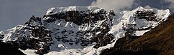
Allin Qhapaq, Macusani District
Macusani District
Country Flag of Peru.svg Peru
Region Puno
Province Carabaya
Capital Macusani
Government
   Mayor Nancy Rossel Angles
Area
  Total
1,029.56 km2 (397.52 sq mi)
Elevation
4,315 m (14,157 ft)
Population
  Total
10,950
  Density10.64/km2 (27.55/sq mi)
Time zone UTC-5 (PET)
UBIGEO 210301

Macusani District is one of ten districts of the Carabaya Province in Peru. [1] Its seat is Macusani.

Contents

Geography

The district lies along the Cordillera Carabaya, a Peruvian Andean range that runs north–northeast of the town of Macusani. [2] [3] [4] The highest local summit is Allincapac, at about 5,780 m (18,960 ft). [5] [6]

Ethnic groups

The people in the district are mainly indigenous citizens of Quechua descent. Quechua is the language which the majority of the population (70.66%) learnt to speak in childhood, 28.51% of the residents started speaking using the Spanish language (2007 Peru Census). [7]

Climate

Climate data for Macusani, elevation 4,363 m (14,314 ft), (1991–2020)
MonthJanFebMarAprMayJunJulAugSepOctNovDecYear
Mean daily maximum °C (°F)11.0
(51.8)
11.1
(52.0)
11.3
(52.3)
11.7
(53.1)
12.3
(54.1)
11.9
(53.4)
11.6
(52.9)
12.2
(54.0)
12.3
(54.1)
12.4
(54.3)
12.7
(54.9)
11.6
(52.9)
11.8
(53.3)
Mean daily minimum °C (°F)1.2
(34.2)
1.4
(34.5)
1.0
(33.8)
−0.5
(31.1)
−4.0
(24.8)
−6.9
(19.6)
−8.0
(17.6)
−7.0
(19.4)
−3.7
(25.3)
−1.2
(29.8)
−0.2
(31.6)
0.7
(33.3)
−2.3
(27.9)
Average precipitation mm (inches)135.7
(5.34)
116.8
(4.60)
101.0
(3.98)
38.4
(1.51)
10.2
(0.40)
3.6
(0.14)
3.8
(0.15)
7.3
(0.29)
17.0
(0.67)
47.8
(1.88)
61.7
(2.43)
110.7
(4.36)
654
(25.75)
Source: National Meteorology and Hydrology Service of Peru [8]

See also

References

  1. (in Spanish) Instituto Nacional de Estadística e Informática. Banco de Información Distrital Archived 2008-04-23 at the Wayback Machine . Retrieved April 11, 2008.
  2. "Mapa: Ubicación geográfica del ámbito de influencia de la cordillera Carabaya". Gob.pe (in Spanish). INAIGEM. March 1, 2018. Retrieved 3 October 2025.
  3. "Cordillera de Carabaya". Encyclopædia Britannica. Retrieved 3 October 2025.
  4. "Cordillera Carabaya – Inventario Turístico". Mincetur (in Spanish). Ministerio de Comercio Exterior y Turismo (Perú). Retrieved 3 October 2025.
  5. Biggar, John (2006). "South America, Peru, Cordillera Carabaya, Various Ascents". American Alpine Journal. Retrieved 3 October 2025.
  6. "Peru 2015–16: Area Notes" (PDF). Alpine Journal. 2017. Retrieved 3 October 2025.
  7. inei.gob.pe Archived 2013-01-27 at the Wayback Machine INEI, Peru, Censos Nacionales 2007, Frequencias: Preguntas de Población: Idioma o lengua con el que aprendió hablar (in Spanish)
  8. "Normales Climáticas Estándares y Medias 1991-2020". National Meteorology and Hydrology Service of Peru. Archived from the original on 21 August 2023. Retrieved 25 October 2023.

14°04′07″S70°25′53″W / 14.06861°S 70.43139°W / -14.06861; -70.43139