Desaguadero District

Last updated
Desaguadero
Huchusuma
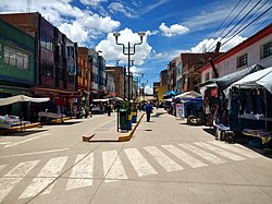
Desaguadero District
Country Flag of Peru.svg  Peru
Region Puno
Province Chucuito
Capital Desaguadero
Government
   Mayor Juan Carlos Aquino Condori
Area
  Total
178.21 km2 (68.81 sq mi)
Elevation
3,832 m (12,572 ft)
Population
  Total
20,009
  Density110/km2 (290/sq mi)
Time zone UTC-5 (PET)
UBIGEO 210402

Desaguadero District is one of seven districts of the province Chucuito in Puno Region, Peru. [1]

Contents

Climate

Climate data for Desaguadero, elevation 3,833 m (12,575 ft), (1991–2020)
MonthJanFebMarAprMayJunJulAugSepOctNovDecYear
Mean daily maximum °C (°F)15.3
(59.5)
15.3
(59.5)
15.3
(59.5)
15.2
(59.4)
14.6
(58.3)
13.4
(56.1)
13.1
(55.6)
13.9
(57.0)
14.9
(58.8)
16.1
(61.0)
16.8
(62.2)
16.4
(61.5)
15.0
(59.0)
Mean daily minimum °C (°F)5.3
(41.5)
5.6
(42.1)
5.4
(41.7)
3.3
(37.9)
−0.8
(30.6)
−3.0
(26.6)
−3.1
(26.4)
−2.2
(28.0)
0.6
(33.1)
2.5
(36.5)
3.5
(38.3)
5.0
(41.0)
1.8
(35.3)
Average precipitation mm (inches)180.9
(7.12)
158.3
(6.23)
108.5
(4.27)
36.3
(1.43)
5.1
(0.20)
7.1
(0.28)
6.8
(0.27)
13.0
(0.51)
18.6
(0.73)
33.5
(1.32)
43.1
(1.70)
88.0
(3.46)
699.2
(27.52)
Source: National Meteorology and Hydrology Service of Peru [2]

Authorities

Mayors

See also

References

  1. (in Spanish) Instituto Nacional de Estadística e Informática. Banco de Información Distrital Archived April 23, 2008, at the Wayback Machine . Retrieved April 11, 2008.
  2. "Normales Climáticas Estándares y Medias 1991-2020". National Meteorology and Hydrology Service of Peru. Archived from the original on 21 August 2023. Retrieved 25 October 2023.

16°33′53″S69°02′50″W / 16.5648°S 69.0472°W / -16.5648; -69.0472