Macari | |
|---|---|
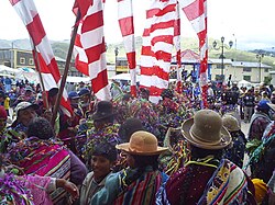 Carnival in Macari | |
 | |
| Country | |
| Region | Puno |
| Province | Melgar |
| Capital | Macari |
| Government | |
| • Mayor | Simon Amador Mamani Chañi |
| Area | |
• Total | 673.78 km2 (260.15 sq mi) |
| Elevation | 3,970 m (13,020 ft) |
| Population | |
• Total | 8,731 |
| • Density | 13/km2 (34/sq mi) |
| Time zone | UTC-5 (PET) |
| UBIGEO | 210805 |
Macari District is one of nine districts of the Melgar Province in Peru. [1] The capital of the district is Macari.