Related Research Articles

The Permian Basin is a large sedimentary basin in the southwestern part of the United States. The basin contains the Mid-Continent Oil Field province. This sedimentary basin is located in western Texas and southeastern New Mexico. It reaches from just south of Lubbock, past Midland and Odessa, south nearly to the Rio Grande River in southern West Central Texas, and extending westward into the southeastern part of New Mexico. It is so named because it has one of the world's thickest deposits of rocks from the Permian geologic period. The greater Permian Basin comprises several component basins; of these, the Midland Basin is the largest, Delaware Basin is the second largest, and Marfa Basin is the smallest. The Permian Basin covers more than 86,000 square miles (220,000 km2), and extends across an area approximately 250 miles (400 km) wide and 300 miles (480 km) long.

The Gulf of Suez is a gulf at the northern end of the Red Sea, to the west of the Sinai Peninsula. Situated to the east of the Sinai Peninsula is the smaller Gulf of Aqaba. The gulf was formed within a relatively young but now inactive Gulf of Suez Rift rift basin, dating back about 26 million years. It stretches some 300 kilometres (190 mi) north by northwest, terminating at the Egyptian city of Suez and the entrance to the Suez Canal. Along the mid-line of the gulf is the boundary between Africa and Asia. The entrance of the gulf lies atop the mature Gemsa oil and gas field. The gulf is considered one of the world's important maritime zones due to being an entrance to the Suez Canal.

In geology, a rift is a linear zone where the lithosphere is being pulled apart and is an example of extensional tectonics.

The Mumbai High Field, formerly called the Bombay High Field, is an offshore oilfield 176 km off the west coast of Mumbai, in Gulf of Cambay region of India, in about 75 m of water. The oil operations are run by India's Oil and Natural Gas Corporation (ONGC).

A salt dome is a type of structural dome formed when salt intrudes into overlying rocks in a process known as diapirism. Salt domes can have unique surface and subsurface structures, and they can be discovered using techniques such as seismic reflection. They are important in petroleum geology as they can function as petroleum traps.
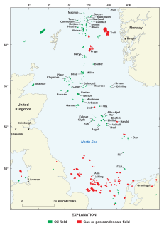
North Sea oil is a mixture of hydrocarbons, comprising liquid petroleum and natural gas, produced from petroleum reservoirs beneath the North Sea.

Tengiz field is an oil field located in northwestern Kazakhstan's low-lying wetlands along the northeast shores of the Caspian Sea. It covers a 2,500 km2 (970 sq mi) project license area which also includes a smaller Korolev field as well as several exploratory prospects.

Ekofisk is an oil field in block 2/4 of the Norwegian sector of the North Sea about 320 km (200 mi) southwest of Stavanger. Discovered in 1969 by Phillips Petroleum Company, it remains one of the most important oil fields in the North Sea. This was the first discovery of oil after the drilling of over 200 exploration wells in the North Sea "triggered" by the Groningen gas field discovery. In 1971, Phillips started producing directly to tankers from four subsea wells. Oil production is planned to continue until at least 2050.

Texas contains a wide variety of geologic settings. The state's stratigraphy has been largely influenced by marine transgressive-regressive cycles during the Phanerozoic, with a lesser but still significant contribution from late Cenozoic tectonic activity, as well as the remnants of a Paleozoic mountain range.

The Sirte Basin is a late Mesozoic and Cenozoic triple junction continental rift along northern Africa that was initiated during the late Jurassic Period. It borders a relatively stable Paleozoic craton and cratonic sag basins along its southern margins. The province extends offshore into the Mediterranean Sea, with the northern boundary drawn at the 2,000 meter (m) bathymetric contour. It borders in the north on the Gulf of Sidra and extends south into northern Chad.
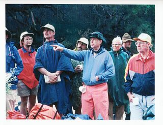
Fred F. Meissner was an American geologist and engineer who contributed to the fields of geology, geophysics, engineering, petroleum engineering, geochemistry, mineralogy, physics, mining, economic geology, and fishing.
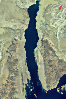
The Gulf of Suez Rift is a continental rift zone that was active between the Late Oligocene and the end of the Miocene. It represented a continuation of the Red Sea Rift until break-up occurred in the middle Miocene, with most of the displacement on the newly developed Red Sea spreading centre being accommodated by the Dead Sea Transform. During its brief post-rift history, the deepest part of the remnant rift topography has been filled by the sea, creating the Gulf of Suez.
In petroleum geology, source rock is rock which has generated hydrocarbons or which could generate hydrocarbons. Source rocks are one of the necessary elements of a working petroleum system. They are organic-rich sediments that may have been deposited in a variety of environments including deep water marine, lacustrine and deltaic. Oil shale can be regarded as an organic-rich but immature source rock from which little or no oil has been generated and expelled. Subsurface source rock mapping methodologies make it possible to identify likely zones of petroleum occurrence in sedimentary basins as well as shale gas plays.

The North German Basin is a passive-active rift basin located in central and west Europe, lying within the southeasternmost portions of the North Sea and the southwestern Baltic Sea and across terrestrial portions of northern Germany, Netherlands, and Poland. The North German Basin is a sub-basin of the Southern Permian Basin, that accounts for a composite of intra-continental basins composed of Permian to Cenozoic sediments, which have accumulated to thicknesses around 10–12 kilometres (6–7.5 mi). The complex evolution of the basin takes place from the Permian to the Cenozoic, and is largely influenced by multiple stages of rifting, subsidence, and salt tectonic events. The North German Basin also accounts for a significant amount of Western Europe's natural gas resources, including one of the world's largest natural gas reservoir, the Groningen gas field.
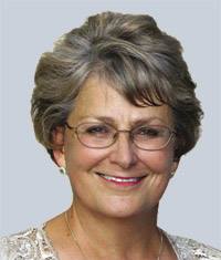
Robbie Rice Gries is an American petroleum geologist who was the first female president (2001–02) of the American Association of Petroleum Geologists (AAPG), president of the Geological Society of America (2018–19), and founder of Priority Oil & Gas LLC. Gries is noted to have made some influential progress for women in this field. In 2017, Gries published the book titled Anomalies—Pioneering Women in Petroleum Geology: 1917-2017. Gries is recognized as an unconventional thinker when approaching geological concepts and applications.
Elizabeth Ann Elliott pioneered the expansion of the role of women in petroleum geology. She was an active member of the American Association of Petroleum Geologists (AAPG) for 56 years.
Denise Cox is the President of the American Association of Petroleum Geologists. She is the President of Storm Energy, an oil and gas exploration company.

The Rub' al Khali Basin or ar-Rubʻ al-Khālī / ar-rubʿ al-ḵālī Basin, Arabic for "Empty Quarter Basin", is a major endorheic sedimentary basin of approximately 560,000 square kilometres (220,000 sq mi) in southern Saudi Arabia, northeastern Yemen, southeastern Oman and southeasternmost United Arab Emirates. The onshore foreland on Mesozoic rift basin is geographically defined by the eponymous Rub' al Khali and covers the regions of Najran and Riyadh and the Eastern Province. The basin is geologically bound by the Central Arabian Arch in the north, the Oman Thrust in the east, the Northern Hadramaut Arch in the south and the Arabian Shield in the west. Politically, the southwestern boundary is formed by the border with Yemen and the border with Oman forms the southeastern boundary.
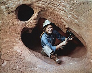
Randi Martinsen is an American geologist who spent much of her career as a senior lecturer in the Department of Geology and Geophysics at the University of Wyoming. Prior to her work at the University of Wyoming, she worked as a consulting petroleum geologist for Cities Service Company in Denver, Colorado. She has extensively worked on the Western Interior Cretaceous basin with particular interest in stratigraphic trap exploration, paleotectonic influences on depositional systems, and clastic reservoir characterization. Martinsen is a former President of the American Association of Petroleum Geologists Foundation (AAPG), an organization that provides educational programs, scientific research, and engineering services in communities around the world. She was President of AAPG from 2014-2015.
Denise M. Stone is an American geologist.
References
- ↑ Sternbach, Charles A. (20 January 2020). "What is the State of Understanding of Super Basins, The World's Richest Oil and Gas Basins?". www.searchanddiscovery.com. Search and Discovery. Retrieved 9 July 2021.
- ↑ Sternbach, Charles A. "Super Basin Initiative". www.aapg.org. AAPG. Retrieved 9 July 2021.
- 1 2 3 4 5 Whaley, Jane (11 November 2019). "Petroleum Geology: What is a Super Basin?". GEO ExPro. GeoExpro. Retrieved 9 July 2021.
- 1 2 Sternbach, Charles A. "It's Not Just The Permian. Super Basins Are A Global Phenomenon". Forbes. Retrieved 9 July 2021.