Maracaibo Basin

Last updated
Maracaibo Basin
Depresión del lago de Maracaibo
Catatumbo Lightning - Rayo del Catatumbo (24335489591).jpg
RegionNatural DepresionLagoMaracaibo.png
Geographic map of the natural region of Lake Maracaibo Depression.
Floor elevation−12–200 m (−39–656 ft)
Area36,803 km2 (14,210 sq mi)
Geography
Country Venezuela
States
Coordinates 9°N71°W / 9°N 71°W / 9; -71

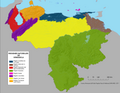
The Maracaibo Basin, also known as Lake Maracaibo natural region, Lake Maracaibo depression or Lake Maracaibo Lowlands, is a foreland basin and one of the eight natural regions of Venezuela, found in the northwestern corner of Venezuela in South America. Covering over 36,657 square km, it is a hydrocarbon-rich region that has produced over 30 billion bbl of oil with an estimated 44 billion bbl yet to be recovered. [1] [2] The basin is characterized by a large shallow tidal estuary, Lake Maracaibo, located near its center. The Maracaibo basin has a complex tectonic history that dates back to the Jurassic period with multiple evolution stages. Despite its complexity, these major tectonic stages are well preserved within its stratigraphy. This makes The Maracaibo basin one of the most valuable basins for reconstructing South America's early tectonic history.

Contents

Geologic setting

The Maracaibo basin is surrounded by two mountain ranges, the Méridas Andes to the southeast and the Sierra de Perija to the west, with the Gulf of Venezuela to the north. The basin lies within a region of deformation created by the interactions of the Caribbean and South American plate boundaries. These interactions include the collision of the Caribbean plate with the South American plate in the Cenozoic era, which formed a belt of foreland basins across northern South America. [3] There are three main fault zones associated with the basin: the Santa Marta-Bucaramanga fault zone, the Boconó fault zone, and the Oca fault zone. These strike-slip zones create a v-shape around the basin which form a smaller plate known as the Maracaibo block. Within this v-shaped wedge, multiple smaller fault zones are present including the Icotea strike-slip fault. Thus the Maracaibo basin geometry is dominated by strike-slip tectonics and subordinate folding with a main syncline, the Maracaibo syncline, striking north-south through the center of Lake Maracaibo. [3]

Tectonic history

The formation of the Maracaibo basin began 160 Ma with the North American, South American, and Caribbean plates playing key roles in the evolution of the basin. It developed into the present-day foreland basin via multiple stages throughout time: Late Jurassic, Late Cretaceous, Paleocene-Eocene, and the Oligocene-Holocene stages.

Present-day tectonic plate position and geometry South American plates.png
Present-day tectonic plate position and geometry

Late Jurassic

During the break-up of Pangea, the North American plate began to separate from the South American plate. The two plates rifted away from each other forming the "Proto-Caribbean Seaway", an 1800 km wide region of oceanic crust. [3] As this rifting occurred, the Caribbean plate began its eastward migration from the Pacific region. [4]

Late Cretaceous

After rifting, the northern edge of the South American plate developed into a passive margin with the Proto-Caribbean Seaway. This stable passive margin allowed for thermal subsidence to occur which began to increase due to the building up of the Cordillera Central range of Colombia. [1] This uplift was initiated by the eastward moving Caribbean plate interacting with the Nazca and northwestern South American plate.

Caribbean plate tectonics-en Caribbean plate tectonics-en.png
Caribbean plate tectonics-en

Paleocene-Eocene

The Caribbean plate has been migrating eastward from the Pacific region and eventually collided with the South American plate in the middle Paleocene. This collision transformed the passive margin of northern South America into an active margin. The Caribbean plate had subducted significant amounts of oceanic Proto-Caribbean crust by this time and was now subducting beneath the South American crust. [3] This boundary interaction was greatly affecting the region of northwestern South America. Foreland basins formed across the region which received large amount of sediment due to the plate boundary interactions to the north.

Oligocene-Holocene

The Caribbean plate continued its eastward migration and continued to deform the northwestern regions of South America while also producing deformation along the northeastern regions. [5] As plate migration proceeded, accretion along the South American plate increased. This accretion greatly influenced mountain building of the region. Uplift of the Sierra de Perijas occurred during the Oligocene whereas the Mérida Andes formed later in the middle Miocene. [3] This uplift and subsequent erosion deposited large amount of sediment into the basin. The Maracaibo syncline formed later in this stage due to "inversion of Eocene rift-related structures". [3]

Stratigraphy

The main events of sediment deposition follow the same pattern as the tectonic events, where major sedimentary formations coincide with the four tectonic stages mentioned above.

Depositional history

The break-up of Pangea resulted in the break-up of the Paleozoic metamorphic basement rock. The basement rock formed half-grabens where eroded sediments from the break-up were then deposited. [6] These sediments created the metasedimentary rocks of the La Quinta formation. [3] Development of the passive margin occurred after rifting. Characterized by carbonate and shale, the stable passive margin allowed for large amounts of clastic sediment to deposit and stay undisturbed until burial. Some of the most important source rocks come from this stage, including the La Luna and Socuy formations. The timing of the Paleogene collision is clearly recorded in the stratigraphy of the Maracaibo basin. There is an abrupt change in sediment type of the late Cretaceous made evident by the thickly deposited, pelagic shale of the Colon formation. This represents the beginnings of the Caribbean arc collision with the South American plate. As the collision continued, this region shifted from the passive margin stage to the foreland basin stage. These Paleogene sediments are characterized by fluvial and deltaic facies [3] and make up the Misoa formation, fluvial sandstones that act as hydrocarbon reservoirs. Mountain building begins in the late Paleogene, producing mostly continental sandstone facies.

Icotea pull-apart basin

The Icotea pull-apart basin is a unique transtensional feature in the center of the Maracaibo Basin. This basin is fault bounded on all 4 sides and formed due to strike slip involved extension along the north to south striking left lateral Icotea strike slip fault. The Icotea fault originally formed as a normal fault during a Mesozoic rifting phase and was subsequently reactivated as a strike slip fault during the late Paleocene. There is a record of 7.5-18 km of fault offset. The basin records 3 km of Eocene sediment fill in a depocenter located in the northern part of the basin. Extension in the Icotea basin is estimated to be between 0.8-2.25 km. Since the Oligocene, basin extension, strike slip motion and basin fill has ceased and inversion has progressed in consequence to continued uplift of the Sierra de Perija and development of the convergent Maracaibo syncline [7] .

Hydrocarbon resources

Oil was discovered in producible quantities in Venezuela in 1914 at the town of Mene Grande in the east central part of the Maracaibo basin near a surface oil seep.

In December 1922, Royal Dutch Shell's George Reynolds (formerly with the Anglo-Persian Oil Company) discovered the La Rosa Oil Field. The Barroso Well blew out at 100 thousand BOPD. In 1928, Jersey Standard discovered oil deposits under Lake Maracaibo. [8]

Today the basin accounts for approximately 50% of Venezuela's crude export capacity and approximately 15% of proven Venezuelan oil reserves. The region hosts one of the world's largest oil refinery complexes, the Paraguaná Refinery Complex. The nearby islands of Aruba and Curaçao also host large refineries that process oil from the Maracaibo basin. Together these refineries form the 'Venezuelan Circuit' of PDVSA.

The Bolivar Coastal Field, BCF, on the eastern shore of Lake Maracaibo produces from Miocene sandstones and Eocene sandstones. [9] West of Maracaibo, the La Paz Field produces from Cretaceous limestones, and oil is found in the stratigraphic traps of Boscan, Los Claros and the Urdaneta fields. [9]

Venezuela produces a mix of conventional heavy crude and unconventional crude derived from bitumen. This latter source, previously too expensive to produce in quantity, now makes up an increasing large percent of Venezuela's oil exports – 600,000 of Venezuela's three million barrels per day in 2006. In the Maracaibo Basin, the balance of reserves is toward its conventional deposits. As the country continues shifting toward bitumen production due to its increasing profitability and decreases in conventional reserves, the level of Maracaibo Basin oil production will decrease, while that of the Orinoco Belt and its massive bitumen deposits will increase.

See also

Related Research Articles

<span class="mw-page-title-main">Sedimentary basin</span> Regions of long-term subsidence creating space for infilling by sediments

Sedimentary basins are region-scale depressions of the Earth's crust where subsidence has occurred and a thick sequence of sediments have accumulated to form a large three-dimensional body of sedimentary rock. They form when long-term subsidence creates a regional depression that provides accommodation space for accumulation of sediments. Over millions or tens or hundreds of millions of years the deposition of sediment, primarily gravity-driven transportation of water-borne eroded material, acts to fill the depression. As the sediments are buried, they are subject to increasing pressure and begin the processes of compaction and lithification that transform them into sedimentary rock.

<span class="mw-page-title-main">Niger Delta Basin (geology)</span>

The Niger Delta Basin, also referred to as the Niger Delta province, is an extensional rift basin located in the Niger Delta and the Gulf of Guinea on the passive continental margin near the western coast of Nigeria with suspected or proven access to Cameroon, Equatorial Guinea and São Tomé and Príncipe. This basin is very complex, and it carries high economic value as it contains a very productive petroleum system. The Niger delta basin is one of the largest subaerial basins in Africa. It has a subaerial area of about 75,000 km2, a total area of 300,000 km2, and a sediment fill of 500,000 km3. The sediment fill has a depth between 9–12 km. It is composed of several different geologic formations that indicate how this basin could have formed, as well as the regional and large scale tectonics of the area. The Niger Delta Basin is an extensional basin surrounded by many other basins in the area that all formed from similar processes. The Niger Delta Basin lies in the south westernmost part of a larger tectonic structure, the Benue Trough. The other side of the basin is bounded by the Cameroon Volcanic Line and the transform passive continental margin.

<span class="mw-page-title-main">Passive margin</span> Transition between oceanic and continental lithosphere that is not an active plate margin

A passive margin is the transition between oceanic and continental lithosphere that is not an active plate margin. A passive margin forms by sedimentation above an ancient rift, now marked by transitional lithosphere. Continental rifting forms new ocean basins. Eventually the continental rift forms a mid-ocean ridge and the locus of extension moves away from the continent-ocean boundary. The transition between the continental and oceanic lithosphere that was originally formed by rifting is known as a passive margin.

<span class="mw-page-title-main">Foreland basin</span> Structural basin that develops adjacent and parallel to a mountain belt

A foreland basin is a structural basin that develops adjacent and parallel to a mountain belt. Foreland basins form because the immense mass created by crustal thickening associated with the evolution of a mountain belt causes the lithosphere to bend, by a process known as lithospheric flexure. The width and depth of the foreland basin is determined by the flexural rigidity of the underlying lithosphere, and the characteristics of the mountain belt. The foreland basin receives sediment that is eroded off the adjacent mountain belt, filling with thick sedimentary successions that thin away from the mountain belt. Foreland basins represent an endmember basin type, the other being rift basins. Space for sediments is provided by loading and downflexure to form foreland basins, in contrast to rift basins, where accommodation space is generated by lithospheric extension.

<span class="mw-page-title-main">Andean orogeny</span> Ongoing mountain-forming process in South America

The Andean orogeny is an ongoing process of orogeny that began in the Early Jurassic and is responsible for the rise of the Andes mountains. The orogeny is driven by a reactivation of a long-lived subduction system along the western margin of South America. On a continental scale the Cretaceous and Oligocene were periods of re-arrangements in the orogeny. The details of the orogeny vary depending on the segment and the geological period considered.

<span class="mw-page-title-main">Geology of Russia</span> Overview of the geology of Russia

The geology of Russia, the world's largest country, which extends over much of northern Eurasia, consists of several stable cratons and sedimentary platforms bounded by orogenic (mountain) belts.

<span class="mw-page-title-main">Geology of Pakistan</span>

The geology of Pakistan encompasses the varied landscapes that make up the land constituting modern-day Pakistan, which are a blend of its geological history, and its climate over the past few million years.

Tectonic subsidence is the sinking of the Earth's crust on a large scale, relative to crustal-scale features or the geoid. The movement of crustal plates and accommodation spaces produced by faulting brought about subsidence on a large scale in a variety of environments, including passive margins, aulacogens, fore-arc basins, foreland basins, intercontinental basins and pull-apart basins. Three mechanisms are common in the tectonic environments in which subsidence occurs: extension, cooling and loading.

<span class="mw-page-title-main">El Tigre Fault</span>

The El Tigre Fault is a 120 km long, roughly north-south trending, major strike-slip fault located in the Western Precordillera in Argentina. The Precordillera lies just to the east of the Andes mountain range in South America. The northern boundary of the fault is the Jáchal River and its southern boundary is the San Juan River. The fault is divided into three sections based on fault trace geometry, Northern extending between 41–46 km in length, Central extending between 48–53 km in length, and Southern extending 26 km in length. The fault displays a right-lateral (horizontal) motion and has formed in response to stresses from the Nazca Plate subducting under the South American Plate. It is a major fault with crustal significance. The Andes Mountain belt trends with respect to the Nazca Plate/South American Plate convergence zone, and deformation is divided between the Precordilleran thrust faults and the El Tigre strike-slip motion. The El Tigre Fault is currently seismically active.

<span class="mw-page-title-main">Growth fault</span>

Growth faults are syndepositional or syn-sedimentary extensional faults that initiate and evolve at the margins of continental plates. They extend parallel to passive margins that have high sediment supply. Their fault plane dips mostly toward the basin and has long-term continuous displacement. Figure one shows a growth fault with a concave upward fault plane that has high updip angle and flattened at its base into zone of detachment or décollement. This angle is continuously changing from nearly vertical in the updip area to nearly horizontal in the downdip area.

<span class="mw-page-title-main">Columbus Basin</span>

The Columbus Basin is a foreland basin located off the south eastern coast of Trinidad within the East Venezuela Basin (EVB). Due to the intensive deformation occurring along the Caribbean and South American plates in this region, the basin has a unique structural and stratigraphic relationship. The Columbus Basin has been a prime area for hydrocarbon exploration and production as its structures, sediments and burial history provide ideal conditions for generation and storage of hydrocarbon reserves. The Columbus Basin serves as a depocenter for the Orinoco River delta, where it is infilled with 15 km of fluvio-deltaic sediment. The area has also been extensively deformed by series of north west to southeast normal faults and northeast to southwest trending anticline structures.

<span class="mw-page-title-main">Middle Magdalena Valley</span>

The Middle Magdalena Valley, Middle Magdalena Basin or Middle Magdalena Valley Basin is an intermontane basin, located in north-central Colombia between the Central and Eastern Ranges of the Andes. The basin, covering an area of 34,000 square kilometres (13,000 sq mi), is situated in the departments of Santander, Boyacá, Cundinamarca and Tolima.

<span class="mw-page-title-main">North German basin</span> Passive-active rift basin in central and west Europe

The North German Basin is a passive-active rift basin located in central and west Europe, lying within the southeasternmost portions of the North Sea and the southwestern Baltic Sea and across terrestrial portions of northern Germany, Netherlands, and Poland. The North German Basin is a sub-basin of the Southern Permian Basin, that accounts for a composite of intra-continental basins composed of Permian to Cenozoic sediments, which have accumulated to thicknesses around 10–12 kilometres (6–7.5 mi). The complex evolution of the basin takes place from the Permian to the Cenozoic, and is largely influenced by multiple stages of rifting, subsidence, and salt tectonic events. The North German Basin also accounts for a significant amount of Western Europe's natural gas resources, including one of the world's largest natural gas reservoir, the Groningen gas field.

<span class="mw-page-title-main">Kutai Basin</span>

The Kutai sedimentary basin extends from the central highlands of Borneo, across the eastern coast of the island and into the Makassar Strait. With an area of 60,000 km2, and depths up to 15 km, the Kutai is the largest and deepest Tertiary age basin in Indonesia. Plate tectonic evolution in the Indonesian region of SE Asia has produced a diverse array of basins in the Cenozoic. The Kutai is an extensional basin in a general foreland setting. Its geologic evolution begins in the mid Eocene and involves phases of extension and rifting, thermal sag, and isostatic subsidence. Rapid, high volume, sedimentation related to uplift and inversion began in the Early Miocene. The different stages of Kutai basin evolution can be roughly correlated to regional and local tectonic events. It is also likely that regional climate, namely the onset of the equatorial ever wet monsoon in early Miocene, has affected the geologic evolution of Borneo and the Kutai basin through the present day. Basin fill is ongoing in the lower Kutai basin, as the modern Mahakam River delta progrades east across the continental shelf of Borneo.

<span class="mw-page-title-main">Geological history of Borneo</span>

The base of rocks that underlie Borneo, an island in Southeast Asia, was formed by the arc-continent collisions, continent–continent collisions and subduction–accretion due to convergence between the Asian, India–Australia, and Philippine Sea-Pacific plates over the last 400 million years. The active geological processes of Borneo are mild as all of the volcanoes are extinct. The geological forces shaping SE Asia today are from three plate boundaries: the collisional zone in Sulawesi southeast of Borneo, the Java-Sumatra subduction boundary and the India-Eurasia continental collision.

<span class="mw-page-title-main">Cesar-Ranchería Basin</span> Geologic formation in Colombia

The Cesar-Ranchería Basin is a sedimentary basin in northeastern Colombia. It is located in the southern part of the department of La Guajira and northeastern portion of Cesar. The basin is bound by the Oca Fault in the northeast and the Bucaramanga-Santa Marta Fault in the west. The mountain ranges Sierra Nevada de Santa Marta and the Serranía del Perijá enclose the narrow triangular intermontane basin, that covers an area of 11,668 square kilometres (4,505 sq mi). The Cesar and Ranchería Rivers flow through the basin, bearing their names.

<span class="mw-page-title-main">Bolivar Coastal Fields</span>

The Bolivar Coastal Fields (BCF), also known as the Bolivar Coastal Complex, is located on the eastern margin of Lake Maracaibo, Venezuela. Bolivar Coastal Field is the largest oil field in South America with its 6,000-7,000 wells and forest of related derricks, stretches thirty-five miles along the north-east coast of Lake Maracaibo. They form the largest oil field outside of the Middle East and contain mostly heavy oil with a gravity less than 22 degrees API. Also known as the Eastern Coast Fields, Bolivar Coastal Oil Field consists of Tía Juana, Lagunillas, Bachaquero, Ceuta, Motatán, Barua and Ambrosio. The Bolivar Coast field lies in the Maracaibo dry forests ecoregion, which has been severely damaged by farming and ranching as well as oil exploitation. The oil field still plays an important role in production from the nation with approximately 2.6 million barrels of oil a day. It is important to note that the oil and gas industry refers to the Bolivar Coastal Complex as a single oilfield, in spite of the fact that the oilfield consists of many sub-fields as stated above.

The geology of Venezuela includes ancient Precambrian igneous and metamorphic basement rocks, layered with sedimentary rocks from the Paleozoic and Mesozoic and thick geologically recent Cenozoic sediments with extensive oil and gas.

<span class="mw-page-title-main">Alaska North Slope basin</span>

The Alaskan North Slope (ANS) is a foreland basin located on the northern edge of the Brooks Range. The Alaska North Slope is bounded on the north by the Beaufort Sea and runs from the Canadian border to the maritime boundary with Russia in the west. The western edge extends into the Chukchi Sea and Chukchi platform where the basin is at its widest. As the basin moves east it narrows towards the Canadian border. The basin is 1000 km long, 600 km at its widest, and covers a total area of 240,000 km2.

<span class="mw-page-title-main">Junggar Basin</span> Sedimentary basin in Xinjiang, China

The Junggar Basin, also known as the Dzungarian Basin or Zungarian Basin, is one of the largest sedimentary basins in Northwest China. It is located in Dzungaria in northern Xinjiang, and enclosed by the Tarbagatai Mountains of Kazakhstan in the northwest, the Altai Mountains of Mongolia in the northeast, and the Heavenly Mountains in the south. The geology of Junggar Basin mainly consists of sedimentary rocks underlain by igneous and metamorphic basement rocks. The basement of the basin was largely formed during the development of the Pangea supercontinent during complex tectonic events from Precambrian to late Paleozoic time. The basin developed as a series of foreland basins – in other words, basins developing immediately in front of growing mountain ranges – from Permian time to the Quaternary period. The basin's preserved sedimentary records show that the climate during the Mesozoic era was marked by a transition from humid to arid conditions as monsoonal climatic effects waned. The Junggar basin is rich in geological resources due to effects of volcanism and sedimentary deposition. According to Guinness World Records it is a land location remotest from open sea with great-circle distance of 2,648 km from the nearest open sea at 46°16′8″N86°40′2″E.

References

  1. 1 2 Escalona, A.; Mann, P. (2006). "An overview of the Petroleum system of Maracaibo Basin". AAPG Bulletin. 90 (4): 657–678. doi:10.1306/10140505038.
  2. Guzman, J.; Fisher, W. (2006). "Early and middle Miocene depositional history of the Maracaibo Basin, western Venezuela". American Association of Petroleum Geologists Bulletin. 90 (4): 625–655. doi:10.1306/10110505035.
  3. 1 2 3 4 5 6 7 8 Mann, P.; Escalona, A.; Castillo, M. (2006). "Regional Geologic and Tectonic Setting of the Maracaibo supergiant basin, western Venezuela". AAPG Bulletin. 90 (4): 445–478. doi:10.1306/10110505031.
  4. Neill, I.; Kerr, A.; Chamberlain, K.; Schmitt, A.; Urbani, F.; Hastie, A.; Pindell, J.; Barry, T.; Millar, I. (2014). "Vestiges of the proto-Caribbean seaway: Origin of the San Souci Volcanic Group, Trinidad". Tectonophysics. 626: 170–185. Bibcode:2014Tectp.626..170N. doi: 10.1016/j.tecto.2014.04.019 . hdl: 2381/31636 .
  5. Escalona, A.; Mann, P. (2006). "Tectonics, basin subsidence mechanisms, and paleogeography of the Caribbean-South American plate boundary zone". Marine and Petroleum Geology . 28: 8–39. doi:10.1016/j.marpetgeo.2010.01.016.
  6. Castillo, M.; Mann (2006). "Cretaceous to Holocene structural and stratigraphic development in south Lake Maracaibo, Venezuela, inferred from well and three-dimensional seismic data". American Association of Petroleum Geologists. 90 (4): 529–565. doi:10.1306/10130505036.
  7. Escalona, Alejandro; Mann, Paul (2003-02-01). "Three-dimensional structural architecture and evolution of the Eocene pull-apart basin, central Maracaibo basin, Venezuela". Marine and Petroleum Geology. 20 (2): 141–161. doi:10.1016/S0264-8172(03)00062-X. ISSN   0264-8172.
  8. Yergin, Daniel (1991). The Prize: The Epic Quest for Oil, Money, and Power. New York: Simon & Schuster. pp. 233–237. ISBN   9780671799328.
  9. 1 2 Martinez, A.R., Giant Fields of Venezuela, in Geology of Giant Petroleum Fields, AAPG Memoir 14, Halbouty, M.T., editor, Tulsa: American Association of Petroleum Geologists, p. 328.