Orinoco Delta

Last updated
Orinoco Delta
Delta del Orinoco
Delta del Orinoco.jpg
Orinoco Delta's sunset
RegionNatural DeltaOrinoco.png
Geographic map of the Orinoco Delta natural region.
Location Delta Amacuro, Monagas & Sucre, Venezuela
Coordinates 9°N61°W / 9°N 61°W / 9; -61
Part of Orinoco Basin
Surface area43,646 km2 (16,852 sq mi)

The Orinoco Delta is a vast river delta of the Orinoco River, located in eastern Venezuela.

Contents

Location

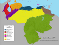
The Orinoco Delta is one of the eight natural regions of Venezuela. It covers the whole of Delta Amacuro State and a few square kilometers of Monagas State and Sucre State, comprising all the mouths of the Orinoco. It is divided into two sections: the principal, at the northernmost part of the system, located between Caño Manamo and the left shore of Caño Araguao, where the majority of villages are established, including the state capital Tucupita; and the secondary, between the right shore of Caño Araguao and Río Grande.

The Warao people live in the region.

Hydrology

The delta is fan-shaped, formed by the Orinoco River as it splits into numerous distributaries, called caños, which meander through the delta on their way to the sea. The main distributary is called the Rio Grande, which empties south-southeast through the southern portion of the delta, and the second major distributary is Caño Manamo, which runs northward along the western edge of the delta. The area of this region is approximately 43,646 square kilometres (16,852 sq mi). The Orinoco Delta is characterized by being non-centric, lagoon lacking, and oceanic, somewhat similar to the delta of the Niger River. Daily tides bring sea water up the "caños", causing the "macareo" or pororoca and reversing the flow direction of water, at least on surface.

Environment

The predominant vegetation is in the Orinoco Delta swamp forests ecoregion. [1] Along the coast and the river margins there are stretches of Amazon-Orinoco-Southern Caribbean mangroves, specifically the Guianan mangroves ecoregion. [2] [3] To the west, and closer to the coast, there are patches of the Orinoco wetlands ecoregion. [4]

The delta includes large areas of permanent wetlands as well as seasonally-flooded freshwater swamp forests. The river margins of the delta are fringed with mangroves. [5]

Related Research Articles

<span class="mw-page-title-main">Maranhão mangroves</span> Mangrove ecoregion of northern Brazil

The Maranhão mangroves is a mangrove ecoregion of northern Brazil. It supports half of the shorebird population of the country. The combination of flat land, heavy rainfall and high tides causes the mangroves to extend up to 40 kilometres (25 mi) inland, where they are interspersed with other rainforest species.

<span class="mw-page-title-main">Caño Manamo</span> River in Venezuela

The Caño Manamo is a distributary of the Orinoco River. It branches northwards from the main channel of the Orinoco to delimit the western edge of the Orinoco Delta, ultimately emptying into the Gulf of Paria. Tucupita, the capital of Delta Amacuro state, is located on the east bank (right) of the Caño Manamo. Manamo is a Warao word meaning "two."

<span class="mw-page-title-main">Guianan savanna</span>

The Guianan savanna (NT0707) is an ecoregion in the south of Venezuela, Guyana and Suriname and the north of Brazil. It is in the Amazon biome. The savanna covers an area of rolling upland plains on the Guiana Shield between the Amazon and Orinoco basins. It includes forested areas, but these are shrinking steadily due to the effect of frequent fires, either accidental or deliberate. The ecoregion includes the Gran Sabana region of Venezuela.

<span class="mw-page-title-main">Negro–Branco moist forests</span> Tropical broadleaf forest covering portions of Venezuela, Colombia, and Brazil

The Negro–Branco moist forests (NT0143) is an ecoregion of tropical moist broadleaf forest to the east of the Andes in southern Venezuela, eastern Colombia and northern Brazil, in the Amazon biome. It lies on the watershed between the Orinoco and Rio Negro basins. It includes both blackwater and whitewater rivers, creating different types of seasonally flooded forest. The vegetation is more typical of the Guiana region than the Amazon.

<span class="mw-page-title-main">Mariusa National Park</span> Venezuelan national park

The Mariusa National Park is a protected area of Venezuela with national park status.

<span class="mw-page-title-main">Turuépano National Park</span> National park in Venezuela

The Turuépano National Park Is a protected area with national park status in the South American country of Venezuela, located in the Benítez, Cajigal, Libertador and Mariño municipalities in the eastern part of Sucre State, north of the San Juan River and in front of the Gulf of Paria.

<span class="mw-page-title-main">Marajó várzea</span>

The Marajó várzea (NT0138) is an ecoregion of seasonally and tidally flooded várzea forest in the Amazon biome. It covers a region of sedimentary islands and floodplains at the mouth of the Amazon that is flooded twice daily as the ocean tides push the river waters onto the land. The flooded forests provide food for a wide variety of fruit-eating fish, aquatic mammals, birds and other fauna. It has no protected areas and is threatened by cattle and water-buffalo ranching, logging and fruit plantations.

<span class="mw-page-title-main">Guianan Highlands moist forests</span> Type of plant habitat

The Guayanan Highlands moist forests (NT0124) is an ecoregion in the south of Venezuela and the north of Brazil and in Guyana, Suriname, French Guiana. It is in the Amazon biome. It encompasses an upland region with diverse fauna and flora, which contains dramatic tepuis, or sandstone table mountains. The region has been inaccessible in the past and is generally fairly intact, apart from the north and northeast where large scale agriculture, ranching and mining operations are steadily encroaching on the ecosystem. New roads are opening the interior to logging, and planned dams will have a drastic impact on the riparian zones.

<span class="mw-page-title-main">Guianan moist forests</span>

The Guianan moist forests (NT0125) is an ecoregion in the east of Venezuela, north of Brazil and the Guyanas. It is in the Amazon biome. The climate is hot and humid, with two rainy seasons each year. As of 1996 the tropical rainforest habitat was relatively intact, although there were mounting threats from illegal logging and gold mining.

<span class="mw-page-title-main">Amazon–Orinoco–Southern Caribbean mangroves</span>

The Amazon–Orinoco–Southern Caribbean mangroves (NT1401) is an ecoregion along the coasts of Colombia, Venezuela, Guyana, Suriname, French Guiana and Brazil.

<span class="mw-page-title-main">Guianan mangroves</span> Coastal ecoregion of southeastern Venezuela, Guyana, Suriname and French Guiana

The Guianan mangroves (NT1411) is a coastal ecoregion of southeastern Venezuela, Guyana, Suriname, French Guiana and Brazil. The mangroves provide an important habitat for migrating birds that winter in the area. Large areas are intact, although they are threatened by destruction of the trees for timber and to make way for agriculture, and from upstream agricultural and industrial pollution.

<span class="mw-page-title-main">Orinoco Delta swamp forests</span> Wetland region of Venezuela and Guyana

The Orinoco Delta swamp forests (NT0147) is an ecoregion of eastern Venezuela and northern Guyana covering the large and shifting Orinoco Delta. The vegetation is mostly permanently flooded rainforest. The ecoregion is relatively intact apart from a large area that was damaged by a failed flood control program in the 1960s. It is inaccessible, so logging is difficult, and the soil is unsuitable for farming. The main threat comes from oil exploration, which would bring an influx of settlers into the delta.

<span class="mw-page-title-main">Orinoco wetlands</span> Ecoregion in northeast Venezuela

The Orinoco wetlands (NT0906) is an ecoregion of northeast Venezuela within the northern Orinoco Delta. It holds areas of tall grasses in flooded land, surrounded by mangroves and swamp forest, giving way to the drier Llanos savanna in the west.

<span class="mw-page-title-main">Amapá mangroves</span>

The Amapá mangroves (NT1402) is an ecoregion along the Atlantic coast of the state of Amapá in Brazil. The low coastal plain has been formed from recent sedimentation, including sediments deposited by the rivers and sediments carried northward from the mouth of the Amazon River by strong currents and deposited by the tides. The extensive mangroves grow on the newly formed coastal mudflats and along the edges of estuaries. They merge into freshwater várzea flooded forests further inland. The ecoregion is generally well-preserved, although excessive extraction of natural resources including timber and shrimps is a concern.

<span class="mw-page-title-main">Pará mangroves</span>

The Pará mangroves (NT1427) is an ecoregion along the Atlantic coast of the state of Pará in Brazil. They constitute the western extension of the Maranhão mangroves ecoregion. The mangroves are relatively intact, although they are under some pressure from agriculture and logging.

<span class="mw-page-title-main">La Costa xeric shrublands</span>

The La Costa xeric shrublands (NT1309) is an ecoregion in Venezuela that stretches along the Caribbean coast. The dry scrub and savanna has been subject to modification since the 16th century by European colonists who replaced it by a patchwork of farm fields and pasturage. Little of the original habitat remains.

<span class="mw-page-title-main">Paramaribo swamp forests</span>

The Paramaribo swamp forests (NT0149) is an ecoregion in the coastal plain of Suriname covering a strip of land that is almost always flooded by fresh waters. It transitions into saline mangrove swamps towards the coast, and into submontane forests towards the interior.

<span class="mw-page-title-main">South American Pacific mangroves</span> Ecoregion along the Pacific coast of Panama, Colombia, Ecuador and Peru.

The South American Pacific mangroves, or Panama Bight mangroves, is an ecoregion along the Pacific coast of Panama, Colombia, Ecuador and Peru.

<span class="mw-page-title-main">Gulf of Panama mangroves</span> Ecoregion along the Pacific coast of Panama and Colombia

The Gulf of Panama mangroves (NT1414) is an ecoregion along the Pacific coast of Panama and Colombia. The mangroves experience seasonal flooding with high levels of sediment, and occasional extreme storms or very low rainfall due to El Niño effects. They are important as a breeding or nursery area for marine species. Areas of the mangroves have been recognized as Important Bird Areas and Ramsar wetlands. The ecoregion has been severely degraded by clearance of mangroves for agriculture, pasturage and shrimp farming, by urban pressure around Panama City, and by pollution related to the Panama Canal.

<span class="mw-page-title-main">Coastal Venezuelan mangroves</span>

The Coastal Venezuelan mangroves ecoregion covers the salt-water mangrove forests along the Caribbean Sea and Atlantic Ocean coast of Venezuela, from Cocinetas Basin to the edge of the Caño Manamo River and the Orinoco Delta in the east. It is one of the largest mangrove ecoregions in South America, with an area of 5,698 km2, and stretching across over 400 km of Venezuelan coastline.

References

  1. Schipper.
  2. Amazon-Orinoco ... Myers.
  3. Tognetti, Burdette & Schipper.
  4. WildFinder – WWF.
  5. "Orinoco Delta Wetlands of Venezuela | Saving Wetlands". Saving Wetlands. 2017-05-03. Retrieved 2017-09-04.

Sources