Surveyor General of the Northwest Territory

Last updated
Surveyor General of the Northwest Territory
Constituting instrumentLand Act of 1796 [1]
First holder Rufus Putnam
Final holder Lucius Lyon
AbolishedJune 1845
Succession Commissioner of the General Land Office
Salary$2,000
Northwest-territory-usa-1787.png

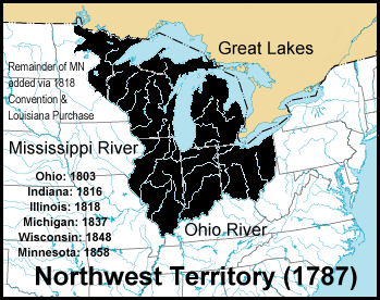
The Surveyor General of the Northwest Territory was a United States government official responsible for surveying land in the Northwest Territory in the United States late in the late 18th and early 19th century. The position was created in the Land Act of 1796 [1] to survey lands ceded by Native Americans northwest of the Ohio River and above the mouth of the Kentucky River. This act, and those that followed evolved into the Public Land Survey System.

Contents

Rufus Putnam was appointed to the office in 1797, and held it until 1803. His office was in Marietta. [2] In 1801, the position was offered to Andrew Ellicott by Thomas Jefferson, but he refused, because he was upset at slow pay for work he had done for the federal government. [3] Jared Mansfield held the office from 1803 to 1813. His office was in Cincinnati. [2] Josiah Meigs held office 1813 to 1815, [4] and Edward Tiffin from 1815 to his death in 1829. [5] Tiffin had his office in Chillicothe. [2] The Surveyor General of Illinois office was created on April 29, 1816, reducing effective area to Ohio, Indiana and Michigan. [6] William Lytle served 1829 until his death in 1831. [7] He moved the office back to Cincinnati. [2] Micajah T. Williams held the office 1831 to 1834, when Robert Todd Lytle took over. Ezekiel S. Haines was appointed in 1838. [8] Judge William Johnston held the office 1841–1845 as thanks for his efforts in supporting the Whig ticket in 1840. [9] [10] [11] Lucius Lyon was appointed in 1845, and moved his office to Detroit. [2] In June 1845, the Ohio and Indiana offices were closed, and subsequent surveys were made under the Commissioner of the General Land Office. [12] The Surveyor General was initially paid $2000 per year, and his deputies were paid three dollars per mile surveyed. [13]

Putnam was occupied in 1797 with laying off the Greenville Treaty Line and surveying the United States Military District and Moravian Indian Grants, and he started the survey of Congress Lands in 1798. [14]

Mansfield is credited with "considerable scientific ability and high standards of workmanship." [15] He laid out astronomically the Indiana baseline and Second Principal Meridian, in spite of the difficulties. Pressures on him are illustrated in a letter Secretary of the Treasury Albert Gallatin wrote to Mansfield: "The new act (March 13, 1805) is intended to palliate errors made in surveys north of the Ohio. At four dollars per mile, great correctness cannot be attained in that part of the country. Do your best at that price. Congress desires that corners and boundaries be definitely fixed, and the precise content of each is not equally important. A few acres more or less is not so important as it is that corners and boundaries should be known with precision to avoid litigation. It is of primary importance that the land should be surveyed and subdivided." [15]

Tiffin established the scheme of guide meridians and standard parallels for townships distant from the principal meridians and baselines, which became a feature of the Public Land Survey System. [16]

On March 3, 1803, [17] a Surveyor General position was created for lands south of Tennessee, and there followed a number of similar positions over the next years. In 1822, the first surveying district was created, namely the state of Ohio, with an officer called Surveyor General in charge. [4]

Until the re-organization of the General Land Office in 1836, each Surveyor General acted more or less independently, setting his own standards for execution of field work. [18]

See also

Northwest Territory

Notes

  1. 1 2 1  Stat.   464 - Text of Act of May 18, 1796 Library of Congress
  2. 1 2 3 4 5 White, p. 218.
  3. Mathews 1908, pp. 204–206.
  4. 1 2 Williamson 1880, pp. 170–171.
  5. Stewart 1935, p. 43.
  6. White, p. 203.
  7. Howe 1907, p. 416.
  8. Greve 1904, p. 673.
  9. Greve 1904, p. 771.
  10. Nelson & Runk 1894, pp. 186–187.
  11. Hunter 1900, pp. 208–209.
  12. White, pp. 204, 218.
  13. Stewart 1935, p. 37.
  14. Treat 1910, p. 93.
  15. 1 2 Stewart 1935, pp. 38–40.
  16. Stewart 1935, p. 44.
  17. 2  Stat.   229 – Text of act of March 3, 1803 (section 10) Library of Congress
  18. Stewart 1935, p. 41.

Related Research Articles

<span class="mw-page-title-main">Columbia Township, Hamilton County, Ohio</span> Township in Ohio, United States

Columbia Township is one of the twelve townships of Hamilton County, Ohio, United States. The 2020 census found 4,446 people in the township. Originally one of Ohio's largest townships by area at its inception in 1791, it gradually shrank to one of the smallest by the early 1950s.

<span class="mw-page-title-main">Northwest Territory</span> United States territory (1787–1803)

The Northwest Territory, also known as the Old Northwest and formally known as the Territory Northwest of the River Ohio, was formed from unorganized western territory of the United States after the American Revolutionary War. Established in 1787 by the Congress of the Confederation through the Northwest Ordinance, it was the nation's first post-colonial organized incorporated territory.

<span class="mw-page-title-main">Land Ordinance of 1785</span>

The Land Ordinance of 1785 was adopted by the United States Congress of the Confederation on May 20, 1785. It set up a standardized system whereby settlers could purchase title to farmland in the undeveloped west. Congress at the time did not have the power to raise revenue by direct taxation, so land sales provided an important revenue stream. The Ordinance set up a survey system that eventually covered over three-quarters of the area of the continental United States.

<span class="mw-page-title-main">Edward Tiffin</span> American politician (1766–1829)

Edward Tiffin was an American politician from Ohio. A member of the Democratic-Republican party, he served as the first governor of Ohio and later as a United States Senator.

No man who has occupied the gubernatorial chair of Ohio has possessed a greater genius for the administration of public affairs than Edward Tiffin, its first governor. He appeared upon the scene of action in the Northwest Territory in its creative period, when the work of moulding the destinies of a future commonwealth was committed to the care of a very few men. Head and shoulders above them all stood Edward Tiffin. His official life displayed a better general average of statesmanship than that of any of his successors. ... His work in advancing and developing Ohio has not been equalled by any man in its history.

Robert Todd Lytle was a politician who represented Ohio in the United States House of Representatives from 1833 to 1835.

<span class="mw-page-title-main">Andrew Ellicott</span> American surveyor

Andrew Ellicott was an American land surveyor who helped map many of the territories west of the Appalachians, surveyed the boundaries of the District of Columbia, continued and completed Pierre (Peter) Charles L'Enfant's work on the plan for Washington, D.C., and served as a teacher in survey methods for Meriwether Lewis.

<span class="mw-page-title-main">South and East of the First Principal Meridian</span>

South and East of the First Principal Meridian is a land description in the American Midwest.

<span class="mw-page-title-main">George E. Seney</span> American politician

George Ebbert Seney was a nineteenth-century politician, lawyer and judge from Ohio. A Democrat, he served four terms in the United States House of Representatives from 1883 to 1891.

George L. Kinnard was a Representative from Indiana; born in Pennsylvania in 1803; moved with his widowed mother to Tennessee and completed preparatory studies; moved to Indianapolis, Ind., in 1823; studied law; was admitted to the bar and practised in Marion County, Indiana; assessor for Marion County in 1826 and 1827; member of the State house of representatives 1827–1830; county surveyor 1831–1835; colonel of the State militia; elected as a Jacksonian to the Twenty-third and Twenty-fourth Congresses and served from March 4, 1833, until his death on November 26, 1836; interment probably in Presbyterian Burying Ground, Cincinnati, Ohio.

<span class="mw-page-title-main">Jared Mansfield</span> American surveyor (1759–1830)

Jared Mansfield was an American teacher, mathematician and surveyor. His career was shaped by two interventions by President Thomas Jefferson. In 1801 Jefferson appointed Mansfield as Professor at the newly founded United States Military Academy at West Point. Again at Jefferson's appointment, Mansfield served as the Surveyor General of the United States from 1803 to 1812, charged with extending the survey of United States land in the Northwest Territory.

<span class="mw-page-title-main">Seven Ranges</span> Land tract in eastern Ohio, US

The Seven Ranges was a land tract in eastern Ohio that was the first tract to be surveyed in what became the Public Land Survey System. The tract is 42 miles (68 km) across the northern edge, 91 miles (146 km) on the western edge, with the south and east sides along the Ohio River. It consists of all of Monroe, Harrison, Belmont and Jefferson, and portions of Carroll, Columbiana, Tuscarawas, Guernsey, Noble, and Washington County.

<span class="mw-page-title-main">Congress Lands</span>

The Congress Lands was a group of land tracts in Ohio that made land available for sale to members of the general public through land offices in various cities, and through the General Land Office. It consisted of three groups of surveys:

<span class="mw-page-title-main">Congress Lands North of Old Seven Ranges</span>

The Congress Lands North of the Old Seven Ranges was a land tract in northeast Ohio that was established by the Congress early in the 19th century. It is located south of the Connecticut Western Reserve and Firelands, east of the Congress Lands South and East of the First Principal Meridian, north of the United States Military District and Seven Ranges, and west of Pennsylvania.

<span class="mw-page-title-main">Congress Lands West of Miami River</span>

The Congress Lands West of Miami River was a land tract in southwest Ohio that was established by the Congress late in the 18th century. It is located south of the Greenville Treaty Line, east of Indiana, and north of the Great Miami River. The original survey in 1798 contained a triangular shaped slice of land, now located in Indiana, that extended to the Greenville line as it ran from Fort Recovery to opposite the mouth of the Kentucky River.

<span class="mw-page-title-main">Congress Lands East of Scioto River</span>

The Congress Lands East of Scioto River was a land tract in southern Ohio that was established by the Congress late in the 18th century. It is located south of the United States Military District and Refugee Tract, west of the Old Seven Ranges, east of the Virginia Military District and north of the Ohio River, French Grant, and the Ohio Company of Associates.

<span class="mw-page-title-main">North and East of First Principal Meridian</span>

North and East of the First Principal Meridian is a survey and land description in the northwest part of the U.S. state of Ohio.

Israel Ludlow was a government surveyor who helped found Cincinnati, Dayton and Hamilton in southwest Ohio.

<span class="mw-page-title-main">William Johnston (judge)</span> American judge and politician

William Johnston, also known as Booby Johnston was a Whig politician from the U.S. State of Ohio. He served in the state legislature, was Surveyor General of the Northwest Territory, was a judge, and was nominated by his party for Governor of Ohio. He had a highly profitable legal career.

Cincinnati Township is a paper township and former civil township in south-central Hamilton County, Ohio. Originally one of Ohio's largest townships by area at its inception in 1791, it was abolished in 1834 when the City of Cincinnati became coextensive with it through annexation. Since then, it has remained solely as a paper township.

References