Related Research Articles
Bear River may mean:
Bear Lake may refer to several places:

This is a list of the extreme points of North America: the points that are highest and lowest, and farther north, south, east or west than any other location on the continent. Some of these points are debatable, given the varying definitions of North America.
Elk Falls Provincial Park is a provincial park in British Columbia, Canada. It is 1,807 hectares in size and is located at the east end of John Hart Lake on the northwest side of the city of Campbell River, on Vancouver Island.
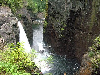
Pyramid Creek Falls Provincial Park is a provincial park in British Columbia, Canada, located on the east side of the North Thompson River between the towns of Blue River (S) and Valemount (N).

Kwakoegron is a town and resort in Suriname. It is located inland, due south of Paramaribo. According to the 2012 census it has a population of 263, and is mainly inhabited by Maroons, of the Matawai people. The resort and town are named after Kwakoe, the native word for Wednesday, and grond, the Dutch word for ground. The captain of the resort resides in the village Commisariskondre.

The Gwa'Sala-Nakwaxda'xw Nations are a union of two Kwakwaka'wakw peoples in a band government based on northern Vancouver Island in British Columbia, Canada, whose main reserve community is near the town of Port Hardy in the Queen Charlotte Strait region of the Central Coast region of British Columbia, Canada. The band government is a member of the Kwakiutl District Council and, for treaty negotiation purposes, the Winalagalis Treaty Group which includes three other members of the Kwakiutl District Council.
The Lytton First Nation, a First Nations band government, has its headquarters at Lytton in the Fraser Canyon region of the Canadian province of British Columbia. While it is the largest of all Nlaka'pamux bands, unlike all other governments of the Nlaka'pamux (Thompson) people, it is not a member of any of the three Nlaka'pamux tribal councils, which are the Nicola Tribal Association, the Fraser Canyon Indian Administration and the Nlaka'pamux Nation Tribal Council.
The Tŝideldel First Nation is the band government of the Tsi Del Del subgroup of the Tsilhqot'in people, located in the Chilcotin District in the western Central Interior region of the Canadian province of British Columbia. It is a member of the Tsilhqot'in National Government.

The Hogem Ranges are a group of mountain ranges in the northwest part of the Omineca Country of the North-Central Interior of British Columbia, Canada, located between Takla Lake (W) and the Omineca River (E) and from the Nation Lakes (SE) to the Sustut River (NW). The ranges have a collective area of 8868 km2 and is a subgrouping of the Omineca Mountains which in turn form part of the Interior Mountains.
The Tahltan First Nation, also known as the Tahltan Indian Band, is a band government of the Tahltan people. Their main community and reserves are located at Telegraph Creek, British Columbia. Their language is the Tahltan language, which is an Athabaskan language also known as Nahanni, is closely related to Kaska and Dunneza. Their Indian and Northern Affairs Canada band number is 682. The Tahltan First Nation is joined with the Iskut First Nation in a combined tribal council-type organization known as the Tahltan Nation.
The Ospika River is a river in the Northern Interior of British Columbia, Canada, rising in the Northern Rocky Mountains to the north of Lake Williston and flowing south to join that lake in the lower end of its Finlay Reach. Before the creation of that lake by the building of WAC Bennett Dam, it was a tributary of the Finlay River.
Kitselas First Nation is the band government of the Kitselas subgroup of the Tsimshian. The band government is based at Gitaus in the Skeena Valley in the Skeena River valley to the northeast of the city of Terrace, British Columbia, Canada. Though there is no Tsimshian tribal council, they are a participant in the Tsimshian First Nations treaty council.
The Bear River is a river in northwestern British Columbia, Canada. It flows northwest into the Sustut River, which flows southwest into the upper Skeena River.
Sustut Lake is a lake in the Omineca Mountains of the Northern Interior of British Columbia, Canada, located northwest of Germansen Landing in the Cassiar Land District. It is the source of the Sustut River, which flows roughly west and is a major tributary of the Skeena River. The lake's old, or alternate, name is Bear Wallow Lake. Sustut Peak is located to the west of the lake.
Sustut Peak, 2481 m, prominence: 1231 m, is the highest summit in the drainage of the Sustut River in British Columbia, Canada. Located in the Hogem Ranges west of Sustut Lake, which is at the Sustut River's headwaters, it is 8 km southwest of the road to the Kemess Mine

The Horton River is a river in Inuvik and Sahtu Regions, Northwest Territories and Kitikmeot Region, Nunavut, Canada. It is a tributary of the Beaufort Sea and hence part of the Arctic Ocean drainage basin. Only the first few kilometres from its source are within Nunavut.
Drury inlet is an inlet in the Queen Charlotte Strait region of the Central Coast of British Columbia, Canada, extending west from Wells Passage to the northwest of North Broughton Island, northwest of the town of Port Hardy. Branching off to the northeast from the north side of the head of the inlet is Actaeon Sound.
The Mosque River is a tributary of the Skeena River in the Stikine Region of the province of British Columbia, Canada. It originates in the Tatlatui Range of the Skeena Mountains, and flows southwest about 50 km (31 mi) to the Skeena River, about 140 km (87 mi) north of Hazelton and about 160 km (99 mi) east of Stewart. Its watershed covers about 148 km2 (57 sq mi), and its mean annual discharge is 15.4 m3/s (540 cu ft/s).
References
- ↑ "Sustut River". BC Geographical Names . Retrieved June 25, 2017.
Coordinates: 56°19′00″N127°22′00″W / 56.31667°N 127.36667°W