Indonesia, officially the Republic of Indonesia, is a country in Southeast Asia and Oceania, between the Indian and Pacific oceans. It consists of more than seventeen thousand islands, including Sumatra, Java, Borneo (Kalimantan), Sulawesi, and New Guinea (Papua). Indonesia is the world's largest island country and the 14th-largest country by land area, at 1,904,569 square kilometres. With over 267 million people, it is the world's 4th-most populous country as well as the most populous Muslim-majority country. Java, the world's most populous island, is home to more than half of the country's population.

Paramaribo is the capital and largest city of Suriname, located on the banks of the Suriname River in the Paramaribo District. Paramaribo has a population of roughly 241,000 people, almost half of Suriname's population. The historic inner city of Paramaribo has been a UNESCO World Heritage Site since 2002.

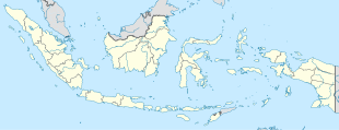
Salatiga is a city in Central Java province, Indonesia. It covers an area of 56.761 km2 and had a population of 170,332 at the 2010 Census; the most recent official estimate is 194,084. Located between the cities of Semarang and Surakarta, and administratively an independent city enclaved within Semarang Regency, it sits at the foot of Mount Merbabu (3,142 m) and Mount Telomoyo, and has a relatively cool climate due to its elevated position. Salatiga is a part of the Semarang metropolitan area.
Klaten is a regency in Central Java province in Indonesia. It covers an area of 655.56 km2 and had a population of 1,130,047 at the 2010 Census; the latest official estimate of population is 1,174,986. Its capital is the town of the same name.

Purbalingga Regency is an inland regency in the southwestern part of Central Java province in Indonesia. Purbalingga Regency has an area of 777.64 km² and population of 848,952 at the 2010 Census; the latest official estimate is 1,003,246, comprising 508,036 male and 495,210 female inhabitants. The administrative capital is the town of Purbalingga.

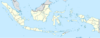
Pangururan is a town and a district of the same name in North Sumatra province of Indonesia and it is the seat (capital) of Samosir Regency, and the largest town on Samosir Island. Its population is 29,412.
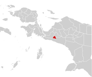
Deiyai Regency is one of the regencies (kabupaten) in Papua Province of Indonesia; it was formed on 29 October 2008 from part of the Paniai Regency area, and inaugurated by the Indonesian Minister of Home Affairs, Mardiyanto. The legal basis for the formation of this regency was the Law of the Republic of Indonesia of 2008 Number 55.

Nabire is a town in the Indonesian province of Papua, at the western end of New Guinea. The town is the administrative seat of the Nabire Regency. It is served by Nabire Airport.
Sarmi is a coastal town and administrative center of Sarmi Regency in province of Papua in Indonesia.

Kenyam is a town and district in Nduga Regency, Papua, Indonesia. It is the capital of the regency. Its population is 8148.
Sentani is a town in Papua Province, Indonesia. It is the administrative seat of Jayapura Regency. The town is located to the north of Lake Sentani and to the south of the Cyclops Mountains.

Sibualong is a village in Balaesang district, Donggala Regency in North Sulawesi province, Indonesia. Its population is 2437. Located about 1520 metres from the equator, it is the closest village in Sulawesi to the equator.

Teluk Kuantan is a town and the seat of Kuantan Singingi Regency, Riau province, Indonesia.
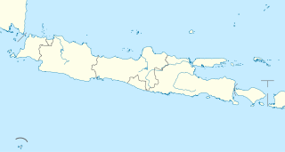
Kajen is a district, town and the regency seat of Pekalongan Regency, Central Java, Indonesia. Its population is 58,048.
Sembungan is a village in Kejajar district, Wonosobo Regency in Central Java province, Indonesia. Its population is 1215.

Gemboyah is a village in Linge district, Central Aceh Regency in Aceh province, Indonesia. Its population is 917.
Kanreapia is a village in Tombolo Pao district, Gowa Regency in South Sulawesi province, Indonesia. Its population is 4304.

Iraiweri is a village in Anggi district, Pegunungan Arfak Regency in West Papua province, Indonesia. Its population is 205.
Usti is a village in Membey district, Pegunungan Arfak Regency in West Papua province, Indonesia. Its population is 163.
Imbonggun is a village in Minyambaouw district, Pegunungan Arfak Regency in West Papua province, Indonesia. Its population is 103.