The principal house is Syde Manor, a listed building which dates from the 16th and 17th centuries, built of stone rubble with a Cotswold stone roof and gables. Some of its mullioned windows have unusual three-centred arches at their heads. The front of the house which has the main entrance was added in the late 18th or early 19th century.[2]
History
The National Gazetteer of Great Britain and Ireland (1868) says of Side (as it spelt the name):
SIDE, a parish in the hundred of Rapsgate, county Gloucester, 7 miles N.W. of Cirencester, its post town, and 7 E. of Painswick. The parish, which is of small extent, is situated near the Roman Ermine Street. The surface is hilly. The soil consists of stonebrash and gravel, with a rocky subsoil. There is no village. The living is a rectory in the diocese of Gloucester and Bristol, value £126. The church, dedicated to St. Mary, is a small stone edifice, with a tower and three bells. The parochial charities produce about £2 per annum. John Hall, Esq., is lord of the manor.[3]
SIDE, or Syde, a parish in Cirencester district, Gloucester; 7½ miles NW by N of Cirencester r. station. Post town, Winstone, under Cirencester. Acres, 614. Real property, £886. Pop., 55. Houses, 11. The manor belongs to J. Hall, Esq. The living is a rectory in the diocese of Gloucester and Bristol. Value, £126. Patron, J. Hall, Esq. The church is good.[4]
The Cotswolds is a region of central South West England, along a range of rolling hills that rise from the meadows of the upper River Thames to an escarpment above the Severn Valley and the Vale of Evesham. The area is defined by the bedrock of Jurassic limestone that creates a type of grassland habitat that is quarried for the golden-coloured Cotswold stone. It lies across the boundaries of several English counties: mainly Gloucestershire and Oxfordshire, and parts of Wiltshire, Somerset, Worcestershire, and Warwickshire. The highest point is Cleeve Hill at 1,083 ft (330 m), just east of Cheltenham. The predominantly rural landscape contains stone-built villages, towns, stately homes and gardens featuring the local stone.
Gloucestershire is a ceremonial county in South West England. It is bordered by Herefordshire to the north-west, Worcestershire to the north, Warwickshire to the north-east, Oxfordshire to the east, Wiltshire to the south, Bristol and Somerset to the south-west, and the Welsh county of Monmouthshire to the west. The city of Gloucester is the largest settlement and the county town.
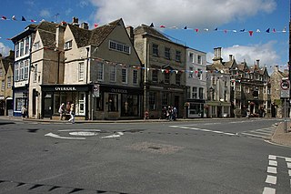
Cirencester is a market town and civil parish in the Cotswold District of Gloucestershire, England. Cirencester lies on the River Churn, a tributary of the River Thames. It is the eighth largest settlement in Gloucestershire and the largest town within the Cotswolds. It is the home of the Royal Agricultural University, the oldest agricultural college in the English-speaking world, founded in 1840. The town had a population of 20,229 in 2021. The town is 18 miles (29 km) northwest of Swindon, 18 miles (29 km) southeast of Gloucester, 37 miles (60 km) west of Oxford and 39 miles (63 km) northeast of Bristol.
Lechlade is a town at the edge of the Cotswolds in Gloucestershire, England, 55 miles (89 km) south of Birmingham and 68 miles (109 km) west of London. It is the highest point at which the River Thames is navigable, although there is a right of navigation that continues south-west into Cricklade, in the neighbouring county of Wiltshire. The town is named after the River Leach that joins the Thames near the Trout Inn and St. John's Bridge.
Painswick is a town and civil parish in the Stroud District in Gloucestershire, England. Originally the town grew from the wool trade, but it is now best known for its parish church's yew trees and the local Rococo Garden. The village is mainly constructed of locally quarried Cotswold stone. Many of the buildings feature south-facing attic rooms once used as weavers' workshops.
Tetbury is a town and civil parish inside the Cotswold district in Gloucestershire, England. It lies on the site of an ancient hill fort, on which an Anglo-Saxon monastery was founded, probably by Ine of Wessex, in 681. The population of the parish was 5,250 in the 2001 census, increasing to 5,472 at the 2011 census. The population further increased to 6,453 in the 2021 Census.
Fairford is a market town in Gloucestershire, England. The town lies in the Cotswold hills on the River Coln, 6 miles (9.7 km) east of Cirencester, 4 miles (6.4 km) west of Lechlade and 9 miles (14 km) north of Swindon. Nearby are RAF Fairford and the Cotswold Water Park.
Broadwell is a village and civil parish in the English county of Gloucestershire. It is about 1.5 miles (2.4 km) north of Stow-on-the-Wold, In the 2001 United Kingdom census, the parish had a population of 384. decreasing to 355 at the 2011 census.
Coln St Aldwyns is a village and civil parish in the Cotswold district of the English county of Gloucestershire.
Long Newnton is a small village and civil parish in Gloucestershire, England, lying on the B4014 road between Malmesbury and Tetbury. It is near the SW end of the Cotswolds. The population of the parish was 211 at the 2011 census.
Siddington is a village and civil parish in Gloucestershire, England. It is located immediately south of Cirencester. At the 2011 United Kingdom Census, the parish had a population of 1,249.
Didmarton is a village and civil parish in Gloucestershire, England. It lies in the Cotswold District, about 6 miles (10 km) southwest of Tetbury. The parish is on the county borders with South Gloucestershire and Wiltshire.
Oldbury-on-the-Hill is a small village and former civil parish, now in the parish of Didmarton, in the Cotswold district, in Gloucestershire, England, ninety-three miles west of London and less than one-mile (1.6 km) north of the village of Didmarton. In 1881 the parish had a population of 386.
Hatherop is a village and civil parish in the Cotswolds Area of Outstanding Natural Beauty, about 2.5 miles (4.0 km) north of Fairford in Gloucestershire, England. The River Coln forms part of the western boundary of the parish.
Duntisbourne Rouse is a village and civil parish in Gloucestershire, England. It lies in the Cotswolds, an Area of Outstanding Natural Beauty. At the 2001 census, it had a population of 70.
Edgeworth is a small village and civil parish in the English county of Gloucestershire. It is located east of Stroud, west of Cirencester and south of Cheltenham.
Poulton is a village and civil parish in the English county of Gloucestershire, approximately 24 miles (39 km) to the south-east of Gloucester. It lies in the south of the Cotswolds, an Area of Outstanding Natural Beauty. In the 2001 United Kingdom census, the parish had a population of 398, increasing to 408 at the 2011 census.
Elkstone is a village and civil parish in the English county of Gloucestershire. In the 2001 United Kingdom census, the parish had a population of 203, increasing to 248 at the 2011 census.
Windrush is a village and civil parish in Gloucestershire, England, approximately five miles southeast of Northleach. It lies in the Cotswolds on the River Windrush, from which it derives its name. The village name is first attested in the Domesday Book of 1086, where it appears as Wenric.
Todenham is a village and civil parish in the Cotswold district of Gloucestershire, England. The village is significant for its Grade I listed 14th-century parish church.
This page is based on this Wikipedia article Text is available under the CC BY-SA 4.0 license; additional terms may apply. Images, videos and audio are available under their respective licenses.