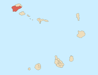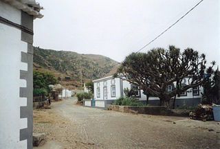
Porto Novo is a concelho (municipality) of Cape Verde. Situated in the southern part of the island of Santo Antão, it covers 72% of the island area, and is home to 41% of its population. Its population at the 2010 census was 18,028. Its capital is the town Porto Novo. Its highest point, which is also the highest point of the entire island, is Tope de Coroa, elevation 1,979 metres. The municipality of Porto Novo was created in 1962 when the parishes of São João Baptista and Santo André were separated from the older Municipality of Paul.

São Lourenço dos Órgãos is a concelho (municipality) of Cape Verde. It is situated in the mountainous central part of the island of Santiago. Its seat is the city João Teves. Its population was 7,388 at the 2010 census, and its area is 36.9 km2. The municipality is bordered by Santa Cruz to the northeast, São Domingos to the south, Ribeira Grande de Santiago to the southwest and São Salvador do Mundo to the northwest. Pico de Antónia, the island's highest mountain, straddles the borders of São Lourenço dos Órgãos, São Salvador do Mundo and Ribeira Grande de Santiago.

São Salvador do Mundo is a concelho (municipality) of Cape Verde. It is situated in the central part of the island of Santiago. Its seat is the city Picos. Its population was 8,677 at the 2010 census, and its area is 26.5 km2, making it the smallest municipality of Cape Verde. The municipality borders Santa Cruz to the northeast, São Lourenço dos Órgãos to the southeast, Ribeira Grande de Santiago to the southwest and Santa Catarina to the northwest.

Nossa Senhora do Monte is a town located in the heart of the island of Brava, Cape Verde. It is the seat of the parish of Nossa Senhora do Monte. Its elevation is 650 m, and its population was 271 in 2010. Nossa Senhora do Monte is surrounded by mountains. Monte Fontainhas, Brava's tallest mountain reaching a height of 976 meters, is close to the village.

Santa Isabel is a freguesia of Cape Verde. It covers the western part of the island of Boa Vista, and contains the island's capital Sal Rei. The freguesia consists of the following settlements:

Nossa Senhora da Lapa is a freguesia of Cape Verde. It covers the smaller northwestern part of the municipality of Ribeira Brava, on the island of São Nicolau.

São João Baptista is a freguesia of Cape Verde. It covers the eastern part of the island of Boa Vista. It is named after the church located in Fundo das Figueiras.

Nossa Senhora do Monte is a freguesia of Cape Verde. It covers the western part of the island of Brava. To its east is the parish of São João Baptista.

Santíssimo Nome de Jesus is a freguesia of Cape Verde. It covers the eastern part of the municipality of Ribeira Grande de Santiago, on the island of Santiago.

São João Baptista is a freguesia of Cape Verde. It covers the western part of the municipality of Ribeira Grande de Santiago, on the island of Santiago.

São Nicolau Tolentino is a freguesia of Cape Verde. It covers the western part of the municipality of São Domingos, on the island of Santiago.

Nossa Senhora do Livramento is a freguesia of Cape Verde. It covers the northern part of the municipality of Ribeira Grande, on the island of Santo Antão.

Nossa Senhora do Rosário is a freguesia of Cape Verde. It covers the eastern part of the municipality of Ribeira Grande, on the island of Santo Antão.

Santo Crucifixo is a freguesia of Cape Verde. It covers the southern part of the municipality of Ribeira Grande, on the island of Santo Antão. The seat of the parish is Coculi. The parish covers much of the Ribeira Grande valley.

São João Baptista is a freguesia of Cape Verde. It covers the larger, southern part of the municipality of Porto Novo, on the island of Santo Antão.

São Pedro Apóstolo is a freguesia of Cape Verde. It covers the western part of the municipality of Ribeira Grande, on the island of Santo Antão.

Nossa Senhora do Rosário is a freguesia of Cape Verde. It covers the larger eastern part of the municipality of Ribeira Brava, on the island of São Nicolau.


