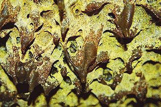
Lava Beds National Monument is located in northeastern California, in Siskiyou and Modoc counties. The monument lies on the northeastern flank of Medicine Lake Volcano and has the largest total area covered by a volcano in the Cascade Range.

The geology of the Lassen volcanic area presents a record of sedimentation and volcanic activity in the area in and around Lassen Volcanic National Park in Northern California, U.S. The park is located in the southernmost part of the Cascade Mountain Range in the Pacific Northwest region of the United States. Pacific Oceanic tectonic plates have plunged below the North American Plate in this part of North America for hundreds of millions of years. Heat from these subducting plates has fed scores of volcanoes in California, Oregon, Washington and British Columbia over at least the past 30 million years and is also responsible for activities in the Lassen volcanic area.

Newberry Volcano is a large active shield volcano located about 20 miles (32 km) south of Bend, Oregon, United States, 35 miles (56 km) east of the major crest of the Cascade Range, within the Newberry National Volcanic Monument. Its highest point is Paulina Peak. The largest volcano in the Cascade Volcanic Arc, Newberry has an area of 1,200 square miles (3,100 km2) when its lava flows are taken into account. From north to south, the volcano has a length of 75 miles (121 km), with a width of 27 miles (43 km) and a total volume of approximately 120 cubic miles (500 km3). It was named for the geologist and surgeon John Strong Newberry, who explored central Oregon for the Pacific Railroad Surveys in 1855. The surrounding area has been inhabited by Native American populations for more than 10,000 years.

Belknap Crater is a shield volcano in the Cascade Range in the U.S. state of Oregon. Located in Linn County, it is associated with lava fields and numerous subfeatures including the Little Belknap and South Belknap volcanic cones. It lies north of McKenzie Pass and forms part of the Mount Washington Wilderness. Belknap is not forested and most of its lava flows are not vegetated, though there is some wildlife in the area around the volcano, as well as a number of tree molds formed by its eruptive activity.

Pisgah Crater, or Pisgah Volcano, is a young volcanic cinder cone rising above a lava plain in the Mojave Desert, between Barstow and Needles, California in San Bernardino County, California. The volcanic peak is around 2.5 miles (4.0 km) south of historic U.S. Route 66-National Old Trails Highway and of Interstate 40, and west of the town of Ludlow. The volcano had a historic elevation of 2,638 feet (804 m), but has been reduced to 2,545 feet (776 m) due to mining.

The Boring Lava Field is a Plio-Pleistocene volcanic field with cinder cones, small shield volcanoes, and lava flows in the northern Willamette Valley of the U.S. state of Oregon. Located 12 miles (19 km) southeast of downtown Portland, the field got its name from the town of Boring, Oregon, which lies just southeast of the most dense cluster of lava vents. The zone became active about 2.7 million years ago, with long periods of activity interspersed with quiescence. Its last eruptions took place about 57,000 years ago at the Beacon Rock cinder cone volcano; the individual volcanic vents of the field are considered extinct, but the field itself is not.

Steptoe Butte is a quartzite island jutting out of the silty loess of the Palouse hills in Whitman County, Washington, in the northwest United States. The 3,612-foot (1,101 m) butte is preserved as Steptoe Butte State Park, a publicly owned 150-acre (61 ha) recreation area located 12 miles (19 km) north of Colfax. Steptoe Butte and Kamiak Butte comprise Steptoe and Kamiak Buttes National Natural Landmark.

Lava Butte is a cinder cone in central Oregon, United States, just west of U.S. Route 97 between the towns of Bend, Oregon, and Sunriver, Oregon. It is part of a system of small cinder cones on the northwest flank of Newberry Volcano, a massive shield volcano which rises to the southeast. The cinder cone is capped by a crater which extends about 60 feet (20 m) deep beneath its south rim, and 160 feet (50 m) deep from the 5,020-foot (1,530 m) summit on its north side. Lava Butte is part of the Newberry National Volcanic Monument.

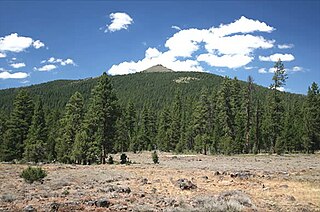
Black Butte is an extinct stratovolcano in the U.S. state of Oregon. Located in Jefferson County, it is part of Deschutes National Forest. Black Butte forms part of the Cascade volcanic arc. The butte lies just south of the Metolius Springs, which merge to form the headwaters of the Metolius River. The Metolius River's basin sustains a wide array of plant life, large and small mammals, and more than 80 bird species.

Rocky Butte is an extinct cinder cone butte in Portland, Oregon, United States. It is also part of the Boring Lava Field, a group of volcanic vents and lava flows throughout Oregon and Washington state. The volcano erupted between 285,000 and 500,000 years ago.

Diamond Peak is a volcano in Klamath and Lane counties of central Oregon in the United States. It is a shield volcano, though it might also be considered a modest stratocone. Diamond Peak forms part of the Cascade Volcanic Arc, a segment of the Cascade Range in western North America extending from southern British Columbia through Oregon to Northern California. Reaching an elevation of 8,748 feet (2,666 m), the mountain is located near Willamette Pass in the Diamond Peak Wilderness within the Deschutes and Willamette national forests. Surrounded by coniferous forest and visible in the skyline from foothills near Eugene, Diamond Peak offers a few climbing routes and can be scrambled.

Olallie Butte is a steep-sided shield volcano in the Cascade Range of the northern part of the U.S. state of Oregon. It is the largest volcano and highest point in the 50-mile (80 km) distance between Mount Hood and Mount Jefferson. Located just outside the Olallie Scenic Area, it is surrounded by more than 200 lakes and ponds fed by runoff, precipitation, and underground seepage, which are popular spots for fishing, boating, and swimming. The butte forms a prominent feature in the Mount Jefferson region and is usually covered with snow during the winter and spring seasons.

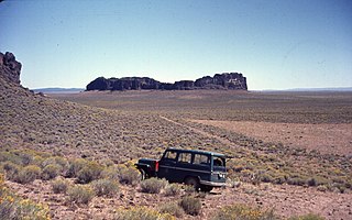
The Fort Rock-Christmas Lake Valley Basin is the basin of a former inland sea that existed in that region from Pliocene through late Pleistocene time. The Fort Rock basin maar field includes over 30 hydrovolcanic landforms spread over an area of 1,500 square miles (4,000 km2). During the Pleistocene and early Holocene, Paleolake Fort Rock encompassed the entire basin.

Pahvant Butte is a butte formed by a dormant volcano in the west-central portion of Utah, United States.

The Black Rock Desert volcanic field in Millard County, Utah, is a cluster of several volcanic features of the Great Basin including as Pahvant Butte, The Cinders, and Tabernacle Hill. The field's Ice Springs event was an explosive eruption followed by lava flows that were Utah's most recent volcanic activity. which overlapped the older flows of Pavant Butte.

Fumarole Butte is a shield volcano in central Juab County, Utah, United States. Built during the Quaternary period, it is composed of basaltic andesite. It stands 207 meters (679 ft) in height and has a diameter of 12 kilometers (7 mi). Under the volcano lies Crater Bench, the result of an eruption of basaltic andesite. To the east of the volcano are a series of hot springs, known as Crater, Baker Hot Springs, or Abraham hot springs.

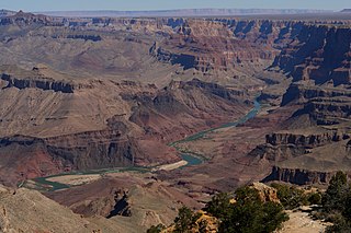
The Cardenas Basalt, also known as either the Cardenas Lava or Cardenas Lavas, is a rock formation that outcrops over an area of about 310 km2 (120 mi2) in the eastern Grand Canyon, Coconino County, Arizona. The lower part of the Cardenas Basalt forms granular talus slopes. Its upper part forms nearly continuous low cliffs that are parallel to the general course of the Colorado River. The most complete, readily accessible, and easily studied exposure of the Cardenas Basalt lies in Basalt Canyon. This is also its type locality.

Hager Mountain is a volcanic peak in Oregon in the northwest corner of the Basin and Range Province in the United States. The mountain is located south of the small unincorporated community of Silver Lake in south-central Oregon, and it is in the Fremont–Winema National Forest. On the summit, there is a fire lookout operated during the summer and fall by the United States Forest Service. There are several hiking trails that lead to the lookout station.

The Cline Buttes are mountains with volcanic origins that form three dome-shaped peaks located in Deschutes County in central Oregon. They are some of the eastern foothills of the Cascade Range. Situated on land administered by the Bureau of Land Management, the buttes are flanked on the east and west sides by two separate sections of the Eagle Crest Resort. On the highest summit, there is a Federal Aviation Administration site with an aircraft navigation beacon. The mountains have several hiking trails as well as a number of popular mountain bike routes.

The Cinders is a lava field including a volcanic hill named Ice Springs craters in the west-central portion of Utah, United States. It is also known as the Ice Springs Volcanic Field.


