
Nevada is a landlocked state in the Western region of the United States. It borders Oregon to the northwest, Idaho to the northeast, California to the west, Arizona to the southeast, and Utah to the east. Nevada is the seventh-most extensive, the 32nd-most populous, and the ninth-least densely populated U.S. state. Nearly three-quarters of Nevada's population live in Clark County, which contains the Las Vegas–Paradise metropolitan area, including three of the state's four largest incorporated cities. Nevada's capital is Carson City. Las Vegas is the largest city in the state.

Mono County is a county located in the east central portion of the U.S. state of California. As of the 2020 census, the population was 13,195, making it the fourth-least populous county in California. The county seat is Bridgeport. The county is located east of the Sierra Nevada between Yosemite National Park and Nevada. The only incorporated town in the county is Mammoth Lakes, which is located at the foot of Mammoth Mountain. Other locations, such as June Lake, are also famous as skiing and fishing resorts. Located in the middle of the county is Mono Lake, a vital habitat for millions of migratory and nesting birds. The lake is located in a wild natural setting, with pinnacles of tufa arising out of the salty and alkaline lake. Also located in Mono County is Bodie, the official state gold rush ghost town, which is now a California State Historic Park.

Sierra County is a county located in the U.S. state of California. As of the 2020 census, the population was 3,236, making it California's second-least populous county. The county seat is Downieville; the sole incorporated city is Loyalton. The county is in the Sierra Nevada, northeast of Sacramento on the border with Nevada.

The Humboldt–Toiyabe National Forest (HTNF) is the principal U.S. National Forest in the U.S. state of Nevada, and has a smaller portion further west in Eastern California in the state of California. With an area of 6,289,821 acres (25,454.00 km2), it is the largest U.S. National Forest reservation outside of Alaska, further northwest on the North American continent.

Mount Whitney is the highest mountain in the contiguous United States, with an elevation of 14,505 feet (4,421 m). It is in East–Central California, in the Sierra Nevada, on the boundary between California's Inyo and Tulare counties, and 84.6 miles (136.2 km) west-northwest of North America's lowest topographic point, Badwater Basin in Death Valley National Park, at 282 ft (86 m) below sea level. The mountain's west slope is in Sequoia National Park and the summit is the southern terminus of the John Muir Trail, which runs 211.9 mi (341.0 km) from Happy Isles in Yosemite Valley. The eastern slopes are in Inyo National Forest in Inyo County. Mount Whitney is ranked 18th by topographic isolation.
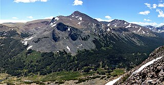
Mount Dana is a mountain in the U.S. state of California. Its summit marks the eastern boundary of Yosemite National Park and the western boundary of the Ansel Adams Wilderness. At an elevation of 13,061 feet (3,981 m), it is the second highest mountain in Yosemite, and the northernmost summit in the Sierra Nevada which is over 13,000 feet (3,962.4 m) in elevation. Mount Dana is the highest peak in Yosemite that accessible to summit. The mountain is named in honor of James Dwight Dana, who was a professor of natural history and geology at Yale.

The White Mountains of California and Nevada are a triangular fault-block mountain range facing the Sierra Nevada across the upper Owens Valley. They extend for approximately 60 mi (97 km) as a greatly elevated plateau about 20 mi (32 km) wide on the south, narrowing to a point at the north, with elevations generally increasing south to north. The range's broad southern end is near the community of Big Pine, where Westgard Pass and Deep Springs Valley separate it from the Inyo Mountains. The narrow northern end is at Montgomery Pass, where U.S. Route 6 crosses. The Fish Lake Valley lies east of the range; the southeast part of the mountains are separated from the Silver Peak Range by block faulting across the Furnace Creek Fault Zone, forming a feeder valley to Fish Lake Valley. The range lies within the eastern section of the Inyo National Forest.

Mount Charleston, including Charleston Peak at 11,916 feet (3,632 m), is the highest mountain in both the Spring Mountains and Clark County, in Nevada, United States. It is the eighth-highest mountain in the state. Well separated from higher peaks by large, low basins, Charleston Peak is the most topographically prominent peak in Nevada, and the eighth-most-prominent peak in the contiguous United States. It is one of eight ultra-prominent peaks in Nevada. It is located about 35 miles (56 km) northwest of Las Vegas within the Mount Charleston Wilderness, which is within the Spring Mountains National Recreation Area of the Humboldt–Toiyabe National Forest.

Wheeler Peak is the tallest mountain in the Snake Range and in White Pine County, in Nevada, United States. The summit elevation of 13,065 feet (3,982 m) makes it the second-highest peak in Nevada, just behind Boundary Peak. With a topographic prominence of 7,563 feet (2,305 m), Wheeler Peak is the most topographically prominent peak in White Pine County and the second-most prominent peak in Nevada, just behind Mount Charleston. The mountain is located in Great Basin National Park and was named for George Wheeler, leader of the Wheeler Survey of the late 19th century.

Boundary Peak is a mountain in Esmeralda County, Nevada, United States. With a peak elevation of 13,147 feet (4,007 m), it is the highest natural point in the state of Nevada.

Mount Ritter is the highest mountain in Madera County, California, in the Western United States, at an elevation of 13,149 feet (4,008 m). It is also the highest and most prominent peak of its namesake, the Ritter Range, a subrange of the Sierra Nevada in the Ansel Adams Wilderness of the Inyo and Sierra National Forests. Mount Ritter is the 15th highest mountain peak in California with at least 500 meters of topographic prominence.

Mount Darwin is a flat-topped mountain in the Sierra Nevada, on the border of between Fresno and Inyo counties in Kings Canyon National Park and the John Muir Wilderness of California.
Table Mountain is a large flat-topped mountain overlooking Cape Town, South Africa.

Mount Langley is a mountain located on the crest of the Sierra Nevada, on the boundary between Inyo and Tulare counties in eastern California, in the United States. To the east is the Owens Valley, and to the west is the Kern River Valley. It is the ninth-highest peak in the state and the seventh-highest in the Sierra. Mount Whitney, the highest peak in the contiguous United States, lies 4.8 miles (7.7 km) to the northwest. Mount Langley also has the distinction of being the southernmost fourteener in the United States.
The Table Mountain Wilderness is a protected wilderness area in the Monitor Range of Nye County in the central section of the state of Nevada. It is the third largest wilderness area in the state. The nearest city is Tonopah, Nevada. The Table Mountain Wilderness Area covers 92,600 acres (37,500 ha), and is administered by the Humboldt-Toiyabe National Forest. The 1860s ghost town of Belmont is nearby.

Mount Jefferson is the highest mountain in both the Toquima Range and Nye County in Nevada, United States. It is the sixth highest mountain in the state. As the high point of a range which is well separated from other ranges by low basins, Mount Jefferson has a high topographic prominence of 5,861 feet (1,786 m). This makes it the most prominent peak in Nye County and the third most prominent peak in Nevada. For similar reasons, it is also the highest mountain for over 90 miles in all directions. It is located about 50 miles (80 km) northeast of the county seat of Tonopah within the Alta Toquima Wilderness of the Humboldt-Toiyabe National Forest, near the smaller towns of Carvers and Round Mountain. Three distinct summits are located on a broad area of subalpine tundra: North Summit rises to 11,820 feet (3,603 m), Middle Summit to 11,692 feet (3,564 m), and South Summit to 11,949 feet (3,642 m). During the Pleistocene, alpine glaciers eroded several cirques east of the summit plateau.

Table Mountain is located near the northern end of the Great Western Divide, a sub-range of the Sierra Nevada in California. The summit marks a point on the boundary between Sequoia and Kings Canyon national parks and is 0.6 miles (1 km) south of Thunder Mountain and 1.3 miles (2.1 km) northeast of Midway Mountain.

Freel Peak is a mountain located in the Carson Range, a spur of the Sierra Nevada, near Lake Tahoe in California.

Mount Rose is the highest mountain in Washoe County, within the Carson Range of Nevada, United States. It ranks thirty-seventh among the most topographically prominent peaks in the state. It is also both the highest and most topographically prominent peak of the greater Sierra Nevada range within the state of Nevada, and the third most topographically prominent peak in the Sierra Nevada overall. It is located in the Mount Rose Wilderness of the Humboldt-Toiyabe National Forest. An extinct volcano, the mountain is in between Lake Tahoe and Reno. State Route 431 traverses Mount Rose Summit southeast of Mount Rose. Due to the high elevation, most of the precipitation that falls on the mountain is snow. The view from Mount Rose facing east is the Truckee Meadows, the second largest population center in Nevada.

Leavitt Peak is located in the Emigrant Wilderness near Sonora Pass in the eastern Sierra Nevada range of California. Leavitt Peak is located on the Tuolumne County - Mono County line. The Pacific Crest Trail runs close to the east of Leavitt Peak, at an elevation of about 10,800 feet (3,290 m) elevation. The peak offers views south to Yosemite National Park and north towards South Lake Tahoe.
