
Papua New Guinea, officially the Independent State of Papua New Guinea, is a country in Oceania that occupies the eastern half of the island of New Guinea and its offshore islands in Melanesia, a region of the southwestern Pacific Ocean north of Australia. Its capital, located along its southeastern coast, is Port Moresby. The western half of New Guinea forms the Indonesian provinces of Papua and West Papua. It is the world's third largest island country with 462,840 km2 (178,700 sq mi).

New Britain is the largest island in the Bismarck Archipelago, part of the Islands Region of Papua New Guinea. It is separated from New Guinea by a northwest corner of the Solomon Sea and from New Ireland by St. George's Channel. The main towns of New Britain are Rabaul/Kokopo and Kimbe. The island is roughly the size of Taiwan. While the island was part of German New Guinea, it was named Neupommern.

The Papuan languages are the non-Austronesian and non-Australian languages spoken on the western Pacific island of New Guinea, and neighbouring islands, by around 4 million people. It is a strictly geographical grouping, and does not imply a genetic relationship. The concept of Papuan peoples as distinct from Austronesian-speaking Melanesians was first suggested and named by Sidney Herbert Ray in 1892.
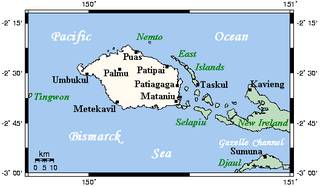
New Hanover Island,, also called Lavongai, is a large volcanic island in the New Ireland Province of Papua New Guinea. This region is part of the Bismarck Archipelago and lies at 2.5°S 150.25°E. Measuring some 460 square miles (1,200 km2), it had a population of 5,000 in 1960, which increased to approximately 17,160 by 2000.

The Bismarck Sea lies in the southwestern Pacific Ocean within the nation of Papua New Guinea. It is located northeast of the island of New Guinea and south of the Bismarck Archipelago. It has coastlines in districts of the Islands Region, Momase Region, and Papua Region.

Vitiaz Strait is a strait between New Britain and the Huon Peninsula, northern New Guinea.

The Solomon Sea is a sea located within the Pacific Ocean. It lies between Papua New Guinea and the Solomon Islands. Many major battles were fought there during World War II.
The Ata language, also known as Pele-Ata after its two dialects, or Wasi, is a Papuan language spoken on New Britain island, Papua New Guinea. It appears to be related to neighboring Anêm, and possibly also to Yélî Dnye in a proposed Yele-West New Britain family. There are about 2000 speakers.

The postage stamps and postal history of Papua New Guinea were linked to the colonial administration on the eastern part of the island of New Guinea until its independence in 1975.
Gasmata is a village on the southern coast of New Britain, Papua New Guinea located at 6° 16' 60S 150° 19' 60E. There is a Gasmata Airport in Surumi Peninsula area adjacent. The village is administered under Gasmata Rural LLG in East New Britain Province.

Alotau District is a district of the Milne Bay Province of Papua New Guinea.
Esa'ala District is a district of the Milne Bay Province of Papua New Guinea. Its capital is Esa'ala. The population of the district was 54,467 at the 2011 census.
Samarai-Murua District is a district of the Milne Bay Province of Papua New Guinea. Its capital is Murua. The population of the district was 58,590 at the 2011 census.
Jimi District is a district of the Jiwaka Province of Papua New Guinea. Its capital is Tabibuga. The population of the district was 71,379 at the 2011 census. Before May 2012, it was part of the Western Highlands Province. It is home to the Jimi Valley and the village of Koinambe.

Momats River is a river in southern Western Papua, Indonesia.

Pawaia, also known as Sira, Tudahwe, Yasa, is a Papuan language that forms a tentative independent branch of the Trans–New Guinea family in the classification of Malcolm Ross (2005).
DeraAKAMangguar and Kamberataro (Komberatoro) is a Senagi language of Papua New Guinea and Indonesia. In Papua New Guinea, it is primarily spoken in Kamberataro village, Amanab Rural LLG, Sandaun Province.
Talasea is a village on the Talasea Peninsula, West New Britain Province, Papua New Guinea. It is located in Talasea Rural LLG.
The Lumis is a river of north-western New Ireland, Papua New Guinea. The name was proposed by Stewart and Sandy in 1986.
Rhinolophus mcintyrei is a species of horseshoe bat that is endemic to Papua New Guinea.
