
Papua New Guinea, officially the Independent State of Papua New Guinea, is a country in Oceania that occupies the eastern half of the island of New Guinea and its offshore islands in Melanesia, a region of the southwestern Pacific Ocean north of Australia. Its capital, located along its southeastern coast, is Port Moresby. The western half of New Guinea forms the Indonesian provinces of Papua and West Papua. It is the world's third largest island country with 462,840 km2 (178,700 sq mi).
The Solomon Islands rain forests are a terrestrial ecoregion covering most of the Solomon Islands archipelago.
Airlink was an airline based in Madang, Papua New Guinea that ceased operations in late July 2007. It provided high-frequency scheduled and charter services to outlying regions of Papua New Guinea. Its main base was Madang Airport, with hubs at Rabaul Airport, Kavieng Airport, Wewak International Airport and Mount Hagen Airport.
The Anêm language is a Papuan language spoken in five main villages along the northwestern coast of New Britain, Papua New Guinea.
The St Matthias Islands are a small archipelago group of islands in the Bismarck Archipelago, in northern Papua New Guinea. They are within New Ireland Province.

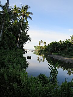
Mussau Island is the largest island of St Matthias Islands, Papua New Guinea, at 1°25′01″S149°37′59″E. It is one of the northernmost islands of Papua New Guinea. The island is a noted Biodiversity hotspot with pristine primeval Rainforest covering most of Mussau's hilly landscape.The island has over 243 endemic plant species as well as at least 47 native butterfly species.

Kandrian Airport is an airport in Kandrian, in the West New Britain Province of Papua New Guinea.

The Northern New Guinea lowland rain and freshwater swamp forests is a tropical moist broadleaf forest ecoregion of northern New Guinea.

Kandrian is the headquarters of Kandrian-Gloucester District, West New Britain Province, Papua New Guinea.
Aisi, or Musak, is a Papuan language of Madang Province, Papua New Guinea.
Onjob is a Papuan language of New Guinea. It is a rather divergent member of the Dagan family.
The Ajova is a river of south-eastern Papua New Guinea. It flows into Collingwood Bay to the southeast of Mount Victory, Papua New Guinea.
The Apmi is a river of central western New Britain, in Papua New Guinea.
The Coalition for Reform Party is a political party in Papua New Guinea.
The Kivung movement ("Meeting") is a millenarian movement sometimes called a cargo cult practiced among the villagers in the Baining and Pomio areas in East New Britain, Papua New Guinea.
Kandrian Coastal Rural LLG is a local-level government (LLG) of West New Britain Province, Papua New Guinea.
Kandrian Inland Rural LLG is a local-level government (LLG) of West New Britain Province, Papua New Guinea.

Koriam Michael Urekit was a Papua New Guinean cargo cult leader and politician. He served as a member of the House of Assembly and National Parliament from 1964 until his death.
