New England is a geographical region in the north of the state of New South Wales, Australia, about 60 km inland from the Tasman Sea. The area includes the Northern Tablelands and the North West Slopes regions. As of 2021, New England had a population of 185,560, with over a quarter of the people living in the area of Tamworth Regional Council.

Coonabarabran is a town in Warrumbungle Shire that sits on the divide between the Central West and North West Slopes regions of New South Wales, Australia. At the 2021 census, the town had a population of 2,387, and as of 2021, the population of Coonabarabran and its surrounding area is 3,477. Local and district residents refer to the town as 'Coona'. Coonabarabran is the gateway to the Warrumbungle National Park, Siding Spring Observatory and the Pilliga Forest.

Manilla is a small town in New South Wales, Australia, located on Fossickers Way 45 kilometres northwest of the regional city of Tamworth and 27 kilometres northeast of the historic village Somerton. Manilla is famous for its setting as a fishing, paragliding, and mountain biking area. The name Manilla comes from the Gamilaraay word 'Maneela', which is said to mean 'meeting of the rivers'.

Gunnedah is a town in north-central New South Wales, Australia and is the seat of the Gunnedah Shire local government area. In the 2021 census the town recorded a population of 8,338. Gunnedah is situated within the Liverpool Plains, a fertile agricultural region, with 80% of the surrounding shire area devoted to farming. The Namoi River flows west then north-west through the town providing water beneficial to agricultural operations in the area.

Keepit Dam is a major gated mass concrete gravity dam with an earth fill abutment and a central gated concrete overflow crest and six radial gate spillways across the Namoi River upstream of its junction with the Peel River in the North West Slopes region of New South Wales, Australia. The dam's purpose includes flood mitigation, hydro-power, irrigation, water supply and conservation. The impounded reservoir is called Lake Keepit.

The Namoi River, a major perennial river that is part of the Barwon catchment of the Murray–Darling basin, is located in the Northern Tablelands and North West Slopes districts of New South Wales, Australia.

Bundanoon is a town in the Southern Highlands of New South Wales, Australia, in Wingecarribee Shire, on Gandangarra and Dharawal Country. It is an Aboriginal name meaning "place of deep gullies" and was formerly known as Jordan's Crossing. Bundanoon is colloquially known as Bundy/Bundi.

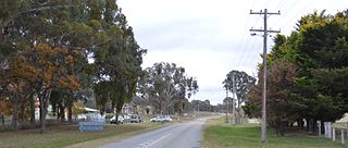
Murrurundi( MURR-oo-RUN-dye), is a rural town located in the Upper Hunter Shire, in the Upper Hunter region of New South Wales, Australia.

Esk is a rural town and locality in the Somerset Region in South East Queensland, Australia. In the 2021 census, the locality of Esk had a population of 1,641 people.

Taralga is the traditional land of the Gundungurra people. Today it is a small village in the Southern Tablelands of New South Wales, Australia, in Upper Lachlan Shire. It is located at the intersection of the Goulburn-Oberon Road and the Laggan-Taralga Road. It is accessible from Oberon to the north, Mittagong to the east, Goulburn to the south, and Crookwell to the west. At the 2016 census, Taralga had a population of 467. Taralga is located relatively close to the famous Wombeyan Caves. The town experiences a volatile climate and is sometimes affected by snow in the winter months.

Gundaroo is a small village in the Southern Tablelands of New South Wales, Australia and in Yass Valley Council. It is situated to the east of the Yass River, about 16 kilometres (10 mi) north of Sutton, about 15 kilometres (9 mi) west of the Lake George range. At the 2016 census, Gundaroo "state suburb" had a population of 1,146. At the 2006 census, its "urban centre/locality" had a population of 331.
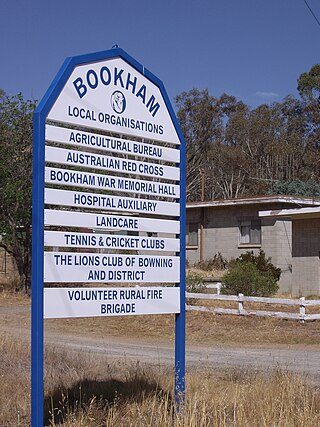
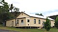
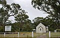
Bookham is a small village and rural locality in the South West Slopes and Riverina regions of New South Wales, Australia in Yass Valley Shire. It is about 29 km west of Yass on the Hume Highway.

Narrabri Shire is a local government area in the North West Slopes region of New South Wales, Australia. The Shire is located adjacent to the Namoi River and the Newell and Kamilaroi Highways.

Walgett Shire is a local government area in the Orana region of New South Wales, Australia. The northern boundary of the Shire is located adjacent to the border between New South Wales and Queensland. The town of Walgett is located on the Namoi River, nearby to its junction with the Barwon River and at the junction of the Kamilaroi Highway and the Castlereagh Highway.

Gunnedah Shire is a local government area in the North West Slopes region of New South Wales, Australia. The Shire is located adjacent to the Liverpool Plains in the Namoi River valley and is traversed by the Oxley Highway and the Kamilaroi Highway.

Wakool is a town in the western Murray region of New South Wales, Australia. Wakool is in the Murray River Council local government area, 791 kilometres (492 mi) south west of the state capital, Sydney and 336 kilometres (209 mi) north-west of Melbourne. At the 2016 census, Wakool had a population of 297.

Collector is a small village on the Federal Highway in New South Wales, Australia halfway between Goulburn and the Australian Capital Territory. It is seven kilometres north of Lake George. The name is also applied to the surrounding area, for postal and statistical purposes. At the 2021 census, Collector and the surrounding district had a population of 376 people.

Woolbrook is a village in the New England region of New South Wales, Australia. The nearest town, Walcha is 29 km to the east of Woolbrook. At the 2011 census, Woolbrook had a population of 248.
Rugby is a village in the Southern Tablelands region of New South Wales, Australia. The village is in the Hilltops Council local government area, 292 kilometres (181 mi) south west of the state capital, Sydney, and 146 kilometres (91 mi) north of the national capital, Canberra.
Namoi Shire was a local government area in the North West Slopes region of New South Wales, Australia.