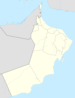
Al Ghubra is a suburb of Muscat, the capital city of the Sultanate of Oman. It is a developing town with a number of malls, hospitals, schools, hotels and many local businesses. There is a sizeable number of expatriates among the locals. The beach is a long expanse of sand dunes. There are many schools here which are owned by different communities. The town is well planned and known for its lake park designed especially with a walk-path and children's playground. Al-Ghubra is Oman's most popular shopping destination with Muscat Grand Mall Oman Avenue Mall and Panorama Mall being two of them. Also in this area lot of hotels and restaurants coffee shops are available. Many cuisines like Indian, Chinese, Italian, Arabic, Continental & Latin are available here.

Al-Seeb, As Seeb or As Sib is a coastal fishing city, located several kilometres northwest of Muscat, in northeastern Oman. As of the 2003 census, it had a population of 221,115.

Raʾs al-Ḥadd is a village in Ash Sharqiyah district in Oman. It is on a point at the entrance to the Gulf of Oman.
Izki is a town in the region Ad Dakhiliyah, northeastern Oman. It is located at c. 544 m (1,785 ft) altitude, and has a population of 35,173 (2003 census).
Saham is a coastal town in the Al Batinah Region, in northeastern Oman. It is located at about 24°10′20″N56°53′19″E and has a population of 85,010. Saham is a fishing and a farming town between Al Khaboura and Sohar.

Cotterdale is a small side dale and hamlet on the north side of Wensleydale in North Yorkshire, England. The dale lies to the west of Great Shunner Fell. It is drained by East Gill and West Gill, which between them have nine waterfalls. They join to form Cotterdale Beck, which flows over three more waterfalls, including Cotter Force, below which the beck joins the River Ure.

Samāʾil is a Wilayah (province) located in Ad-Dakhiliyah Region of the Sultanate of Oman.

Dashtadem is a village located in the Aragatsotn Province of Armenia. The village contains the large Dashtadem Fortress dating to the 10th century but substantially rebuilt in the 19th century, along with a chapel dedicated to Saint Sargis also dating to the 10th century. The fortress keep has an Arabic dedicatory inscription of 1174, written in Kufic script attributing the structure to Sultan ibn Mahmud (Shahanshah), one of the Shaddadids. Past the village to the north just east of the road to Talin, and a few hundred meters before the electric substation (south), are the ruins of a large medieval caravanserai. Large sections of walls remain standing and the overall plan is still easily distinguished amongst the ruins. The remains of Stone Age obsidian workshops can be found on a hill to the west. In a cemetery south of Dashtadem, lies the restored 7th-century Kristapori Vank.
The Sharqiya Sands is a region of desert in Oman, The region was named for the Bani Wahiba tribe. divided between the northern and southern governorates in the Eastern Region. The area is defined by a boundary of 180 kilometers (110 mi) north to south and 80 kilometers (50 mi) east to west, with an area of 12,500 square kilometers (4,800 sq mi). The desert has been of scientific interest since a 1986 expedition by the Royal Geographical Society documented the diversity of the terrain, the flora and fauna, noting 16,000 invertebrates as well as 200 species of other wildlife, including avifauna. They also documented 150 species of native flora.
Safir Hotels & Resorts is a Kuwaiti-owned luxury hotel chain in the Arabic world. Clientele includes the sister of the Emir of Kuwait who stayed in the hotel's $3000 a month apartments.

Raʾs al-Jinz or Raʾs al-Junayz, located in Ash-Sharqiyyah South Governorate, Oman, is the easternmost point of the Arabian Peninsula. It is a nesting site for green turtles, as also is the beach at the local village of Ras al Hadd. It is home to a well-known turtle reserve. Important archaeological discoveries have also been made at this site, demonstrating connections to the Indus Valley in ancient times.

Nartë is a community in Vlorë County. At the 2015 local government reform it became part of the municipality Vlorë. It is situated northwest of the city of Vlorë.
Seeb Palace is a royal palace in Seeb, near Muscat, Oman. It is an official residence of the Sultan of Oman. It also home to the Royal Oman Symphony Orchestra, established in 1985.
Naseem Garden is a large park between Seeb and Barka, near Muscat, Oman. It contains an aquarium, lake, waterfall, Arabic and Japanese gardens, a maze and a playground.
Al-Qābil is a village in Al Buraimi Governorate, in northeastern Oman. A small agricultural village on the edge of the Wahibah Desert, Al Qabil lies about 25 km (16 mi) south along the Muscat-Sur Highway from Al Ain across the border in the United Arab Emirates. The village lies south of Mazyad and Al-Zahir, west of Hisn Mazyad, and 10 km (6.2 mi) northwest of Al-Mintirib. Described as a "prosperous market village", Al-Qabil lies at a curve in the road before "descending into the Sa'dah basin from the west". The village is said to contain populations of Al Bu-Shamis group of the Na'im who moved into the village from across the border with the Emirates. Wadi Sarin is said to flow nearby.
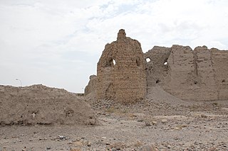
Queen of Sheba's Palace is a ruined palace at the archaeological site of Khor Rori, near Salalah, Oman. It was first excavated in 1952 by American archaeologist Wendell Phillips.

Anakao or Anokao is a coastal fishing town of about 3000 on the southwest coast of Madagascar, 35 kilometres south of Toliara. It is located southwest of Soalara. It is inhabited by the Vezo people and is a notable resort getaway, containing the Club Resort Anakao, Anakao Ocean Lodge, Prince Anakao, and Chez Emile hotels. There are some tombs located near the point of the town. The topography is described as "rather flat, except where the sandy soil forms dunes." To the south are the villages of Ankilimivony and Ankiririsa.
Hināwī are one of two major tribes of Oman and the Trucial Coast, the other being the Ghāfirī. Characterized as two significant factions having distinct interests and organizations, their rivalry began approximately 2000 years ago; almost during the time Ghafiris arrived to Oman. The Hinawis, for the most part, resided in southeast Oman, while the Ghafiris predominated in the northwestern part of Oman. Several tribal groups make up the Hinawi alliance, such as, the Dhowahir, Beni Yas, and the Awamir, Beni Hina and the Harasis. During the 18th century, serious conflicts occurred between the two factions. These conflicts only ended after many sub-tribes were united under one leader that belonged to one of the two factions. The Hinawis gathered under Khalaf bin Mubarak Alhinai from the Bani Hina tribe, while the Ghafiris gathered under Mohammed bin Nasir Alghafiri of the Beni Ghafir tribe. The almost equal strength of the two alliances led to the end of the feud. The rivalry played a decisive role in shaping the political history of Oman, with Omani tribes affiliating themselves historically with either the Ghafiri or Hinawi alliances.
The Ghāfirī are one of two major tribal confederations of Oman and the Trucial Coast, the other being the Hināwī. Both confederations claim their origin to the Bedouin tribe and the Ghafiri also trace their roots to the Nizari or Adnani tribes. Both groups provided support to the ruling sultans to further their own interests. The Ghafiri are Sunni Muslim.

Bull wrestling, cow fighting or bull fighting is a non-lethal bloodsport between bulls or cows found in some parts of the world.