The Peak District is an upland area in England at the southern end of the Pennines. Mostly in Derbyshire, it extends into Cheshire, Greater Manchester, Staffordshire, West Yorkshire and South Yorkshire. It includes the Dark Peak, where moorland is found and the geology is dominated by gritstone, and the White Peak, a limestone area with valleys and gorges. The Dark Peak forms an arc on the north, east and west sides; the White Peak covers central and southern tracts. The historic Peak District extends beyond the National Park, which excludes major towns, quarries and industrial areas. It became the first of the national parks of England and Wales in 1951. Nearby Manchester, Stoke-on-Trent, Derby and Sheffield send millions of visitors – some 20 million live within an hour's ride. Inhabited from the Mesolithic era, it shows evidence of the Neolithic, Bronze and Iron Ages. Settled by the Romans and Anglo-Saxons, it remained largely agricultural; mining arose in the Middle Ages. Richard Arkwright built cotton mills in the Industrial Revolution. As mining declined, quarrying grew. Tourism came with the railways, spurred by the landscape, spa towns and Castleton's show caves.

The North York Moors is an upland area in north-eastern Yorkshire, England. It contains one of the largest expanses of heather moorland in the United Kingdom. The area was designated as a National Park in 1952, through the National Parks and Access to the Countryside Act 1949. Covering an area of 554 sq mi (1,430 km2), the National Park has a population of 23,380. It is administered by the North York Moors National Park Authority, whose head office is based in Helmsley.

Moorland or moor is a type of habitat found in upland areas in temperate grasslands, savannas, and shrublands and montane grasslands and shrublands biomes, characterised by low-growing vegetation on acidic soils. Moorland, nowadays, generally means uncultivated hill land, but also includes low-lying wetlands. It is closely related to heath, although experts disagree on what precisely distinguishes these types of vegetation. Generally, moor refers to highland and high rainfall zones, whereas heath refers to lowland zones which are more likely to be the result of human activity. Moorland habitats mostly occur in tropical Africa, northern and western Europe, and neotropical South America. Most of the world's moorlands are diverse ecosystems. In the extensive moorlands of the tropics, biodiversity can be extremely high. Moorland also bears a relationship to tundra, appearing as the tundra and the natural tree zone. The boundary between tundra and moorland constantly shifts with climatic change.

Mohawk State Forest, also known as Mohawk State Forest/Mohawk Mountain State Park, encompasses over 4,000 acres (1,600 ha) in the towns of Cornwall, Goshen, and Litchfield in the southern Berkshires of Litchfield County, Connecticut. As overseen by the Connecticut Department of Energy and Environmental Protection, the area is used for hiking, picnicking, and winter sports by the public, while being actively managed to produce timber and other forest products.

The West Pennine Moors is an area of the Pennines covering approximately 90 square miles (230 km2) of moorland and reservoirs in Lancashire and Greater Manchester, England. It is a Site of Special Scientific Interest.

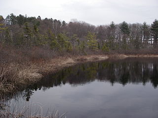
Black Moshannon State Park is a 3,480-acre (1,410 ha) Pennsylvania state park in Rush Township, Centre County, Pennsylvania, United States. It surrounds Black Moshannon Lake, formed by a dam on Black Moshannon Creek, which has given its name to the lake and park. The park is just west of the Allegheny Front, 9 miles (14 km) east of Philipsburg on Pennsylvania Route 504, and is largely surrounded by Moshannon State Forest. A bog in the park provides a habitat for diverse wildlife not common in other areas of the state, such as carnivorous plants, orchids, and species normally found farther north. As home to the "largest reconstituted bog in Pennsylvania", it was chosen by the Pennsylvania Department of Conservation and Natural Resources for its "25 Must-see Pennsylvania State Parks" list.

Scotstown Moor is in the north of Aberdeen, Scotland.

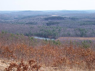
The Charles W. Ward Reservation is a 704-acre (285 ha) open space reserve located in Andover and North Andover, Massachusetts, 20 miles (32 km) north of Boston. The reserve, managed by the land conservation non-profit organization The Trustees of Reservations, is notable for its open drumlin hilltops and vistas encompassing Boston and Salem. The Ward Reservation offers 13 miles (21 km) of trails and former woods roads available for hiking, horseback riding, mountain biking, and cross country skiing; it is also a link in the 200-mile (320 km) Bay Circuit Trail system.

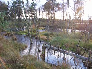
The Bullenkuhle is a predominantly marshy lake in the extreme north of the district of Gifhorn in the north German state of Lower Saxony. This strange biotope and geotope has been formed into a natural hollow in the terrain that is termed a sinkhole. The area is environmentally protected.

The Südheide Nature Park is a large protected area of forest and heathland in the southern part of the Lüneburg Heath in North Germany. It has been designated as a protected nature park since 1964.

The Tiste Bauernmoor is an area of raised bog on the Lüneburg Heath in north Germany that was designated as a nature reserve on 2 May 2002. It has an area of 570 hectares and belongs, together with the Ekelmoor, Avensermoor and Everstofer Moor, to the large Ekelmoor moorland region that has a total area of 1,220 hectares.

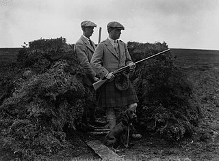
Driven grouse shooting is the hunting of the red grouse, a field sport of the United Kingdom. The grouse-shooting season extends from 12 August, often called the "Glorious Twelfth", to 10 December each year. Large numbers of grouse are driven to fly over people with shotguns. Driven grouse shooting first appeared around 1850 and became popular in the later Victorian era as a fashionable sport for the wealthy. The expanding rail network allowed relatively easy access into the remote upland areas of Britain for the first time and driven grouse shooting developed in tandem with this by providing shooting in a convenient and reliable form. Large numbers of birds are driven over a fixed position providing a regular supply of fast moving targets without the need to seek out the birds. The development of the breech-loading shotgun was also an essential ingredient in the development of the practice as it allowed more rapid reloading in the field matching the availability of target birds.

The Maujahn or Maujahn Moor is a kettle bog in North Germany which began as a sinkhole. It is located a good two kilometres west of the town of Dannenberg between the villages of Thunpadel and Schmarsau in northeastern Lower Saxony.

The Lebrade Pond Bird Sanctuary is a nature reserve in the north German state of Schleswig-Holstein, that lies within the district of Plön, about 7 kilometres north of the town of Plön. The reserve is part of the Holstein Switzerland Nature Park and covers an area of about 144 hectares. It has been designated as a Special Area of Conservation and therefore is part of the Natura 2000 network. It has a length of about 1.7 kilometres and a width of about one kilometre.

Bowes Moor is a Site of Special Scientific Interest in the County Durham district in south-west County Durham, England. It is an extensive area of moorland, most of it covered by blanket bog, which supports significant breeding populations of a number of wading birds.

Healey Nab or "The Nab" is an area of countryside owned partly by Lancashire County Council containing rolling hills, moorland, woodland, ponds and streams to the east of Chorley, Lancashire, between the M61 and the West Pennine Moors. To its southeast is Anglezarke Reservoir and to its northeast is White Coppice.
Abrod is a national nature reserve in the Slovak municipality of Veľké Leváre in the Malacky District. The nature reserve covers an area of 92 ha of the Borská lowland area. It has a protection level of 4 under the Slovak nature protection system. The nature reserve is part of the Site of Community Importance with the same name which measures 162 ha. Since 1988 it is also a part of the Záhorie Protected Landscape Area.

Penistone Hill Country Park is an open space of moorland that is located to 0.31 miles (0.5 km) west of Haworth and 0.62 miles (1 km) north-west of Oxenhope in West Yorkshire, England. The park's highest point is detailed with a trig point which is 1,030 feet (310 m) above sea level. Since 1994, the park has been notified as being an SSSI as part of the South Pennine Moors.
Border Moors and Forests NCA is an upland plateau region in Northern England between the North East and North West regions, and touching the Anglo-Scottish border. The region, like much of the northern English uplands, is sparsely populated, with scattered farming and hardy shepherding in river valleys. Because of this sparse population, 39% of the region is part of the Northumberland National Park in the southeast and several military assets are placed here, both modern and ancient. The NCA is of lower elevation to the Cheviot Hills to the east. The A68 is the only main road going through the region. Conifer plantations, moorland, bogs, wet heaths make up the landscape of the region, which only allows for rough grazing of sheep in most areas outside of the valleys. Afforestation is a major environmental factor within the 20th and 21st centuries, as the Kielder Forest is the largest planted forest in northern Europe and has destroyed many native mires and peat bogs of the region. As such in the 21st century preserving the moors has been a top priority in the region as its habitat is home to high biodiversity and the region also serves as an important storer of carbon in its moors.


