Tarata, Peru

Last updated
Tarata
San Benedicto de Tarata
Escudo de Tarata.png
Nickname: 
Fellowship city (Spanish: Ciudad de la confraternidad)
Mapa de localizacion Tacna.svg
Red pog.svg
Tarata
Peru location map.svg
Red pog.svg
Tarata
Coordinates: 17°28′28.67″S70°1′57″W / 17.4746306°S 70.03250°W / -17.4746306; -70.03250
CountryFlag of Peru.svg  Peru
Region Tacna
Province Tarata
District Tarata
Time zone UTC-5 (PET)
Website http://www.munitarata.gob.pe/

Tarata is a city in the Tacna Region in southern Peru. It is the capital of Tarata District and Tarata Province.

Contents

History

Pre-Inca Era

The works of the archaeologist Rogger Ravines in the Karu cave show a very early settlement of Tarata, around 7000 BC, that is, more or less 9000 years ago. The study of regional cultural development over time is a task that Archeology has yet to develop. Not much is known of Tarata's remote past. The archaeologist Ravines found an Archaic settlement at the site of Kano, high up in the Tarata district, not far from their present city. The petroglyphs and cave paintings stand out in the province of Tarata, for this remote period. [1]

Spanish Era

In 1611 work began on the temple of San Benedicto Abad, patron of the city of Tarata, thus beginning the process of evangelization of the area and in turn the process of acculturation and conversion of the indigenous populations. The temple was officially inaugurated on January 3, 1741, the same day that the Spanish foundation of the city took place. [1]

Republican Era

In 1824, Simón Bolivar decrees the political creation of the district of Tarata, with President Manuel Pardo promulgating decades later the creation of the province of Tarata, on November 12, 1874, as well as its districts: Estike, Tarukachi, Tarata, Tikako and Kandarave. [1]

Administration by Chile

After the Battle of Tacna, and the subsequent retreat of Peruvian and Bolivian forces, the city was occupied by Chile and incorporated as a commune, beginning a process of Chilenisation. The commune was formally established on December 22, 1891, [2] taking into account the limits assigned by the decrees of November 9, 1885 and of May 10, 1886, [3] and was composed of six subdelegations: Pocollai, Pachía, Palca, Tarata, Sama and Calana. A Civil Registry office had operated in the commune since 1885. [4]

MunicipalitySub-delegations
Tarata Pocollai
Pachía
Palca
Tarata
Sama
Calana

In 1911, the city was officially incorporated into the Chilean Province of Tacna as the Department of Tarata, [lower-alpha 1] with Tarata becoming the seat of the eponymous department. [8] [6] In 1921, however, Chile abolished the department, and in 1925 gave back the city to Peru under the mediation of U.S. President Calvin Coolidge, who enforced the limits agreed upon on the north, which did not include the city. [9] [10]
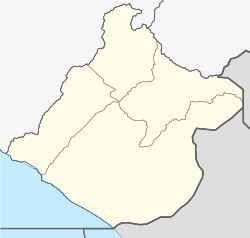
Demographics

According to the 2007 Peru Census, The city of Tarata had 2,882 inhabitants, of which 2,577 speak Spanish as their native language, this being the most widely spoken language, followed by Aymara with 840 speakers. The predominant age group is children between 10 and 14 years old.

Geography

The region is located below the Titicaca plateau and has a diverse geography, including volcanoes, deserts, and mountainous zones, from which arise rivers that go over the punas and the plateaus, thus forming the hydrographical system of this zone. The region is small in size but has a significant mining and agriculture potential. It has various climates and diverse production.

Climate

The average climate per year is 8.6°C (47.5°F).

Climate data for Tarata
MonthJanFebMarAprMayJunJulAugSepOctNovDecYear
Daily mean °C (°F)10.5
(50.9)
10.6
(51.1)
10.4
(50.7)
9.3
(48.7)
7.6
(45.7)
6.1
(43.0)
5.8
(42.4)
6.4
(43.5)
7.9
(46.2)
8.8
(47.8)
9.7
(49.5)
10.2
(50.4)
8.6
(47.5)
Source: [11]

See also

Notes

  1. Disputed by Peru as per the Treaty of Ancón on continuous occasions with the arbitration of the United States. [5] [6] [7]

Related Research Articles

<span class="mw-page-title-main">Tacna</span> Place in Peru

Tacna, officially known as San Pedro de Tacna, is a city in southern Peru and the regional capital of the Tacna Region. A very commercially active city, it is located only 35 km (22 mi) north of the border with Arica y Parinacota Region from Chile, inland from the Pacific Ocean and in the valley of the Caplina River. It is Peru's tenth most populous city.

<span class="mw-page-title-main">National Congress of Chile</span> National legislature of Chile

The National Congress of Chile is the legislative branch of the Republic of Chile. According to the current Constitution, it is a bicameral organ made up of a Chamber of Deputies and a Senate. Established by law No. 18678, the city of Valparaíso is its official headquarters.

<span class="mw-page-title-main">Arica</span> City in Arica y Parinacota, Chile

Arica is a commune and a port city with a population of 222,619 in the Arica Province of northern Chile's Arica y Parinacota Region. It is Chile's northernmost city, being located only 18 km (11 mi) south of the border with Peru. The city is the capital of both the Arica Province and the Arica and Parinacota Region. Arica is located at the bend of South America's western coast known as the Arica Bend or Arica Elbow. At the location of the city are two valleys that dissect the Atacama Desert converge: Azapa and Lluta. These valleys provide citrus and olives for export.

<span class="mw-page-title-main">Elections in Chile</span> Political elections for public offices in Chile

Elections in Chile are held nationwide, including the presidency, parliament, regional offices, and municipal positions. Chilean citizens and foreign residents with legal residency of at least five years, who are 18 years or older on election day, are eligible to vote. Previously, voting was voluntary, but since 2023, it has become compulsory.

<span class="mw-page-title-main">Arica y Parinacota Region</span> Region of Chile

The Arica y Parinacota Region is one of Chile's 16 first order administrative divisions. It comprises two provinces, Arica and Parinacota. It borders Peru's Department of Tacna to the north, Bolivia's La Paz and Oruro departments to the east and Chile's Tarapacá Region to the south. Arica y Parinacota is the 5th smallest, the 3rd least populous and the 6th least densely populated of the regions of Chile. Arica is the region's capital and largest city.

<span class="mw-page-title-main">Tarata Province</span> Province in Tacna, Peru

Tarata is one of four provinces in the Tacna Region in southern Peru. Its capital is Tarata city.

<span class="mw-page-title-main">Ñuble Province (1974–2018)</span> Province in Bío Bío, Chile

Ñuble Province was one of the provinces of the Chilean region of Bío Bío (VIII). It used to span an area of 13,178.5 km2 (5,088 sq mi) and it was administratively constituted by 21 communes. It has in 2017 a population of 441,604 inhabitants. Its capital was the city of Chillán. On the 6th of September of 2018, the province became the Ñuble Region.

<span class="mw-page-title-main">Sama District</span> District in Tacna, Peru

Sama District is one of eleven districts that make up Tacna Province, located in the department of Tacna, under the administration of the Regional Government of Tacna, in southern Peru. In 2017 it had a population of 3,106 inhabitants and a population density of 2.89 per km². It covers a total area of 1,116 km².

<span class="mw-page-title-main">Arica Province (Peru)</span> Historical Peruvian province

Arica was a historical province of Peru, which existed between 1823 and 1883. It was populated by pre-Hispanic peoples for a long period of time before Spanish colonization in the early 16th century saw the transformation of a small town into a thriving port. Trade in both gold and silver was facilitated through Arica after the precious metals were first extracted from the Potosí silver mines of Bolivia. Following the War of the Pacific, the province was transferred to Chile and became an official Chilean territory in 1929.

<span class="mw-page-title-main">Tarapacá Department (Peru)</span> Department of Peru (1878–1883)

Tarapacá was a Department of Peru, which existed between 1878 and 1884, when it was unconditionally ceded to Chile after the War of the Pacific under the Treaty of Ancón.

<span class="mw-page-title-main">Guido Girardi</span> Chilean politician

Guido Girardi Lavín is a Chilean doctor and politician. He was a senator in district no. 7 for Santiago Poniente. He previously served as the president of that chamber.

<span class="mw-page-title-main">Wallatiri (Peru)</span> Mountain in Peru

Wallatiri is a mountain in the northwestern extensions of the Barroso mountain range in the Andes of Peru, about 4,600 metres (15,092 ft) high. It is situated in the Tacna Region, Tarata Province, Tarata District.

<span class="mw-page-title-main">Tacna Province (Chile)</span> Former province of Chile

The Tacna Province was a territorial division of Chile that existed between 1884 and 1929. It was ceded by the Treaty of Ancón in 1883 and placed under military administration, and then created on 31 October 1884, incorporating the former Peruvian provinces of Tacna and Arica of the also former Tacna Department, as well as a contested claim over Tarata, and was returned to Peru at midnight on 28 August 1929, under the terms agreed upon in the Treaty of Lima of the same year.

<span class="mw-page-title-main">Tacna Department (Chile)</span>

The Tacna Department was a territorial division of Chile that existed between 1884 and 1929. It was ceded by the Treaty of Ancón in 1883 and placed under military administration, and then created on the 31st of October 1884, as one of the three departments of the Tacna Province, incorporating as well a disputed claim over Tarata, and was returned to Peru at midnight on the 28th of August 1929, under the terms agreed upon in the Treaty of Lima of the same year.

<span class="mw-page-title-main">Tarata Department (Chile)</span>

The Tarata Department was a territorial division of Chile that existed between 1911 and 1921. Its territory comprised some controversial territory east of Sama River.

<span class="mw-page-title-main">Handover of Tacna</span> 1929 handover of Tacna from Chile to Peru

The handover of Tacna from Chile to Peru took place on August 28, 1929. The event ended 49 years of Chilean rule over its then newest province, which began in 1880 after the Bolivian–Peruvian defeat at the Battle of Tacna against the Chilean Army during the War of the Pacific.

<span class="mw-page-title-main">Isla de Pascua Department</span> Department of Chile (1966–1976)

Isla de Pascua Department, also named Easter Island Department, was one of the departments of the historical province of Valparaíso before the "regionalization" of 1974. It was named after Easter Island and comprised such territory and the Sala y Gómez island. It was effectively replaced in 1976 by the Isla de Pascua Province.

<span class="mw-page-title-main">Chilean–Peruvian territorial dispute</span>

The Chilean–Peruvian territorial dispute is a territorial dispute between Chile and Peru that started in the aftermath of the War of the Pacific and ended significantly in 1929 with the signing of the Treaty of Lima and in 2014 with a ruling by the International Court of Justice. The dispute applies since 2014 to a 37,610 km2 territory in the Chile–Peru border, as a result of the maritime dispute between both states.

Ticalaco River is a river on the Pacific slope, located in southern Peru, department of Tacna, it runs from east to west crossing the coastal desert of Peru until its mouth at the Sama River in Tacna Province.

Sama River is a river on the Pacific slope, located on the southern coast of Peru, in the department of Tacna. It is born in the Cotanvilque lagoon located in the Andean peaks south of the western mountain range of the Peruvian Andes in the province of Tarata, between the Contanvilque and Cauchina hills, and runs from east to west crossing the coastal desert of Peru to its mouth in the Mar de Grau, located in the province of Tacna.

References

  1. 1 2 3 "Historia de Tarata" (in Spanish). Municipalidad Provincial de Tarata. Retrieved 28 April 2017.
  2. Correa Bravo, Agustín (1903). Comentarios y concordancias de la Ley de Organización y Atribuciones de las Municipalidades de 22 de diciembre de 1891 (in Spanish). Santiago, Chile: Imprenta Cervantes.
  3. Zamudio, Orlando (2001). Chile. Historia de la división político-administrativa 1810-2000 (in Spanish). Santiago, Chile: Instituto Nacional de Estadísticas.
  4. "DTO-3176". Ley Chile - Biblioteca del Congreso Nacional .
  5. "PERU DEMANDS CHILE SETTLE PROVINCE DISPUTE". Providence News. 2 Jan 1922.
  6. 1 2 "Bolivian Bid Meets New Parley Rebuff". Newark Sunday Call. 1922-05-21. p. 1. Retrieved 2021-08-19.
  7. "Peru Renews Demands That Chilean Issue Be Given to Arbitration". The Deseret News . 2 Jan 1922.
  8. "LEY-2575 02-DIC-1911 MINISTERIO DEL INTERIOR". Ley Chile - Biblioteca del Congreso Nacional . 1911-12-02.
  9. "LEY-3802 22-SEP-1921 MINISTERIO DE RELACIONES EXTERIORES, CULTO Y COLONIZACIÓN". Ley Chile - Biblioteca del Congreso Nacional . 1921-09-22.
  10. "El representante del gobierno de Chile hizo entrega ayer del Departamento de Tarata al representante peruano" (PDF). La Nación . 1925-09-02.
  11. "Tarata, Peru Travel Weather Averages (Weatherbase)".

17°28′29″S70°01′57″W / 17.47463°S 70.03262°W / -17.47463; -70.03262