Taraš Тараш | |
|---|---|
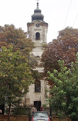 The Orthodox Church | |
 Taraš Location within Serbia  Taraš Taraš (Serbia)  Taraš Taraš (Europe) | |
| Coordinates: 45°28′03″N20°11′32″E / 45.46750°N 20.19222°E | |
| Country | |
| Province | |
| District | Central Banat |
| Municipalities | Zrenjanin |
| Elevation | 72 m (236 ft) |
| Population (2002) | |
• Taraš | 1,140 |
| Time zone | UTC+1 (CET) |
| • Summer (DST) | UTC+2 (CEST) |
| Postal code | 23209 |
| Area code | +381(0)23 |
| Car plates | ZR |
Taraš (Serbian Cyrillic : Тараш; Hungarian : Tiszatarrós) is a village located in the Zrenjanin municipality, in the Central Banat District of Serbia. It is situated in the Autonomous Province of Vojvodina. The village has a Serb ethnic majority (96.49%) and its population numbering 1,140 people (2002 census).