Hetin | |
|---|---|
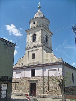 The Holy Trinity Catholic Church | |
 Hetin Location within Serbia  Hetin Hetin (Serbia)  Hetin Hetin (Europe) | |
| Coordinates: 45°33′20″N20°41′24″E / 45.55556°N 20.69000°E | |
| Country | |
| Province | |
| District | Central Banat |
| Municipalities | Žitište |
| Elevation | 65 m (213 ft) |
| Population (2002) | |
• Hetin | 763 |
| Time zone | UTC+1 (CET) |
| • Summer (DST) | UTC+2 (CEST) |
| Postal code | 23235 |
| Area code | +381(0)23 |
| Car plates | ZR |
Hetin (Serbian Cyrillic : Хетин; Hungarian : Tamásfalva or Hetény; German : Hettin or Tomsdorf) is a village in Serbia. It is situated in the Žitište municipality, in the Central Banat District, Vojvodina province. The village has a Hungarian ethnic majority (53.21%) and its population numbering 763 people (2002 census).