
Airasca is a comune (municipality) in the Metropolitan City of Turin in the Italian region Piedmont, located about 25 kilometres (16 mi) southwest of Turin.

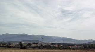
Cantalupa is a comune (municipality) in the Metropolitan City of Turin in the Italian region Piedmont, located about 30 kilometres (19 mi) southwest of Turin, at the foot of Monte Freidour.
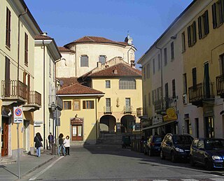
Cumiana is a comune (municipality) in the Metropolitan City of Turin in the Italian region Piedmont, located about 30 kilometres (19 mi) southwest of Turin.

Pinasca is a comune (municipality) in the Metropolitan City of Turin in the Italian region Piedmont, located about 40 kilometres (25 mi) southwest of Turin in the Val Chisone.

Piossasco is a comune (municipality) in the Metropolitan City of Turin in the Italian region Piedmont, located about 20 km southwest of Turin.
Piscina is a comune (municipality) in the Metropolitan City of Turin in the Italian region Piedmont, located about 25 km southwest of Turin.
Sfruz is a comune (municipality) in Trentino in the northern Italian region Trentino-Alto Adige/Südtirol, with some 230 inhabitants in 2009 and an area of 11.7 square kilometres (4.5 sq mi).

Spigno Monferrato is a comune (municipality) in the Province of Alessandria in the Italian region of Piedmont, located about 80 kilometres (50 mi) southeast of Turin and about 45 kilometres (28 mi) southwest of Alessandria.

Montoggio is a comune (municipality) in the Province of Genoa in the Italian region Liguria, located about 14 kilometres (9 mi) northeast of Genoa. As of October 2006, it had a population of 2,018 and an area of 46.4 square kilometres (17.9 sq mi).

Esperia is a comune (municipality) in the Province of Frosinone in the Italian region Lazio, located about 110 kilometres (68 mi) southeast of Rome and about 40 kilometres (25 mi) southeast of Frosinone. It is located within the Monti Aurunci Natural Park.

Bacoli is a comune (municipality) in the Metropolitan City of Naples in the Italian region Campania, located about 15 kilometres (9.3 mi) west of Naples.

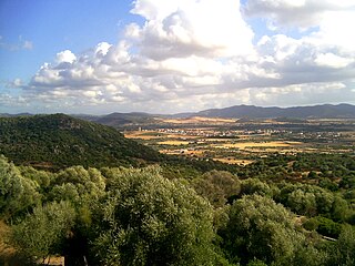
Arbus is a comune (municipality) in the Province of South Sardinia in the Italian region of Sardinia. Located in the southwest coast of the island, Arbus is known for its coastline, the Costa Verde, and for several archeological sites, such as the mines of Montevecchio. With an area of 267 square kilometres, Arbus is the second largest municipality in Sardinia.
Santadi is a comune (municipality) in the Province of South Sardinia in the Italian region Sardinia, located about 35 kilometres (22 mi) southwest of Cagliari and about 20 kilometres (12 mi) southeast of Carbonia.

Masainas is a comune (municipality) in the Province of South Sardinia in the Italian region Sardinia, located about 45 kilometres southwest of Cagliari and about 15 km (9 mi) southeast of Carbonia. It is part of the Sulcis traditional region.
Villaperuccio, Sa Baronia in sardinian language, is a comune (municipality) in the Province of South Sardinia in the Italian region Sardinia, located about 40 kilometres (25 mi) southwest of Cagliari and about 13 kilometres (8 mi) southeast of Carbonia, in the lower Sulcis.

Piscinas is a comune (municipality) in the Province of South Sardinia in the Italian region Sardinia, located about 40 kilometres (25 mi) southwest of Cagliari and about 15 kilometres (9 mi) southeast of Carbonia, in the Sulcis-Iglesiente traditional subregion. Piscinas borders the following municipalities: Giba, Masainas, Santadi, Teulada, Tratalias, Villaperuccio.

Giba is a comune (municipality) in the province of South Sardinia, Sardinia, Italy.
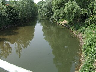
Chisola is a torrent in Piedmont, north-western Italy.

Monte Freidour is peak in the Cottian Alps, Metropolitan City of Turin in Piedmont, north-western Italy. It has an elevation of 1,445 metres (4,741 ft) and is composed of gneiss cliffs overlooking the town of Cumiana.

Monte Tre Denti is peak in the Cottian Alps, Metropolitan City of Turin in Piedmont, north-western Italy. It has an elevation of 1,365 metres (4,478 ft) and is located between the comuni of Cumiana and Cantalupa. Together with the nearby Monte Freidour, it is part of a natural park called Parco naturale di interesse provinciale del Monte Tre Denti - Freidour.


