
Laconia or Lakonia is a historical and administrative region of Greece located on the southeastern part of the Peloponnese peninsula. Its administrative capital is Sparta. The word laconic—to speak in a blunt, concise way—is derived from the name of this region, a reference to the ancient Spartans who were renowned for their verbal austerity and blunt, often pithy remarks.

Salamis or Salamina is the largest Greek island in the Saronic Gulf, about two kilometres from the coast of Piraeus and about 16 km west of central Athens. The chief city, Salamina, lies in the west-facing core of the crescent on Salamis Bay, which opens into the Saronic Gulf. On the eastern side of the island is its main port, Paloukia, the second largest port in Greece in terms of size, after the port of Piraeus.

The Rhodopes are a mountain range in Southeastern Europe, and the largest by area in Bulgaria, with over 83% of its area in the southern part of the country and the remainder in Greece. Golyam Perelik is its highest peak at 2,191 meters (7,188 ft). The mountain range gives its name to the terrestrial ecoregion Rodope montane mixed forests that belongs in the temperate broadleaf and mixed forests biome and the Palearctic realm. The region is particularly notable for its karst areas with their deep river gorges, large caves and specific sculptured forms, such as the Trigrad Gorge.

Chalkidiki, also known as Chalcidice, is a peninsula and regional unit of Greece, part of the region of Central Macedonia, in the geographic region of Macedonia in Northern Greece. The autonomous Mount Athos region constitutes the easternmost part of the peninsula, but not of the regional unit.

Imbros, officially Gökçeada since 29 July 1970, is the largest island of Turkey, located in Çanakkale Province. It is located in the north-northeastern Aegean Sea, at the entrance of Saros Bay, and has the westernmost point of Turkey. Imbros has an area of 286.8 km2 (110.7 sq mi), and has some wooded areas.

Alonnisos, also transliterated as Alonissos, is a Greek island in the Aegean Sea. After Skiathos and Skopelos it is the third member of the Northern Sporades. It is 3 km (2 mi) (2 nm) east of the island of Skopelos. Alonnisos is also the name of a village on the island, as well as the municipality that encompasses the island and the village.

Eordaia is a municipality in the Kozani regional unit, Western Macedonia, Greece. The seat of the municipality is the town Ptolemaida. The municipality has an area of 708.807 km2. The population was 42,515 in 2021.
Tymvou is a village in the central Mesaoria plain of Cyprus. Tymvou is occupied by the Turkish Armed Forces and is under the de facto control of Northern Cyprus. After 1960, the village was inhabited exclusively by Greek Cypriots; in 1973, they numbered 1,288. The original population fled the village in 1974, following the Turkish Invasion of Cyprus. As of 2011, Tymbou had a population of 384.

Agathonísi is a small Greek island and municipality located at the northernmost point of the Dodecanese in Greece. It is surrounded by many smaller islands and is home to two villages, both inland; Megalo Chorio, and Mikro Chorio. Between them is the small settlement of Agios Georgios, which forms the island's only harbor and consists of a few hotels and restaurants. The island is also locally known as Gaidaro ("Donkey"), or by its ancient name Tragea.
Neochori is a village and a community in the southeastern part of the island of Corfu, Greece. It is located in the municipal unit of Lefkimmi. In 2011 its population was 182 for the village and 1,443 for the community. Neochori is located east-southeast of the city of Corfu. It is situated between low hills.

Evrychou is a village in Cyprus. It is located in the Nicosia District and the agricultural centre of the "Solea" region located about 50 km south-west of Nicosia and 30 km from Troodos Mountains.
Anageia or Anagyia is a village in the Nicosia District of Cyprus, which lies approximately 15 km south of the capital Nicosia, just south of the village of Pano Deftera and north of the village of Ergates. The river Pedieos flows along the east side of the village, forming the municipal border between it and the neighbouring communities of Pano Deftera and Psimolofou.

Deneia is a village in the Nicosia District of Cyprus, west of Mammari. It is one of only four villages located within the United Nations Buffer Zone, the other three being Pyla, Athienou and Troulloi.
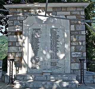
The Drakeia massacre refers to the mass execution of 115 men by SS soldiers in the village of Drakeia, located on Mount Pelion, in Thessaly, on 18 December 1943. It was part of the multiple Nazi reprisals against the Greek Resistance in occupied Greece.
The Holocaust of Kedros, also known as the Holocaust of Amari, was the mass murder of the civilian residents of nine villages located in the Amari Valley on the Greek island of Crete during its occupation by the Axis powers in World War II. The massacre was a reprisal operation mounted by Nazi German forces.

Theopetra Cave is a limestone cave located in Theopetra village of Meteora municipality, Thessaly, Greece. It is situated on the northeast side of a limestone rock formation that is 3 km (2 mi) south of Kalambaka. The site has become increasingly important as human presence is attributed to all periods of the Middle and Upper Paleolithic, the Mesolithic, Neolithic and beyond, bridging the Pleistocene with the Holocene.
Maionia or Maeonia, was a city of the Hellenistic, Roman and Byzantine era located near the Hermos River, in ancient Lydia. Both Ramsay and Talbert tentatively identified the ancient polis with the modern village of Koula a village known for its carpet manufacture.
Arilla was a village of ancient Lydia, inhabited during Roman times. The village was allowed to hold an annual seven-day fair in September from the year 134-135 by Titus Aurelius Fulvus Boionius, then governor of Asia.
Cimiata or Kimiata was a hill town of ancient Paphlagonia, which gave its name to a division of Paphlagonia named Cimiatene. It was situated at the foot of the Olgassys.
Candara or Kandara was a town of ancient Paphlagonia, inhabited from Achaemenid through Roman times. Stephanus of Byzantium writes that it was "in Paphlagonia, three schoeni from Gangra, and a village Thariba" and that a temple of Hera Candarene was there.

