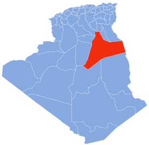
Touggourt is a city and commune, former sultanate and capital of Touggourt District, in Touggourt Province, Algeria, built next to an oasis in the Sahara. As of the 2008 census, the commune had a population of 39,409 people, up from 32,940 in 1998, and an annual growth rate of 1.8%. Touggourt's urban area includes the communes of Nezla, Tebesbest and Zaouia El Abidia, for a total population of 146,108.

Illizi is a town and commune, coextensive with Illizi District, situated in the south-eastern part of Algeria, and capital of Illizi Province. According to the 2008 census it is the largest commune by population in the province, with a population of 17,252, up from 10,163 in 1998, and an annual population growth rate of 5.5%, the highest in the province. It is one of the gates to the Tassili N'Ajjer National Park with caves situated under the sands containing prehistoric drawings dating from 6000 years BC. There is a hotel and two camping sites, as well as many local tourist agencies.

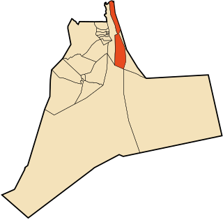
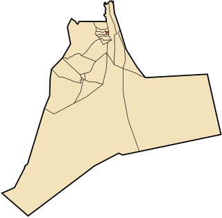
Taïbet is a district in Touggourt Province, Algeria. It was named after its capital, Taibet. As of the 2008 census, the district had a total population of 44,683.

El Guerrara is a town and commune, coextensive with El Guerrara District, in Ghardaïa Province, Algeria. According to the 2008 census it has a population of 59,514, up from 48,313 in 1998, with an annual growth rate of 2.1%.

Balidat Ameur is a town and commune in Touggourt Province, Algeria, located near the provincial capital of Ouargla. According to the 2008 census it has a population of 14,540, up from 12,135 in 1998, and a population growth rate of 1.9%. The commune is made of two areas, the main town of Balidat Ameur, and the village of Goug 7 kilometres (4.3 mi) to the southeast.

Benaceur is a town and commune in Taibet District, Touggourt Province, Algeria. According to the 2008 census it has a population of 10,330, up from the 1998 census when it had a population of 7,808. The annual population growth rate is estimated at 2.9%.

El Allia is a town and commune in El Hadjira District, Ouargla Province, Algeria. According to the 2008 census it has a population of 7,509, up from 6,530 in 1998, and an annual growth rate of 1.4%.

El Hadjira is a town and commune, and capital of El Hadjira District, in Ouargla Province, Algeria. According to the 2008 census it has a population of 14,965, up from 12,781 in 1998, and an annual population growth rate of 1.6%.

Megarine is a town and commune in Touggourt Province, Algeria, located just north of the city of Touggourt. According to the 2008 census it has a population of 13,751, up from 10,996 in 1998, and an annual growth rate of 2.3%.

M'Naguer is a town and commune in Taibet District, Touggourt Province, Algeria. According to the 2008 census it has a population of 14,179, up from 11,243 in 1998, and an annual population growth rate of 2.4%.

Nezla is a town and commune in Touggourt District, Touggourt Province, Algeria. According to the 2008 census it has a population of 51,674, up from 40,524 in 1998, and an annual population growth rate of 2.5%. Nezla is part of the urban area of Touggourt, and forms much of the southern area of that city. Agriculture is the main industry of the region, along with some tourism. The Sidi Madhi Airport is found in Nezla commune, and serves Touggourt and the surrounding areas.

Sidi Slimane is a town and commune in Mégarine District, Touggourt Province, Algeria, located near the city of Touggourt. According to the 2008 census it has a population of 8,072, up from 6,822 in 1998, and an annual growth rate of 1.7%.
Taibet is a town and commune, and the capital of Taibet District, in Touggourt Province, Algeria. According to the 2008 census it has a population of 20,174, up from 14,322 in 1998, and a growth rate of 3.6%.
Tamacine is a town and commune, and capital of Témacine District, in Touggourt Province, Algeria. According to the 2008 census it has a population of 20,067, up from 15,933 in 1998, and an annual growth rate of 2.4%. It is around 10 kilometres (6.2 mi) south of Touggourt. The Tugurt language is spoken by some residents of Tamacine.
Zaouia El Abidia is a town and commune in Touggourt District, Touggourt Province, Algeria. According to the 2008 census it has a population of 19,993, up from 15,381 in 1998, and has an annual population growth rate of 2.7%. It forms the northern part of the urban area of Touggourt.
Goug is a village in the commune of Balidat Ameur, in Témacine District, Ouargla Province, Algeria. The village is located 5.5 kilometres (3.4 mi) southeast of Balidat Ameur and 23 kilometres (14 mi) south of Touggourt.
Tamellaht is a town in the commune of Tamacine, in Témacine District, Ouargla Province, Algeria. The village is located 2 kilometres (1.2 mi) southwest of Tamacine and 11 kilometres (6.8 mi) south of Touggourt.
Meggarine Guedima is a neighbourhood in the oasis town of Megarine, in the southeast of Algeria. Administratively, it forms part of the municipality of Meggarine, which in itself is part of the Touggourt Province, Algeria. The village is located 10 kilometres (6.2 mi) east of the provincial capital Touggourt.
Moggar is a village in the commune of Sidi Slimane, in Megarine District, Ouargla Province, Algeria. The village is located 3 kilometres (1.9 mi) southwest of Sidi Slimane and 18 kilometres (11 mi) north of Touggourt.
El Khoubna is a village in the commune of Taibet, in Taibet District, Ouargla Province, Algeria. The village is located 2.5 kilometres (1.6 mi) northeast of Taibet and 33 kilometres (21 mi) east of Touggourt.